Punxsutawney in Jefferson County, Pennsylvania — The American Northeast (Mid-Atlantic)
Early Settlement in Punxsutawney
Photographed by Mark Parker, July 16, 2026
1. Early Settlement in Punxsutawney Marker
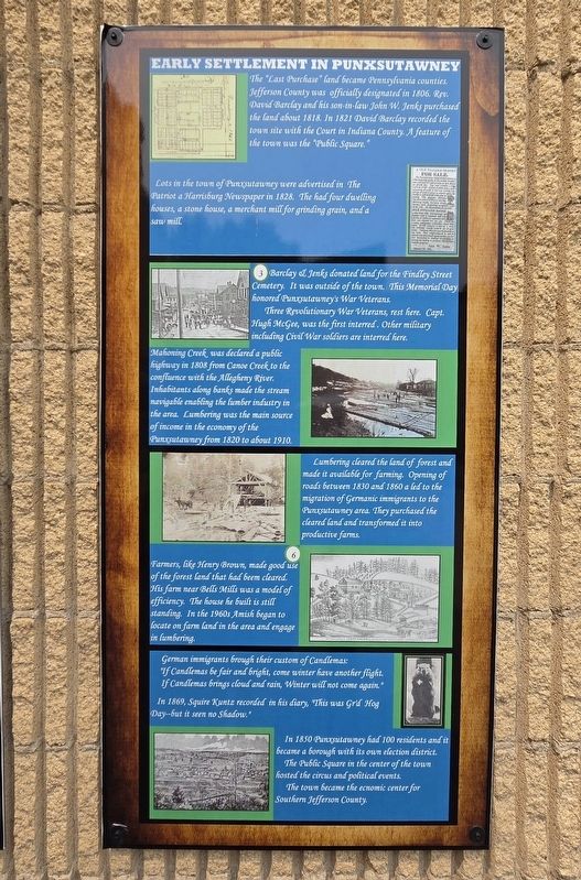
Lots in the town of Punxsutawney were advertised in The Patriot a Harrisburg Newspaper in 1828. The had four dwelling houses, a stone house, a merchant mill for grinding grain, and a saw mill.
Barclay & Jenks donated land for the Findley Street Cemetery. It was outside of the town. This Memorial Day honored Pungutawney's War Veterans.
Three Revolutionary War Veterans, rest here. Capt. Hugh McGee, was the first interred. Other military including Civil War soldiers are interred here.
Mahoning Creek was declared a public highway in 1808 from Canoe Creek to the confluence with the Allegheny River. Inhabitants along banks made the stream navigable enabling the lumber industry in the area. Lumbering was the main source of income in the economy of the Punxsutawney from 1820 to about 1910.
Lumbering cleared the land of forest and made it available for farming. Opening of roads between 1830 and 1860 a led to the migration of Germanic immigrants to the Punxsutawney area. They purchased the cleared land and transformed it into productive farms.
Farmers, like Henry Brown, made good use of the forest land that had been cleared. His farm near Bells Mills was a model of efficiency. The house he built is still standing. In the 1960s Amish began to locate on farm land in the area and engage in lumbering.
German immigrants brough their custom of Candlemas:
"If Candlemas be fair and bright, come winter have another flight.
If Candlemas brings cloud and rain, Winter will not come again."
In
this page online
In 1850 Punxsutawney had 100 residents and it became a borough with its own election district.
The Public Square in the center of the town hosted the circus and political events.
The town became the economic center for Southern Jefferson County.
Erected by Punxsutawney Area Historical & Geological Society, Inc.
Topics. This historical marker is listed in these topic lists: Agriculture • Horticulture & Forestry • Industry & Commerce • Settlements & Settlers. A significant historical year for this entry is 1806.
Location. 40° 56.633′ N, 78° 58.078′ W. Marker is in Punxsutawney, Pennsylvania, in Jefferson County. It is at the intersection of East Union Street and Merchants Alley, on the right when traveling west on East Union Street. Location of the marker is at the Punxsutawney Municipal Building between the Police Department and the library. Touch for map. Marker is at or near this postal address: 301 E Mahoning Street, Punxsutawney PA 15767, United States of America. Touch for directions.

Regionally, this marker is in the
Photographed by Mark Parker, July 16, 2026
2. Early Settlement in Punxsutawney Marker
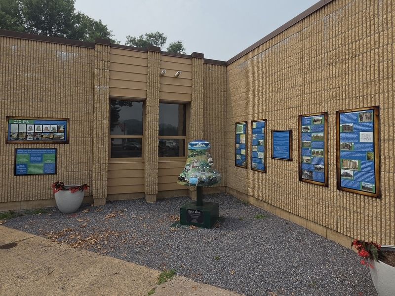
Location is the second from the left of the history series on the right wall.
Other nearby markers. At least 8 other markers are within walking distance of this marker: Before the Revolutionary War (here, next to this marker); "Punxsutawney Seasons" (here, next to this marker); Industrial Development (here, next to this marker); Modern Punxsutawney (here, next to this marker); Punxsutawney (a few steps from this marker); World War II Memorial (within shouting distance of this marker); SFC Scott R. Smith (within shouting distance of this marker); Weather Capital of the World (within shouting distance of this marker). Touch for a list and map of all markers in Punxsutawney.
More about this marker. The numbers on the marker are locations of groundhog statues placed around the Punxsutawney Area.
Credits. This page was last revised on August 4, 2026. It was originally submitted on July 19, 2026, by Mark Parker of Hickory, North Carolina. This page has been viewed 19 times since then. Photos: 1, 2. submitted on July 19, 2026, by Mark Parker of Hickory, North Carolina. • Andrew Ruppenstein was the editor who published this page.
