Punxsutawney in Jefferson County, Pennsylvania — The American Northeast (Mid-Atlantic)
Modern Punxsutawney

Photographed by Mark Parker, July 16, 2026
1. Modern Punxsutawney Marker
Photo by Wick Divelbiss for the Punxsutawney Spirit.
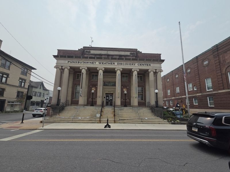
Located a few blocks from Barclay Square is the First Federal Building, the Punxsutawney Post Office, constructed in 1917. Today this building is the home of the Punxsutawney Weather Discovery Center, where visitors may learn about weather and experience being a forecaster.
Urban Renewal brought Punxsutawney the Mahoning East Civic Center which includes the Punxsutawney Memorial Library and Groundhog Zoo. According to the dedication program, the building presents a series of geometric shapes, a triangle, rectangles and a circle forming abstract sculptures angled on an 11,000 square foot block of land that flows into and becomes part of the park"
Punxsutawney Phil's may be viewed through the arched window next to the Punxsutawney Library at the Civic Center. Barclay
this page online
The Mahoning Shadow Trail, which follows the former Pennsylvania Railroad Bed across southern Jefferson County, provides all season outdoor recreation for walkers, bird watchers, skiers, both for residents and visitors.
The former Jefferson Street High School Building now serves a the Punxsutawney Community Center and Jefferson Theater which provides opportunities for recreation, physical fitness, and a theater for entertainment.
Hotels occupied this corner since the town began. Charles R, Barclay's house provided hospitality in the 1830s. The house, was purchased and operated as the Mahoning House which burned. In 1886 Jennings Hotel was built on the lot. It later became the St. Elmo Hotel, which also burned. Pantall's Hotel opened in 1898 and is being renovated to become the Shadow Hotel.
The hotel overlooks Barclay Square, originally the Public Square in Punxsutawney. The square has the years served as the gathering place for activities and as a place where those who

Photographed by Mark Parker, July 16, 2026
2. Modern Punxsutawney Marker
Location is the far right of the marker series
Erected by Punxsutawney Area Historical & Geological Society, Inc.
Topics. This historical marker is listed in these topic lists: Notable Buildings • Parks & Recreational Areas. A significant historical year for this entry is 1887.
Location. 40° 56.632′ N, 78° 58.076′ W. Marker is in Punxsutawney, Pennsylvania, in Jefferson County. It is at the intersection of East Union Street and Merchants Alley, on the right when traveling west on East Union Street. Location of the marker is at the Punxsutawney Municipal Building between the Police Department and the library. Touch for map. Marker is at or near this postal address: 301 E Mahoning St, Punxsutawney PA 15767, United States of America. Touch for directions.

Regionally, this marker is in the Pennsylvania Wilds. It is also in the American Northeast, in the Mid-Atlantic, in Appalachia, and specifically in Northern Appalachia. Globally, it is in North America, the Western Hemisphere, the Western World, and the Anglosphere. Historically, it finds itself in what was once the Haudenosaunee (Iroquois)
Photographed by Mark Parker, July 16, 2026
3. The former post office, now the Punxsutawney Weather Discovery Center
Other nearby markers. At least 8 other markers are within walking distance of this marker: Industrial Development (here, next to this marker); Before the Revolutionary War (here, next to this marker); Early Settlement in Punxsutawney (here, next to this marker); "Punxsutawney Seasons" (here, next to this marker); Punxsutawney (a few steps from this marker); SFC Scott R. Smith (within shouting distance of this marker); World War II Memorial (within shouting distance of this marker); Weather Capital of the World (within shouting distance of this marker). Touch for a list and map of all markers in Punxsutawney.
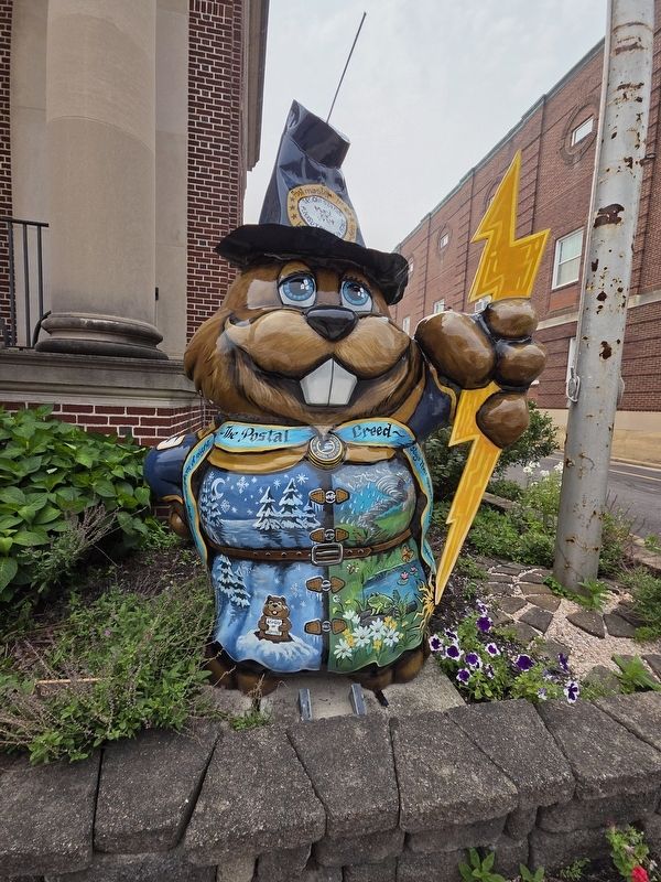
More about this marker. The numbers on the marker are locations of groundhog statues placed around the Punxsutawney Area.
Related markers. Click here for a list of markers that are related to this marker.
Photographed by Mark Parker, July 16, 2026
4. One of the groundhog statues noted on the marker at the Weather Discovery Center
Credits. This page was last revised on August 4, 2026. It was originally submitted on July 19, 2026, by Mark Parker of Hickory, North Carolina. This page has been viewed 19 times since then. Photos: 1, 2, 3, 4. submitted on July 19, 2026, by Mark Parker of Hickory, North Carolina. • Andrew Ruppenstein was the editor who published this page.
