Punxsutawney in Jefferson County, Pennsylvania — The American Northeast (Mid-Atlantic)
Punxsutawney
| — | Cloe - 4 | — |
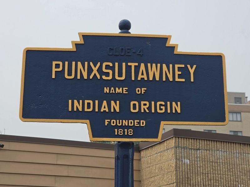
Photographed by Mark Parker, July 16, 2026
1. Punxsutawney Marker
Indian origin
Founded
1818
Topics and series. This historical marker is listed in these topic lists: Indigenous Peoples and Communities • Settlements & Settlers. In addition, it is included in the Pennsylvania Keystone Markers series list. A significant historical year for this entry is 1818.
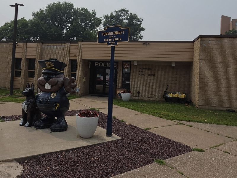
Location. 40° 56.637′ N, 78° 58.065′ W. Marker is in Punxsutawney, Pennsylvania, in Jefferson County. It is at the intersection of East Union Street and Merchants Alley, on the right when traveling west on East Union Street. The marker is located on the East Union Side of the Punxsutawney Municipal Building. It is next to K-9 Officer Phil Statue in front of the Police Department. Touch for map. Marker is at or near this postal address: 301 E Mahoning St, Punxsutawney PA 15767, United States of America. Touch for directions.

Regionally, this marker is in the Pennsylvania Wilds. It is also in the American Northeast, in the Mid-Atlantic, in Appalachia, and specifically in Northern Appalachia. Globally, it is in North America, the Western Hemisphere, the Western World, and the Anglosphere. Historically, it
this page online
Other nearby markers. At least 8 other markers are within walking distance of this marker: Modern Punxsutawney (a few steps from this marker); Industrial Development (a few steps from this marker); Before the Revolutionary War (a few steps from this marker); Early Settlement in Punxsutawney (a few steps from this marker); a different marker also named Punxsutawney (within shouting distance of this marker); World War II Memorial (within shouting distance of this marker); SFC Scott R. Smith (within shouting distance of this marker); Fraternal Order of Eagles War Memorial (about 300 feet away, measured in a direct line). Touch for a list and map of all markers in Punxsutawney.
More about this marker. A separate Punxsutawney marker is located on the East Mahoning Street side of the building.
Regarding Punxsutawney. The "Cloe-4" text at the top of the sign is the distance to Cloe, PA.
Also see . . . The Punxsutawney Historical & Genealogical Website. The origins of the name Punxsutawney
Punxsutawney(Submitted on July 20, 2026, by Mark Parker of Hickory, North Carolina.)was originally a campsite halfway between the Allegheny and Susquehanna rivers. It is located on the earliest known trail to the East, the Shamokin path. The area was, at times, occupied by Shawnee or Delaware Indians and, sometimes, by Senecas or Iroquois.Photographed by Mark Parker, July 16, 20262. Punxsutawney Marker next to K-9 Officer Phil in front of the Police Department
According to the original "Creation" Story of the Delaware Indians, the "Lenni Lenape" (or original people), who were their forebears, began life as animals in "mother earth" and emerged centuries later to hunt and live as men. Thus it was that Oijik (Wejak), or Wojak, which was carried over to us as "'Woodchuck", came to be recognized as the "grandfather" of the earliest known inhabitants of this area.
Although the area previously served as a "border" between Indian nations, the displaced Delawares settled in large numbers about 1723 because of the pressures from white men in the East and Iroquois intrigue. The main move toward the west followed between l740 and l760 as the result of further pressure.
It was during this period that an lndian sorcerer first appeared in various forms and attacked travelers from the East. He was hunted and killed in combat by a young chief. His body was burned to destroy the "evil medicine" but miraculously turned to searing sandflies, or "ponksad," which plagued the area and the Indians. From that time the Indians called the location, " Ponksaduteney," which meant the "town of the sandflies." The sandflies are now gone, but the "ghost of the spelling" is with us to stay.
Credits. This page was last revised on July 22, 2026. It was originally submitted on July 20, 2026, by Mark Parker of Hickory, North Carolina. This page has been viewed 21 times since then. Photos: 1, 2. submitted on July 20, 2026, by Mark Parker of Hickory, North Carolina. • Devry Becker Jones was the editor who published this page.
