Mount Evelyn in Yarra Ranges Shire, Victoria, Australia — Oceania
Mt Evelyn
Highest Station on the Warburton Line
| — | Warburton Rail Trail | — |
Photographed by Dean Barton-Ancliffe, June 18, 2026
1. Mt Evelyn Marker
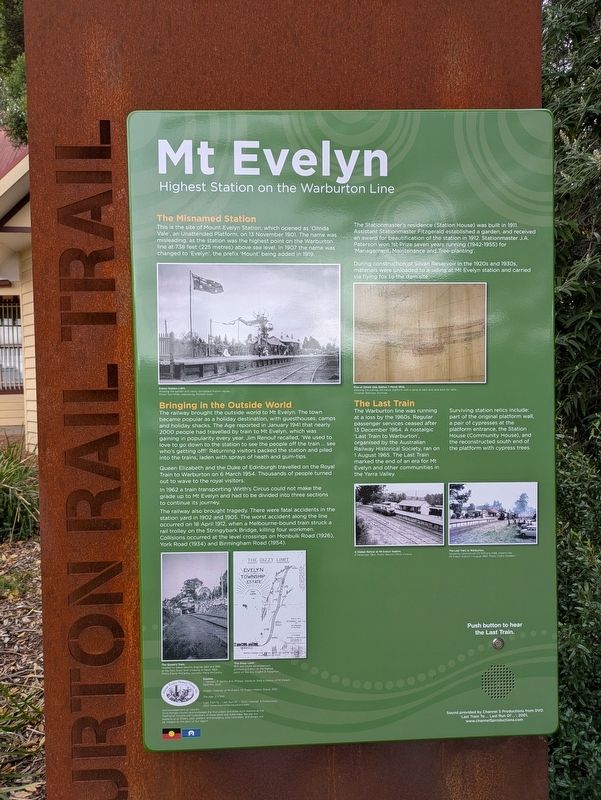
This is the site of Mount Evelyn Station which opened as 'Olinda Vale', an Unattended Platform, on 13 November 1901. The name was misleading as the station was the highest point on the Warburton line at 738 feet (225 metres) above sea level. In 1907 the name was changed to 'Evelyn', the prefix Mount being added in 1907.
Bringing in the Outside World
The railway brought the outside world to Mt Evelyn. The town became popular as a holiday destination, with guesthouse, camps and holiday shacks. The Age reported in January 1941 that early 2000 people had travelled by train to Mt Evelyn, which was gaining in popularity every year. Jim Renouf recalled, 'We used to love to go down to the station to see the people off the train ... see who's getting off'. Returning visitors packed the station and piled into the trains, laden with sprays of heath and gum-tips.
Queen Elizabeth and the Duke of Edinburgh travelled on the Royal Train to Warburton on 6 March 1954. Thousands of people turned out to wave to the royal visitors.
In 1962 a train transporting Wirth's Circus could not make the grade up to Mt
this page online
The railway also brought tragedy. There were fatal accidents in the station yard in 1902 and 1905. The worst accident along the line occurred on 18 April 1912, when a Melbourne-bound train struck a rail trolley on the Stringybark Bridge, killing four workmen. Collisions occurred at the level crossings on Monbulk Road (1926), York Road (1934) and Birmingham Road (1954).
The Stationmaster's residence (Station House) was built in 1911. Assistant Stationmaster Fitzgerald established a garden, and received an award for beautification of the station in 1912. Stationmaster J.A. Paterson won 1st Prize seven years running (1942-1955) for 'Management, Maintenance and Tree-planting'.
During construction et Silvan Reservoir in the 1920s and 1930s, materials were unloaded to a siding at Mt Evelyn station and carried via flying fox to the dam site.
The Last Train
The Warburton line was running at a loss by the 1960s. Regular passenger services ceased after 13 December 1964. A nostalgic 'Last Train to Warburton', organised by the Australian Railway Historical Society,
Photographed by Dean Barton-Ancliffe, June 18, 2026
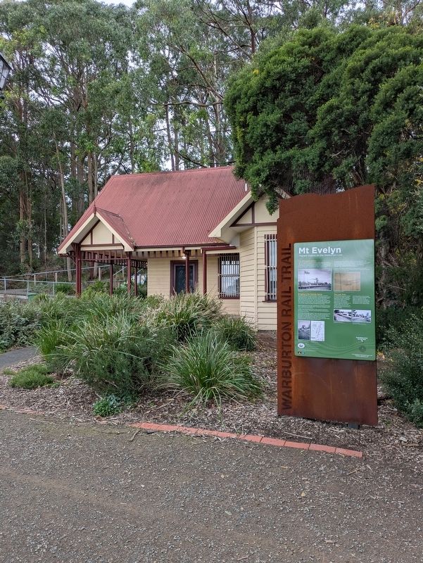
2. Mt Evelyn Marker in front of the old Station House
Surviving station relics include part of the original platform wall, a pair of cypresses at the platform entrance, the Station House (Community House), and the reconstructed south end of the platform with cypress trees.
Erected by Mount Evelyn Historic Group Inc.
Topics. This historical marker is listed in these topic lists: Colonial Era • Railroads & Streetcars. A significant historical date for this entry is November 13, 1901.
Location. 37° 47.128′ S, 145° 22.755′ E. Marker is in Mount Evelyn, Victoria, in Yarra Ranges Shire. It can be reached from Wray Crescent 0.1 kilometers east of Station Street. Touch for map. Marker is at or near this postal address: 8A Birmingham Road, Mount Evelyn VIC 3796, Australia. Touch for directions.

Regionally, it is in Oceania, in Australasia, in the Pacific Ocean, in South Pacific, on the Pacific Rim, in the Western World, and in the Anglosphere. Historically, it finds itself in what was once a British colony.
Other nearby markers. At least 8 other markers are within walking distance of this marker: The Wurrundjeri (within shouting distance of this marker); Bullock Teams and Timber (within shouting distance of this marker); The Berry Farm (within shouting distance of this marker); Swaggies in Tough Times (within shouting distance of this marker); The First Train (within shouting distance of this marker); Peace after War (within shouting distance of this marker); Scouts 80 Years in Mt Evelyn (about 90 meters away, measured in a direct line); The Aqueduct from Silvan (about 90 meters away). Touch for a list and map of all markers in Mount Evelyn.
Also see . . . Lilydale - Warburton Railway. Yarra Ranges Heritage Database
The Lilydale to Warburton Railway line is a linear feature (running from E 354200 N 5819900, to E 385500 N 5821000). (Context 1994) The track from the Lilydale to Warburton Railway Line has been removed. The section of the railway reserve between Launching Place and Warburton East has been developed as the 'Centenary Trail', 12 kilometres of pathway for walkers, cyclists and horse riders. Another portion has been converted into a walking track. (Watt 1993; Supple 1991)(Submitted on July 20, 2026, by Dean Barton-Ancliffe of Rowville, Victoria.)
The Lilydale to Warburton Railway Line includes the following features; the easement from Warburton to Lilydale, cuttings, bridges (Woori Yallock Creek bridge, Warburton bridge and other smaller bridges), stations (Yarra Junction station, goods shed and adjacent Lands Dept depot - probably a former railway house; Woori Yallock station, platform and railway house; remains of the platform at Wesburn station, railway house and several large poplars. The Yarra Junction to Powelltown timber tramway route, which connected to this railway was also noted. (Elphinstone & Johnston 1984: 33-34) Also remaining at the Woori Yallock and Wesburn stations are remnant rails and the railway formation. (Supple 1991)
Credits. This page was last revised on July 21, 2026. It was originally submitted on July 20, 2026, by Dean Barton-Ancliffe of Rowville, Victoria. This page has been viewed 16 times since then. Photos: 1, 2. submitted on July 20, 2026, by Dean Barton-Ancliffe of Rowville, Victoria. • Andrew Ruppenstein was the editor who published this page.
