Lewistown in Logan County, Ohio — The American Midwest (Great Lakes)
Council House
Logan County, On Top of Ohio
Photographed by Dale K. Benington, August 4, 2010
1. Council House Marker
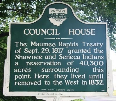
View of the south side of the historical marker.
The Maumee Rapids Treaty of Sept. 29, 1817 granted the Shawnee and Seneca Indians a reservation of 40,300 acres surrounding this point. Here they lived until removed to the West in 1832.
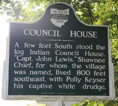
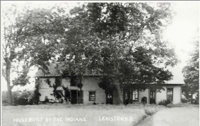
A few feet South stood the log Indian Council House. "Capt. John Lewis," Shawnee Chief, for whom the village was named, lived 800 feet southeast, with Polly Keyser his captive white drudge.
Erected 1947 by Logan County Historical Society.
Topics. This historical marker is listed in these topic lists: Indigenous Peoples and Communities • Settlements & Settlers. A significant historical date for this entry is September 29, 1802.
Location. 40° 25.274′ N, 83° 53.018′ W. Marker is in Lewistown, Ohio, in Logan County. It is on Main Street (County Road 91) east of County Road 1107, on the left when traveling north. Touch for map. Marker is at or near this postal address: 7570 Main Street, Lewistown OH 43333, United States of America. Touch for directions.

Regionally, this marker is in Ohio’s Till Plains. It is also in the American Midwest and in the Corn Belt. Globally, it is in North America, the Western Hemisphere, the Western
this page online
Other nearby markers. At least 8 other markers are within 4 miles of this marker, measured as the crow flies: McColly Covered Bridge - 1876 (approx. 2.6 miles away); St. Mary of the Woods Veterans Memorial (approx. 3.2 miles away); Indian Lake State Park (approx. 3.3 miles away); Indian Lake Spillway (approx. 3.3 miles away); Indian Lake Veterans Memorial (approx. 3.3 miles away); Miami- Erie Canal / Lewistown Reservoir (approx. 3.6 miles away); Interurban Transportation (approx. 3.6 miles away); Sandy Beach and the Big Band Era (approx. 3.6 miles away).
Also see . . . Salvage Investigations at the Wapaughkonetta Shawnee Council House Site. This is a link to information on Shawnee Council House Sites provided by Murray State University. (Submitted on September 20, 2013, by Dale K. Benington of Toledo, Ohio.)
Additional commentary.
1. Lewistown Council House
Dear Mr. Bennington, I have
Photographed by Dale K. Benington, August 4, 2010
2. Council House Marker
View of the north side of the historical marker.
— Submitted September 7, 2013, by Rev. Ronald Irick of West Liberty, Ohio.

Photographed by Craig Doda, July 11, 2026
3. Council House Marker
Photographed by Dale K. Benington, August 4, 2010
4. Council House Marker
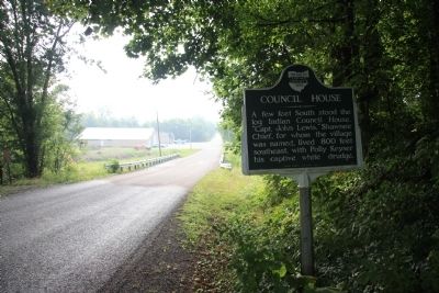
View of historical marker looking south along County Road 91.
Photographed by Dale K. Benington, August 4, 2010
5. Council House Marker
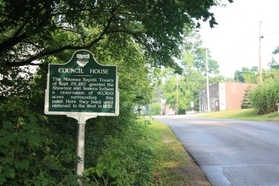
View of historical marker looking north along County Road 91 (Main Street), with downtown Lewistown in the background.
Photographed by Dale K. Benington, August 4, 2010
6. Council House Marker
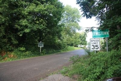
View of historical marker along County Road 91, on the southern edge of the village of Lewistown.
Photographed by Old Post Card
7. Lewistown Council House
Credits. This page was last revised on July 22, 2026. It was originally submitted on August 27, 2010, by Dale K. Benington of Toledo, Ohio. This page has been viewed 2,027 times since then and 75 times this year. Last updated on July 21, 2026, by Craig Doda of Napoleon, Ohio. Photos: 1, 2. submitted on August 27, 2010, by Dale K. Benington of Toledo, Ohio. 3. submitted on July 21, 2026, by Craig Doda of Napoleon, Ohio. 4, 5, 6. submitted on August 27, 2010, by Dale K. Benington of Toledo, Ohio. 7. submitted on September 7, 2013, by Rev. Ronald Irick of West Liberty, Ohio. • Devry Becker Jones was the editor who published this page.
