Gillette in Campbell County, Wyoming — The American West (Mountains)
The Burlington Ditch
Photographed by Cosmos Mariner, July 29, 2022
1. The Burlington Ditch Marker
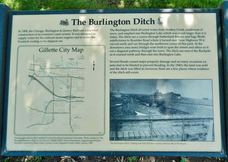
In 1908, the Chicago, Burlington & Quincy Railroad completed construction of an extensive canal system. It was designed to supply water for the railroad steam engines and to water the livestock waiting to be shipped out.
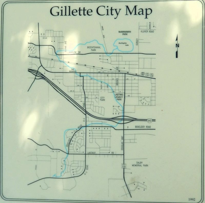
The Burlington Ditch diverted water from Donkey Creek, southwest of town, and emptied into Burlington Lake which was much larger than it is today. The ditch ran a course through Sutherland Estates and Sage Bluffs subdivisions to Boxelder Road where it turned east. Near Highway 59 it curved north and ran through the northwest corner of this park. In the downtown area many bridges were built to span the streets and alleys as it cut a diagonal pathway through the town. The ditch ran east of the Rockpile as it coursed north and then east into Burlington Lake.
Several floods caused major property damage and on many occasions ice jams had to be blasted to prevent flooding. In the 1940's the land was sold and the ditch was filled in; however, there are a few places where evidence of the ditch still exists.
Historical research by Mary Gillis, courtesy of the Campbell County Public Library. 1992
Erected by Campbell
this page online
Topics. This historical marker is listed in these topic lists: Industry & Commerce • Railroads & Streetcars • Settlements & Settlers • Waterways & Vessels. A significant historical year for this entry is 1908.
Location. 44° 17.163′ N, 105° 29.773′ W. Marker is in Gillette, Wyoming, in Campbell County. It can be reached from the intersection of South Douglas Highway (State Highway 59) and East 8th Street, on the right when traveling south. The marker is along the park walkway in Lasting Legacy Park. Touch for map. Marker is at or near this postal address: 800 South Douglas Highway, Gillette WY 82716, United States of America. Touch for directions.

Regionally, this marker is in the Powder River Basin. It is also in the American Mountain West, on the Great Plains, on the Northern Plains, and specifically on the High Plains. Globally, it is in North America, the Western Hemisphere, the Western World, and the Anglosphere. Historically, it finds itself in what was once the Louisiana Purchase.
Other nearby markers. At least 8 other markers are within walking distance of this marker: In Memory of Specialist Manuel Michael Davila
Courtesy Rockpile Museum
2. Marker detail: Gillette City Map
Map by Lee Varvaro, Gillette Public Works Department, Engineering Division. 1992
Also see . . . Discover more about The Burlington Ditch.
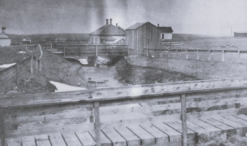
Excerpt: The Burlington Ditch stands as a testament to the pioneering spirit that shaped the American West. Constructed in the late 1800s, this historical landmark is not just a ditch but a significant engineering feat that enabled agricultural development in an otherwise arid region. Visitors to the Burlington Ditch can appreciate the historical context of this site, which played a crucial role in the irrigation practices of early settlers seeking to cultivate the land. The Burlington Ditch serves as a reminder of the perseverance and resourcefulness of the early(Submitted on July 22, 2026, by Cosmos Mariner of Cape Canaveral, Florida.)settlers, who faced numerous challenges to create a sustainable living environment.Courtesy Rockpile Museum3. Marker detail: The Burlington DitchLooking east from Warren Avenue, between 4th & 5th Streets.

Photographed by Cosmos Mariner, July 29, 2022
4. The Burlington Ditch Marker
Looking south through the south side of Lasting Legacy Park.
Credits. This page was last revised on July 22, 2026. It was originally submitted on July 21, 2026, by Cosmos Mariner of Cape Canaveral, Florida. This page has been viewed 13 times since then. Photos: 1, 2, 3, 4. submitted on July 22, 2026, by Cosmos Mariner of Cape Canaveral, Florida.
