Gillette in Campbell County, Wyoming — The American West (Mountains)
Early Homesteaders
Photographed by Cosmos Mariner, July 29, 2022
1. Early Homesteaders Marker
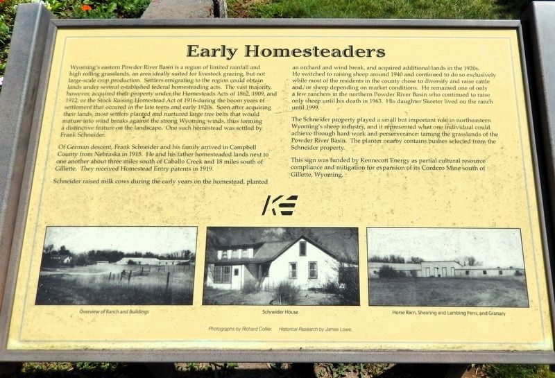
Wyoming's eastern Powder River Basin is a region of limited rainfall and high rolling grasslands, an area ideally suited for livestock grazing, but not large-scale crop production. Settlers emigrating to the region could obtain lands under several established federal homesteading acts. The vast majority, however, acquired their property under the Homesteads Acts of 1862, 1909, and 1912, or the Stock Raising Homestead Act of 1916 during the boom years of settlement that occurred in the late teens and early 1920s. Soon after acquiring their lands, most settlers planted and nurtured large tree belts that would mature into wind breaks against the strong Wyoming winds, thus forming a distinctive feature on the landscape. One such homestead was settled by Frank Schneider.
Of German descent, Frank Schneider and his family arrived in Campbell County from Nebraska in 1915. He and his father homesteaded lands next to one another about three miles south of Caballo Creek and 18 miles south of Gillette. They received Homestead Entry patents in 1919.
Schneider raised milk cows during the early years on the homestead, planted an orchard
this page online
The Schneider property played a small but important role in northeastern Wyoming's sheep industry, and it represented what one individual could achieve through hard work and perseverance: taming the grasslands of the Powder River Basin. The planter nearby contains bushes selected from the Schneider property.
This sign was funded by Kennecott Energy as partial cultural resource compliance and mitigation for expansion of its Cordero Mine south of Gillette, Wyoming.
[photo captions]
• Overview of Ranch and Buildings
• Schneider House
• Horse Barn, Shearing and Lambing Pens, and Granary
Photographs by Richard Collier.
Historical Research by James Lowe.
Erected by Kennecott Energy.
Topics. This
Photographed by Cosmos Mariner, July 29, 2022
2. Early Homesteaders Marker
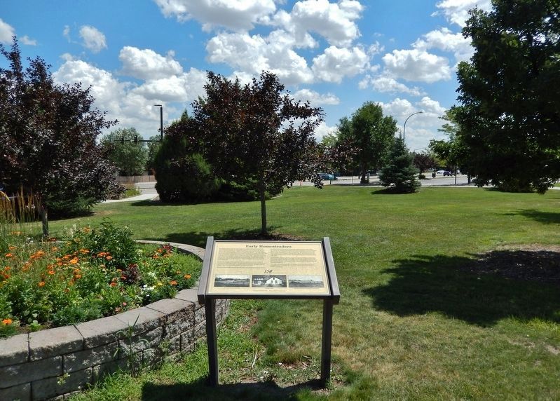
Looking southeast through Lasting Legacy Park. South Douglas Highway is in the background.
Location. 44° 17.193′ N, 105° 29.692′ W. Marker is in Gillette, Wyoming, in Campbell County. It can be reached from the intersection of South Douglas Highway (State Highway 59) and East 8th Street, on the right when traveling south. The marker is along the park walkway in Lasting Legacy Park. Touch for map. Marker is at or near this postal address: 800 South Douglas Highway, Gillette WY 82716, United States of America. Touch for directions.

Regionally, this marker is in the Powder River Basin. It is also in the American Mountain West, on the Great Plains, on the Northern Plains, and specifically on the High Plains. Globally, it is in North America, the Western Hemisphere, the Western World, and the Anglosphere. Historically, it finds itself in what was once the Louisiana Purchase.
Other nearby markers. At least 8 other markers are within walking distance of this marker: In Memory of Betty Hettinger and the Cowboy Bar (here, next to this marker); “All Gave Some and Some Gave All” (a few steps from this marker); Commemorating the Brave Young Men & Women of Campbell County (within shouting distance of this marker); In Memory of Specialist Manuel Michael Davila (within shouting distance of this marker); Area Stocktrails (within shouting distance of this marker); The Burlington Ditch (about 400 feet away, measured in a direct line); Campbell County Centennial Benchmark (approx. half a mile away); George Amos (approx. half a mile away). Touch for a list and map of all markers in Gillette.
Also see . . . July 1921 Campbel County Homestead Land Patents (Rockpile Museum — facebook).
Excerpt: On July 29, 1921 the U.S. General Land Office awarded 10 Homestead Land Patents per the U.S. Homestead Act of 1862 in Campbell County, Wyoming. Those Homestead Patents were received by 10 different Campbell County residents.(Submitted on July 23, 2026, by Cosmos Mariner of Cape Canaveral, Florida.)
Carrie Ayers Daniels (1874-1940) was granted 320 Acres Northeast of Weston, Wyoming.
Frank Schneider - 324 Acres North of Wright, WY
Elmer Reno - 320 Acres South of Wright, WY
Daisy Bryan - 321 Acres South of Wright, WY
William Bartram - 316 Acres North of Wright, WY
Otis Ballard - 318 Acres NW of Wright, WY
John Tuite - 320 Acres South of Wright, WY
Charlie Peterson - 280 Acres East of Rozet, WY
Rosalie Kenney - 320 Acres NW of Gillette, WY
William Roberts - 320 Acres SE of Weston, WY
Credits. This page was last revised on July 23, 2026. It was originally submitted on July 21, 2026, by Cosmos Mariner of Cape Canaveral, Florida. This page has been viewed 18 times since then. Photos: 1, 2. submitted on July 22, 2026, by Cosmos Mariner of Cape Canaveral, Florida.
