Neave Township in Fort Jefferson in Darke County, Ohio — The American Midwest (Great Lakes)
Excavation
Fort Jefferson
Photographed by Craig Doda, September 14, 2019
1. Excavation Marker
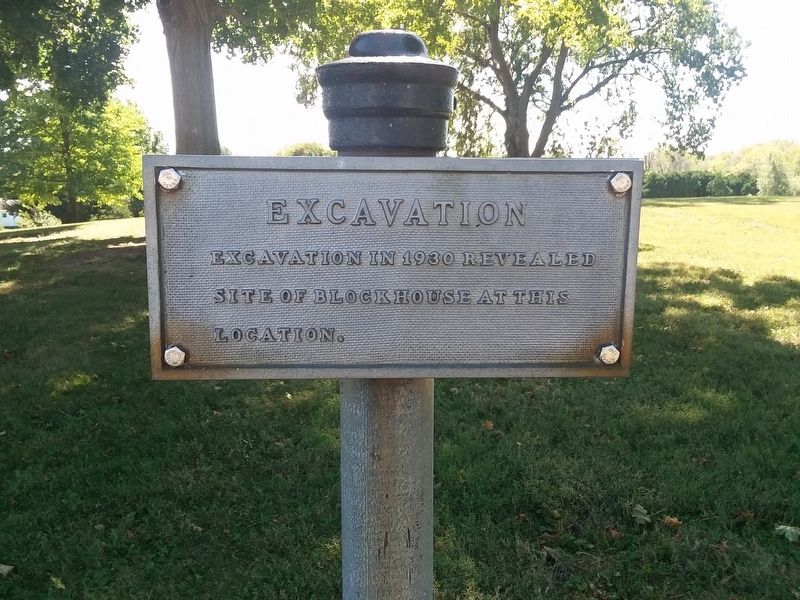
Excavation in 1930 revealed site of blockhouse at this location.
Topics. This historical marker is listed in these topic lists: Anthropology & Archaeology • Forts and Castles. A significant historical year for this entry is 1930.
Location. Marker has been permanently removed. It was located near 40° 1.536′ N, 84° 39.383′ W. Marker was in Fort Jefferson, Ohio, in Darke County. It was in Neave Township. It was on Weavers-Fort Jefferson Road west of Ohio Route 121, on the left when traveling west. Touch for map. Marker was at or near this postal address: 3981 Weavers-Fort Jefferson Rd, Greenville OH 45331, United States of America.
We have been informed that this marker is no longer there and will not be replaced. This page is an archival view of what was.
Regionally, this marker was in Ohio’s Till Plains. It was also in the American Midwest and in the Corn Belt. Globally, it was in North America, the Western Hemisphere, the Western World, and the Anglosphere. Historically, it found itself in what was once the Haudenosaunee (Iroquois) Confederacy, the territory of the Mississippian Culture, and the

this page online
Other nearby markers. At least 8 other markers are within walking distance of this location: A different marker also named Firepit (a few steps from this marker); a different marker also named Excavation (a few steps from this marker); Dedicated in Memory to All American Soldiers Who Died at or Near Fort Jefferson, Northwest Territory (within shouting distance of this marker); Fort Jefferson (within shouting distance of this marker); a different marker also named Well or Magazine Pit (within shouting distance of this marker); a different marker also named Underground Passage (within shouting distance of this marker); a different marker also named Ash Pit (within shouting distance of this marker); Fort Jefferson / St. Clair’s Defeat (within shouting distance of this marker). Touch for a list and map of all markers in Fort Jefferson.
Other markers no longer nearby. Firepit (was here, next to this marker but has been permanently removed); Well or Magazine Pit (was a few steps from this marker but has been permanently removed); Trench (was within shouting distance of this marker but has been permanently removed);
Photographed by Craig Doda, September 14, 2019
2. Excavation Marker
Credits. This page was last revised on July 22, 2026. It was originally submitted on February 6, 2021, by Craig Doda of Napoleon, Ohio. This page has been viewed 237 times since then and 25 times this year. Last updated on July 22, 2026, by Craig Doda of Napoleon, Ohio. Photos: 1, 2. submitted on February 6, 2021, by Craig Doda of Napoleon, Ohio. • Devry Becker Jones was the editor who published this page.
