Near Honey Grove in Fannin County, Texas — The American South (West South Central)
McCraw's Chapel Methodist Church and Cemetery
Photographed by Duane and Tracy Marsteller, May 2, 2026
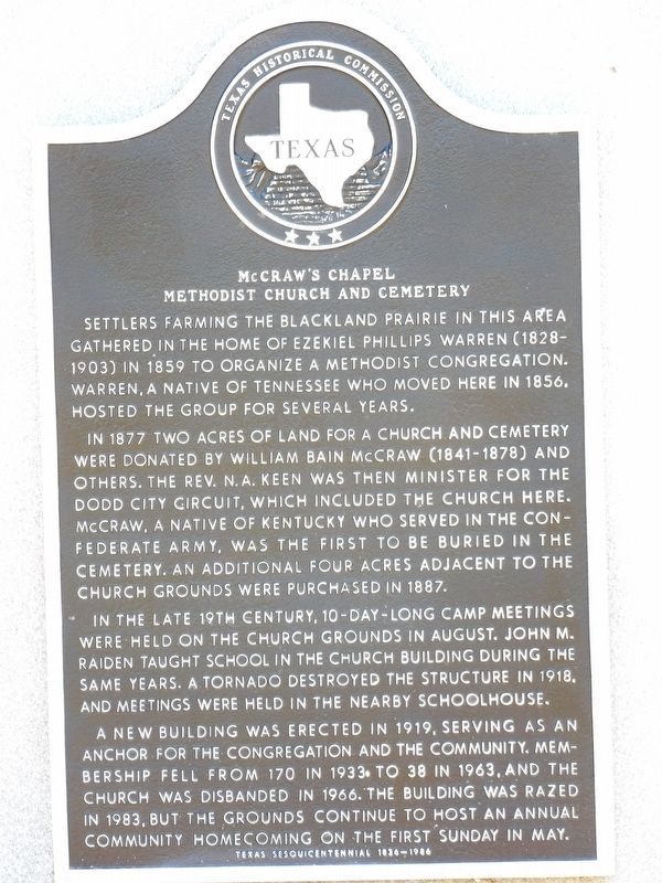
1. McCraw's Chapel Methodist Church and Cemetery Marker
In 1877 two acres of land for a church and cemetery were donated by William Bain McCraw (1841-1878) and others. The Rev. N. A. Keen was then minister for the Dodd City Circuit, which included the church here. McCraw, a native of Kentucky who served in the Confederate Army, was the first to be buried in the cemetery. An additional four acres adjacent to the church grounds were purchased in 1887.
In the late 19th century, 10-day-long camp meetings were held on the church grounds in August. John M. Raiden taught school in the church building during the same years. A tornado destroyed the structure in 1918, and meetings were held in the nearby schoolhouse.
A new building was erected in 1919, serving as an anchor for the congregation and the community. Membership fell from 170 in 1933 to 38 in 1963, and the church was disbanded in 1966. The building was razed in 1983, but
this page online
Erected 1986. (Marker Number 8911.)
Topics. This historical marker is listed in these topic lists: Cemeteries & Burial Sites • Religion & Religious Structures. A significant historical year for this entry is 1859.
Location. 33° 31.611′ N, 95° 57.426′ W. Marker is near Honey Grove, Texas, in Fannin County. It is at the intersection of County Road 3455 and County Road 3425, on the right when traveling east on County Road 3455. Touch for map. Marker is at or near this postal address: 3556 Co Rd 3455, Windom TX 75492, United States of America. Touch for directions.

Regionally, this marker is in the Prairies & Lakes Region. It is also in the American South. Globally, it is in North America, a Gulf of Mexico state, the Western Hemisphere, the Western World, and the Anglosphere. Historically, it finds itself in what was once New Spain, the Republic of Texas, one of the Confederate States of America, and the Antebellum South.
Other nearby markers. At least 8 other markers are within 5 miles of this marker, measured as the crow flies:
Photographed by Duane and Tracy Marsteller, May 2, 2026
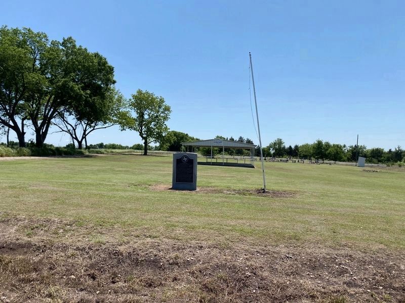
2. McCraw's Chapel Methodist Church and Cemetery Marker
Also see . . . McCraw’s Chapel Methodist Church. About the middle of the Nineteenth Century, settlers from the Eastern States began homesteading the land in the community about halfway between Honey Grove and what was then known as McCowanville (now Ladonia). This wooded area provided not only materials to build their homes but fertile land to raise food for their families. (Jewel Parsons, Honey Grove Signal-Citizen, Aug. 5, 1966; via Honey Grove Preservation League)(Submitted on July 22, 2026, by Duane and Tracy Marsteller of Murfreesboro, Tennessee.)
Credits. This page was last revised on July 22, 2026. It was originally submitted on July 22, 2026, by Duane and Tracy Marsteller of Murfreesboro, Tennessee. This page has been viewed 16 times since then. Photos: 1, 2. submitted on July 22, 2026, by Duane and Tracy Marsteller of Murfreesboro, Tennessee.
