Goderich in Huron County, Ontario — Central Canada (North America)
The Sunset Hotel
| — | Goderich Marine Heritage Trail | — |
Photographed by Tim Boyd, July 15, 2026
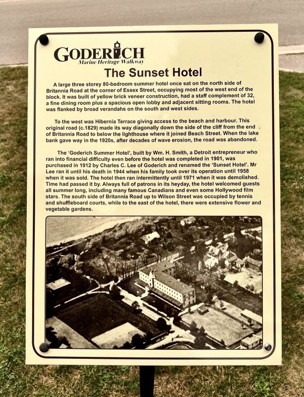
1. The Sunset Hotel Marker
A large three storey 80-bedroom summer hotel once sat on the north side of Britannia Road at the corner of Essex Street, occupying most of the west end of the block. It was built of yellow brick veneer construction, had a staff complement of 32, a fine dining room plus a spacious open lobby and adjacent sitting rooms. The hotel was flanked by broad verandahs on the south and west sides.
To the west was Hibernia Terrace giving access to the beach and harbour. This original road (c.1829) made its way diagonally down the side of the cliff from the end of Britannia Road to below the lighthouse where it joined Beach Street. When the lake bank gave way in the 1920s, after decades of wave erosion, the road was abandoned.
The 'Goderich Summer Hotel', built by Wm. H. Smith, a Detroit entrepreneur who ran into financial difficulty even before the hotel was completed in 1901, was purchased in 1912 by Charles C. Lee of Goderich and renamed the 'Sunset Hotel'. Mr Lee ran it until his death in 1944 when his family took over its operation until 1958 when it was sold. The hotel then ran intermittently until 1971 when it was demolished. Time
this page online
Topics. This historical marker is listed in these topic lists: Architecture • Industry & Commerce • Parks & Recreational Areas. A significant historical year for this entry is 1901.
Location. 43° 44.362′ N, 81° 43.455′ W. Marker is in Goderich, Ontario, in Huron County. It is at the intersection of Essex Street and Britannia Road West, on the right when traveling south on Essex Street. Touch for map. Marker is at or near this postal address: 90 Essex Street, Goderich ON N7A 3X3, Canada. Touch for directions.

Regionally, this marker is in the Huron-Perth-Waterloo-Wellington Area and in Southwestern Ontario. It is also in Central Canada. Globally, it is in North America, on the Great Lakes, in the Western Hemisphere, in the Western World, and in the Anglosphere. Historically,

Photographed by Tim Boyd, July 15, 2026
2. The Sunset Hotel Marker
The marker on the left
Other nearby markers. At least 8 other markers are within walking distance of this marker: The Cottages (here, next to this marker); The Boneyard (approx. 0.2 kilometers away); Goderich Lighthouse (approx. 0.3 kilometers away); Port of Goderich Lighthouse (approx. 0.3 kilometers away); The Great Storm of 1913 (approx. 0.4 kilometers away); Canadian Pacific Railroad Roundhouse (approx. 0.4 kilometers away); The Canadian Pacific Railway Station (approx. 0.4 kilometers away); Former Canadian Pacific Railway Station (approx. 0.4 kilometers away). Touch for a list and map of all markers in Goderich.
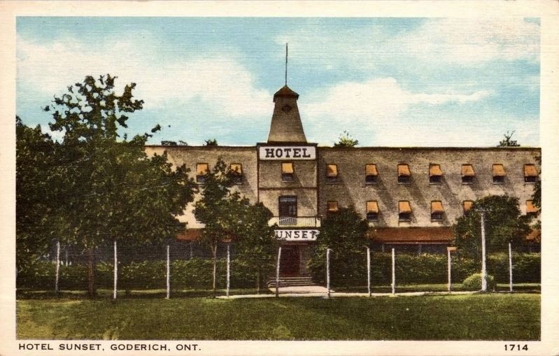
3. The Sunset Hotel, ca 1930
Public domain
Credits. This page was last revised on July 23, 2026. It was originally submitted on July 22, 2026, by Tim Boyd of Hamilton, Ontario. This page has been viewed 8 times since then. Photos: 1, 2, 3. submitted on July 22, 2026, by Tim Boyd of Hamilton, Ontario. • Andrew Ruppenstein was the editor who published this page.
