Newcastle in Weston County, Wyoming — The American West (Mountains)
Camp Jenney
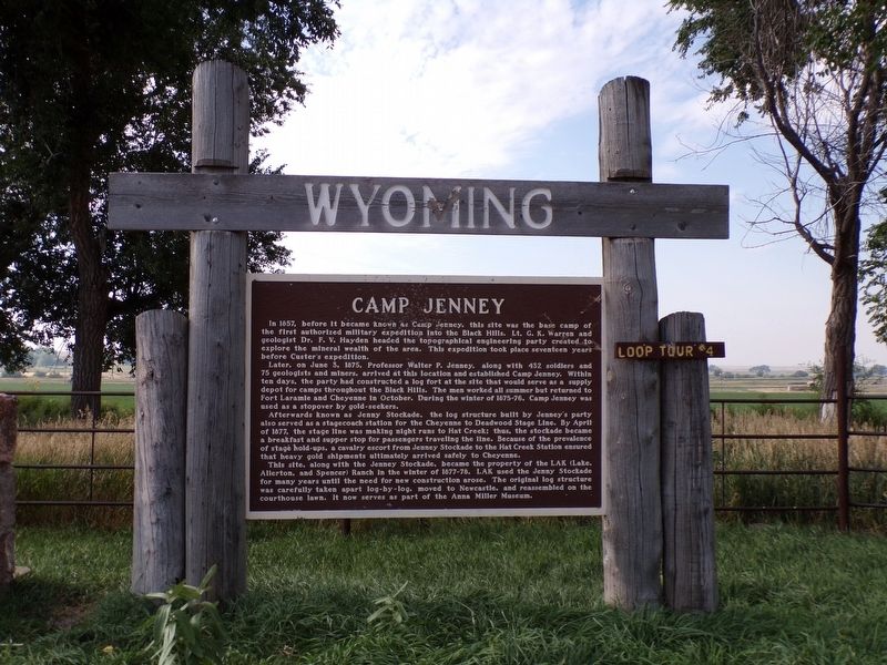
Photographed by Jimmy Emerson, September 7, 2022
1. Camp Jenney Marker
Later, on June 3, 1875, Professor Walter P. Jenney, along with 432 soldiers and 75 geologists and miners, arrived at this location and established Camp Jenney. Within ten days, the party had constructed a log fort at the site that would serve as a supply depot for camps throughout the Black Hills. The men worked all summer but returned to Fort Laramie and Cheyenne in October. During the winter of 1875-76, Camp Jenney was used as a stopover by gold-seekers.
Afterwards known as Jenny Stockade, the log structure built by Jenney's party also served as a stagecoach station for the Cheyenne to Deadwood Stage Line. By April of 1877, the stage line was making night runs to Hat Creek; thus, the stockade became a breakfast and supper stop for passengers traveling the line.
this page online
This site, along with the Jenney Stockade, became the property of the LAK (Lake, Allerton, and Spencer) Ranch In the winter of 1877-78. LAK used the Jenny Stockade for many years until the need for new construction arose. The original log structure was carefully taken apart log-by-log, moved to Newcastle, and reassembled on the courthouse lawn. It now serves as part of the Anna Miller Museum.
Topics. This historical marker is listed in these topic lists: Exploration • Roads & Vehicles. A significant historical year for this entry is 1875.
Location. 43° 48.963′ N, 104° 7.378′ W. Marker is in Newcastle, Wyoming, in Weston County. It is on U.S. 16, on the right when traveling east. Touch for map. Marker is at or near this postal address: 5428 US-16, Newcastle WY 82701, United States of America. Touch for directions.

Regionally, this marker is in the Powder River Basin. It is also in the American Mountain West, in the Black Hills, on the Great Plains,
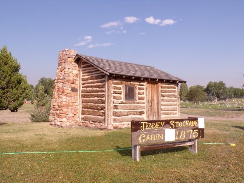
Photographed by Jimmy Emerson, September 7, 2022
2. The Jenney Stockade
Now on the grounds of the Anna Miller Museum in Newcastle.
Other nearby markers. At least 8 other markers are within 8 miles of this marker, measured as the crow flies: The Jenney Stockade (a few steps from this marker); Site of Field City (approx. ¼ mile away); Cheyenne – Deadwood Trail (approx. ¾ mile away); Accidental Oil Well (approx. one mile away); The Trains Power Newcastle (approx. 4.9 miles away); Cambria Powers the Trains (approx. 4.9 miles away); Hanging of Diamond L. Slim Clifton (approx. 4.9 miles away); Cambria (approx. 7.6 miles away). Touch for a list and map of all markers in Newcastle.
Other markers no longer nearby. Camp Jenney (was here, next to this marker but has been permanently removed); The Hanging of Diamond L Slim Clifton (was approx. 4.9 miles away but has been permanently removed).
Credits. This page was last revised on July 22, 2026. It was originally submitted on July 22, 2026, by Jimmy Emerson of Dalton, Georgia. This page has been viewed 14 times since then. Photos: 1, 2. submitted on July 22, 2026, by Jimmy Emerson of Dalton, Georgia. • Andrew Ruppenstein was the editor who published this page.
