Peterborough, England, United Kingdom — Northwestern Europe (the British Isles)
Narrow Bridge Street
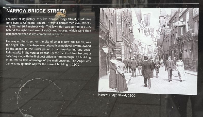
Photographed by Ray Gurganus, May 3, 2026
1. Narrow Bridge Street Marker
Halfway up the street, on the site of what is now WH Smith, was the Angel Hotel. The Angel was originally a medieval tavern, owned by the abbey. In the Tudor period it had bear-baiting and cock-fighting pits in the yard at its rear. By the 1700s it had become a coaching inn, with the first post office in Peterborough in a building at its rear to take advantage of the mail coaches. The Angel was demolished to make way for the current building in 1972.
Topics. This historical marker is listed in this topic list: Roads & Vehicles.
Location. 52° 34.219′ N, 0° 14.538′ W. Marker is in Peterborough, England. It is on Bridge Street. Touch for map. Marker is at or near this postal address: 61 Bridge St, Peterborough, England PE1 1HA, United Kingdom. Touch for directions.

Regionally,
this page online
Other nearby markers. At least 8 other markers are within walking distance of this marker: Foundry Walk (about 90 meters away, measured in a direct line); Crossing the River (about 180 meters away); Abbey and Cathedral (about 210 meters away); St Thomas Becket (approx. 0.2 kilometers away); The Guildhall (approx. 0.2 kilometers away); Simon Gunton (approx. 0.3 kilometers away); Welcome to Peterborough Cathedral (approx. 0.3 kilometers away); Markets and Monarchs (approx. 0.3 kilometers away). Touch for a list and map of all markers in Peterborough.
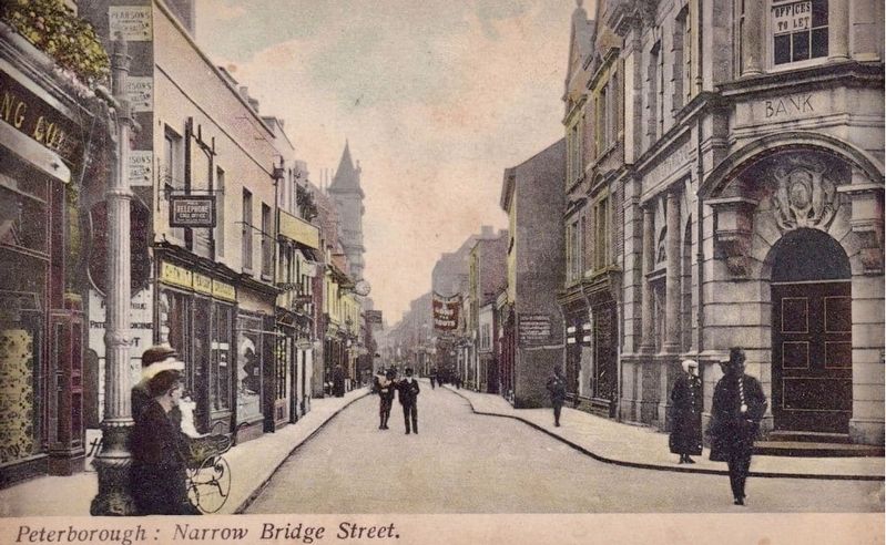
circa 1910
2. Narrow Bridge Street, looking south
This photo was taken from about 150 meters north of the marker site, looking south
Credits. This page was last revised on July 23, 2026. It was originally submitted on July 22, 2026, by Ray Gurganus of Washington, District of Columbia. This page has been viewed 9 times since then. Photos: 1. submitted on July 22, 2026, by Ray Gurganus of Washington, District of Columbia. 2. submitted on July 23, 2026, by Andrew Ruppenstein of Lamorinda, California. • Andrew Ruppenstein was the editor who published this page.
Editor’s want-list for this marker. photo of the marker within its surroundings • Can you help?
