Van Buren in Hancock County, Ohio — The American Midwest (Great Lakes)
Ohio Department of Natural Resources 75th Anniversary
Protecting Ohio's natural resources since 1949.
| — | Hancock County | — |
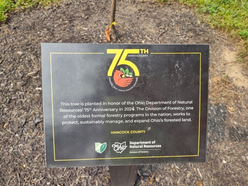
Photographed by Craig Doda, July 17, 2026
1. Ohio Department of Natural Resources 75th Anniversary Marker
Erected 2024 by Department of Ohio Natural Resources Division of Forestry.
Topics. This historical marker is listed in these topic lists: Horticulture & Forestry • Parks & Recreational Areas. A significant historical year for this entry is 2024.
Location. 41° 8.046′ N, 83° 38.559′ W. Marker is in Van Buren, Ohio, in Hancock County. It is at the intersection of County Route 218 and Railroad Street, on the right when traveling east on County Route 218. Touch for map. Marker is at or near this postal address: 12611 Township Rd 218, Van Buren OH 45889, United States of America. Touch for directions.

Regionally, this marker is in the Till Plains. It is also in the American Midwest and in the Corn Belt. Globally, it is in North America, the Western Hemisphere, the Western World, and the Anglosphere. Historically, it finds itself in what was once the Haudenosaunee
this page online
Other nearby markers. At least 8 other markers are within 3 miles of this marker, measured as the crow flies: Welcome (about 500 feet away, measured in a direct line); Van Buren Schools Veterans Memorial (approx. 0.4 miles away); Veterans Memorial (approx. half a mile away); Van Buren War Memorial (approx. half a mile away); The Village of Van Buren (approx. half a mile away); North Baltimore (approx. 2.7 miles away); Ives Reservoir (approx. 3 miles away); Veterans Memorial Water Tower (approx. 3.1 miles away). Touch for a list and map of all markers in Van Buren.

Photographed by Craig Doda, July 17, 2026
2. Ohio Department of Natural Resources 75th Anniversary Marker
Credits. This page was last revised on July 23, 2026. It was originally submitted on July 22, 2026, by Craig Doda of Napoleon, Ohio. This page has been viewed 11 times since then. Photos: 1, 2. submitted on July 22, 2026, by Craig Doda of Napoleon, Ohio. • Devry Becker Jones was the editor who published this page.
