Sarah Ann in Logan County, West Virginia — The American South (Appalachia)
The Resting Place
Hatfield Cemetery
Photographed by Mark Parker, July 11, 2026
1. The Resting Place Marker
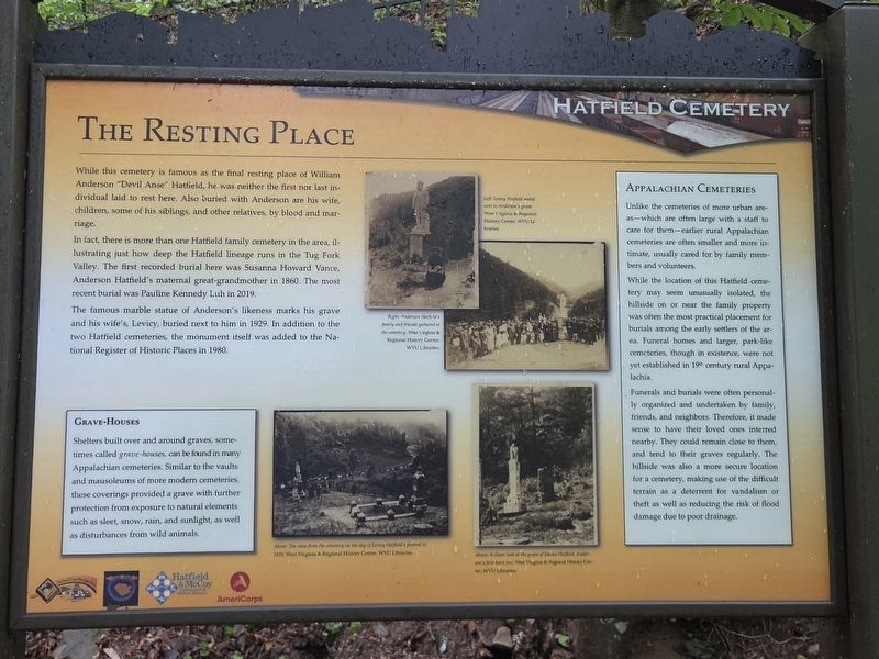
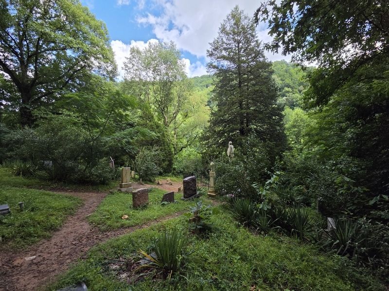
While this cemetery is famous as the final resting place of William Anderson "Devil Anse" Hatfield, he was neither the first nor last individual laid to rest here. Also buried with Anderson are his wife, children, some of his siblings, and other relatives, by blood and marriage.
In fact, there is more than one Hatfield family cemetery in the area, illustrating just how deep the Hatfield lineage runs in the Tug Fork Valley. The first recorded burial here was Susanna Howard Vance, Anderson Hatfield's maternal great-grandmother in 1860. The most recent burial was Pauline Kennedy Luh in 2019.
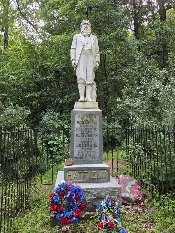
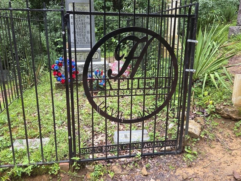
The famous marble statue of Anderson's likeness marks his grave and his wife's, Levicy, buried next to him in 1929. In addition to the two Hatfield cemeteries, the monument itself was added to the Na- tional Register of Historic Places in 1980.
[Sidebars]
Grave-Houses
Shelters built over and around graves, sometimes called grave-houses, can be found in many Appalachian cemeteries. Similar to the vaults and mausoleums of more modern cemeteries, these coverings provided a grave with further protection from exposure to natural
this page online
Appalachian Cemeteries
Unlike the cemeteries of more urban areas — which are often large with a staff to care for them — earlier rural Appalachian cemeteries are often smaller and more intimate, usually cared for by family members and volunteers.
While the location of this Hatfield cemetery may seem unusually isolated, the hillside on or near the family property was often the most practical placement for burials among the early settlers of the area. Funeral homes and larger, park-like cemeteries, though in existence, were not yet established in 19th century rural Appalachia.
Funerals and burials were often personally organized and undertaken by family, friends, and neighbors. Therefore, it made sense to have their loved ones interred nearby. They could remain close to them, and tend to their graves regularly. The hillside was also a more secure location for a cemetery, making use of the difficult terrain as a deterrent for vandalism or theft as well as reducing the risk of flood damage due to poor drainage.
Erected by National
Photographed by Mark Parker, July 11, 2026
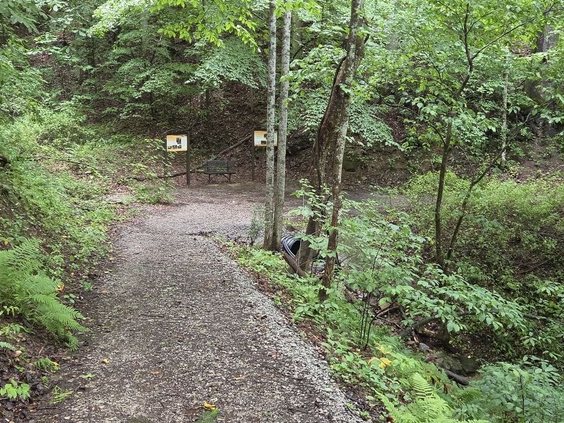
2. The Resting Place Marker (lef) at the end of the second incline on the Hatfield Cemetery trail
Topics. This historical marker is listed in this topic list: Cemeteries & Burial Sites. A significant historical year for this entry is 1860.
Location. 37° 42.246′ N, 81° 59.554′ W. Marker is in Sarah Ann, West Virginia, in Logan County. It can be reached from Jerry West Highway (West Virginia Route 44) half a mile south of Philips Street, on the right when traveling south. The marker is on the Hatfield Cemetery trail at the end of the second incline. Touch for map. Marker is at or near this postal address: 12602 Jerry West Hwy, Sarah Ann WV 25644, United States of America. Touch for directions.

Regionally, this marker is in the Southern Coalfields. It is also in the American South, specifically in the Upper South, in Appalachia, and specifically in Southern Appalachia. Globally, it is in North America, the Western Hemisphere, the Western World, and the Anglosphere. Historically, it finds itself in what was once the territory of the Mississippian Culture.
Other nearby markers. At least 8 other markers are within walking distance
Photographed by Mark Parker, July 11, 2026
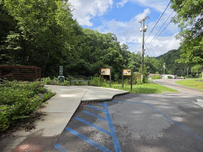
3. Hatfield Cemetery trailhead of Jerry West Hwy (WV Hwy 44)
Related marker. Click here for another marker that is related to this marker.
Additional commentary.
1. Visiting Hatfield Cemetery
Persons wishing to visit the cemetery itself should know that it is a trek to get there.
The trail shown currently on Google Maps, leading from the "Hatfield Cemetery" marker, will get you there, but it is steep and tricky to climb when it is wet.
A new trail (not yet shown in Google maps) has been constructed a short distance south which offers an easier climb to the cemetery with paved gravel, and contains several markers, including this one. There is also more and easier parking available.
Regardless of which trail is taken, the last climb
Photographed by Mark Parker, July 11, 2026
4. Devil Anse Hatfield Statue
— Submitted July 23, 2026, by Mark Parker of Hickory, North Carolina.
Photographed by Mark Parker, July 11, 2026
5. Hatfield Cemetery overlooking the hollow
Photographed by Mark Parker, July 11, 2026
6. Hatfield Cemetery gate to Devil Anse statue
Credits. This page was last revised on July 23, 2026. It was originally submitted on July 23, 2026, by Mark Parker of Hickory, North Carolina. This page has been viewed 11 times since then. Photos: 1, 2, 3, 4, 5, 6. submitted on July 23, 2026, by Mark Parker of Hickory, North Carolina. • Devry Becker Jones was the editor who published this page.
