
Near Charleston in Charleston County, South Carolina — The American South (South Atlantic)
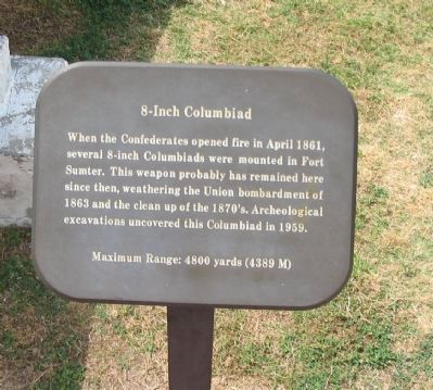
8-Inch Columbiad
Photographed by Craig Swain, May 3, 2010
1. 8-Inch Columbiad Marker
Maximum Range: 4800 yards (4389 M)
Topics. This historical marker is listed in this topic list: War, US Civil. A significant historical month for this entry is April 1861.
Location. 32° 45.163′ N, 79° 52.488′ W. Marker is near Charleston, South Carolina, in Charleston County. It can be reached from Fort Sumter Ferry Terminal. Marker is located at Fort Sumter National Monument and only reached by boat. Touch for map. Marker is in this post office area: Charleston SC 29412, United States of America. Touch for directions.

Regionally, this marker is in Historic Charleston and in the Lowcountry. It is also in the American South, specifically in the Deep South, and on the Eastern Seaboard. Globally, it is in the North Atlantic Region, North America, the Western Hemisphere, the Western World, and the Anglosphere. Historically, it finds itself
this page online
Other nearby markers. At least 8 other markers are within walking distance of this marker: 15-Inch Rodman (here, next to this marker); Arming the Fort (a few steps from this marker); 10-Inch Mortar, Model 1819 (a few steps from this marker); Holding the Fort (a few steps from this marker); Siege of Fort Sumter (a few steps from this marker); Mining Casemate (a few steps from this marker); 42-Pounder, Banded and Rifled (within shouting distance of this marker); Fort Sumter Today (within shouting distance of this marker). Touch for a list and map of all markers in Charleston.
Photographed by Craig Swain, May 3, 2010
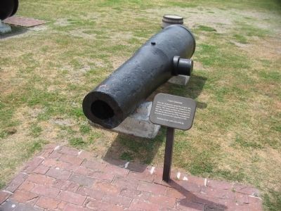
2. 8-Inch Columbiad and Marker
Photographed by Craig Swain, May 3, 2010
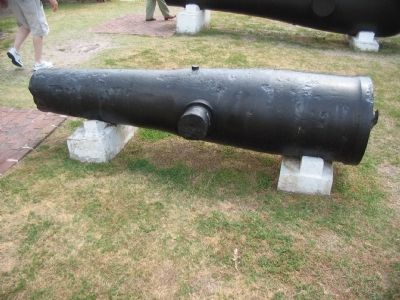
3. 8-Inch Columbiad
Credits. This page was last revised on January 4, 2026. It was originally submitted on May 12, 2010, by Craig Swain of Leesburg, Virginia. This page has been viewed 1,330 times since then and 26 times this year. Photos: 1, 2, 3. submitted on May 12, 2010, by Craig Swain of Leesburg, Virginia.
