
Fairfield Township near Fairton in Cumberland County, New Jersey — The American Northeast (Mid-Atlantic)
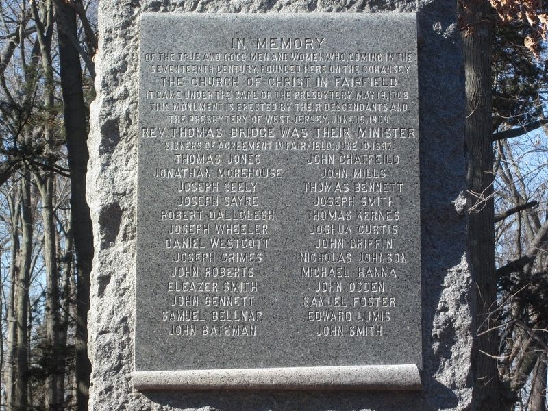
The Church of Christ in Fairfield
Photographed by Donald B. Caselli (Barry), February 13, 2012
1. The Church of Christ in Fairfield Marker
The Church of Christ in Fairfield
It came under the care of the Presbytery, May 19, 1708
This monument is erected by their descendants and the Presbytery of West Jersey, June 15, 1909
Rev. Thomas Bridge was their minister.
Signers of agreement in Fairfield, June 10, 1697:
Erected 1909 by the Presbytery of West Jersey.
Topics. This historical marker is listed in these topic lists: Colonial Era • Religion & Religious Structures • Settlements & Settlers. A significant historical date for this entry is May 19, 1708.
Location. 39° 22.569′ N, 75° 14.139′ W. Marker is near Fairton, New Jersey, in Cumberland
this page online

Regionally, this marker is in New Jersey’s South Jersey. It is also in the American Northeast, in the Mid-Atlantic, and on the Eastern Seaboard. Globally, it is in the North Atlantic Region, North America, the Western Hemisphere, the Western World, and the Anglosphere. Historically, it finds itself in what was once New Netherland and also one of the original Thirteen Colonies.
Other nearby markers. At least 8 other markers are within 6 miles of this marker, measured as the crow flies: New Jersey Coastal Heritage Trail Route (approx. 3½ miles away); "Liberty Bell" (approx. 3.6 miles away); These Patriots (approx. 3.7 miles away); Old Broad Street Presbyterain Church (approx. 3.7 miles away); Broad St. Church (approx. 3.7 miles away);
Photographed by Donald B. Caselli (Barry), November 3, 2012
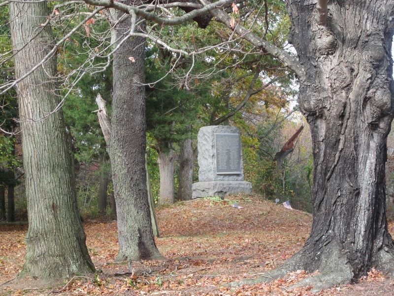
2. The Church of Christ in Fairfield Marker
More about this marker. Behind the marker, mostly to its left, is the old Fairfield Presbyterian cemetery. The Fairfield Church actually dates to 1680, though that date isn't mentioned on the marker.
Credits. This page was last revised on July 27, 2026. It was originally submitted on July 24, 2026, by Donald B. Caselli (Barry) of Hopewell, Virginia. This page has been viewed 6 times since then. Photos: 1, 2. submitted on July 24, 2026, by Donald B. Caselli (Barry) of Hopewell, Virginia. • Michael Herrick was the editor who published this page.
