Coeur d'Alene in Kootenai County, Idaho — The American West (Mountains)
Fort Sherman
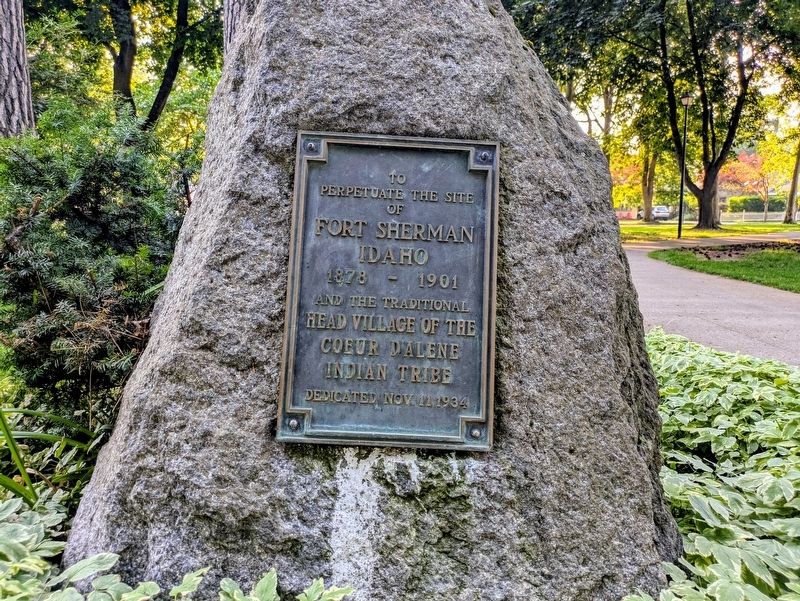
Photographed by Clayton Pickett, July 23, 2026
1. Fort Sherman Marker
Fort Sherman Idaho
1878 - 1901
and the traditional
head village of the Coeur d'Alene Indian tribe
Erected 1934.
Topics. This historical marker is listed in these topic lists: Forts and Castles • Indigenous Peoples and Communities. A significant historical year for this entry is 1878.
Location. 47° 40.54′ N, 116° 47.444′ W. Marker is in Coeur d'Alene, Idaho, in Kootenai County. It is at the intersection of West Fort Grounds Drive and East Rosenberry Drive on West Fort Grounds Drive. Marker is located near the northwest corner of City Park. Touch for map. Marker is at or near this postal address: 415 W Fort Grounds Drive, Coeur D Alene ID 83814, United States of America. Touch for directions.

Regionally, this marker is in North Idaho — Idaho’s Panhandle and in Greater Spokane. It is also in the American Mountain West and specifically in the Pacific Northwest. Globally, it is in North America, the Western Hemisphere, the Western World, and the Anglosphere.
Other nearby markers. At least 8 other markers are within 8 miles of this marker, measured as the crow flies: Fort Sherman Chapel (approx. 0.2 miles away); "Big Hank Cabin" (approx. 0.4 miles away); Fort Sherman Powder Magazine (approx. 0.4 miles away); Tubbs Hill (approx. 0.6 miles away); Lake Steamers (approx. 3.2 miles
this page online
Also see . . .
1. Fort Sherman (Idaho) (Wikipedia). Overview:
Fort Sherman (1878–1900) was a military post in the northwest United States, located in northern Idaho at Coeur d'Alene. General William T. Sherman (1820–91) of the U.S. Army had recommended the site after an inspection tour in 1877.(Submitted on July 24, 2026.)
2. Coeur d'Alene people (Wikipedia). Overview:
The Coeur d'Alene Tribe (also Skitswish; Coeur d'Alene: Schi̱tsu'umsh) are a Native American tribe and one of five federally recognized tribes in the state of Idaho. The Coeur d'Alene have sovereign control of their Coeur d'Alene Reservation, which includes a significant portion of Lake Coeur d'Alene and its submerged lands.(Submitted on July 24, 2026.)
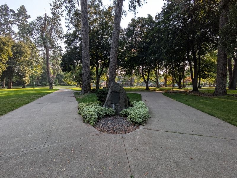
Photographed by Clayton Pickett, July 23, 2026
2. Fort Sherman Marker
Credits. This page was last revised on July 24, 2026. It was originally submitted on July 24, 2026, by Clayton Pickett of Richland, Washington. This page has been viewed 22 times since then. Photos: 1, 2. submitted on July 24, 2026, by Clayton Pickett of Richland, Washington. • Andrew Ruppenstein was the editor who published this page.
