Emerson in Emerson – Franklin Municipality, Manitoba — Canada’s Prairie Region (North America)
The March West
⎯⎯⎯
La Marche Vers L'ouest
Photographed by Jimmy Emerson, June 2005
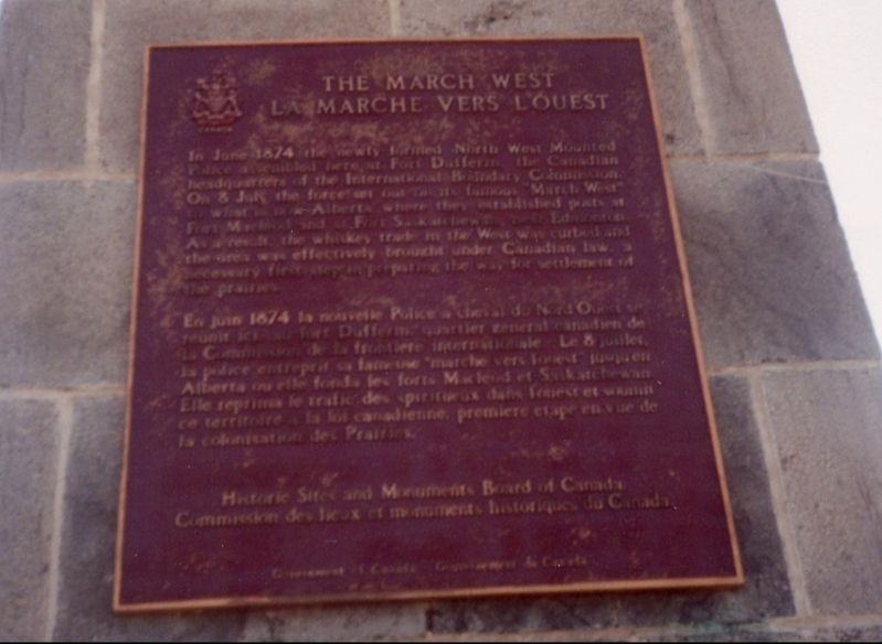
1. The March West/La Marche Vers L'ouest Marker

In June 1874 the newly-formed North-West Mounted Police assembled here at Fort Dufferin, the Canadian headquarters of the International Boundary Commission. On 8 July the force set out on its famous "March West” to what is now Alberta where they established posts at Fort Macleod and at Fort Saskatchewan hear Edmonton. As a result, the whiskey trade in the West was curbed and the area was effectively brought under Canadian law. a necessary first step in preparing the way for settlement of the prairies.
En juin 1874 la nouvelle Police a cheval du Nord Ouest se réunit ici au fort Dufferin quartier général canadien de la Commission de la frontière internationale. Le 8 juillet, la police entreprit sa fameuse "marche vers l’ouest" jusqu'en Alberta où elle fonda les forts Macleod et Saskatchewan. Elle reprima le trafic des spiritueux dans l'ouest et soumit ce territoire a la loi canadienne, première étape en vue de la colonisation des Prairies.
Erected by Historic Sites and Monuments Board of Canada.
Topics and series. This historical marker is
this page online
Location. Marker has been permanently removed. It was located near 49° 1.895′ N, 97° 12.324′ W. Marker was in Emerson, Manitoba, in Emerson – Franklin Municipality. It was on Manchester Avenue, on the right when traveling north. Touch for map. Marker was at or near this postal address: 393 Manchester Avenue, Emerson MB R0A 0L0, Canada.
We have been informed that this marker is no longer there and will not be replaced. This page is an archival view of what was.
Regionally, this marker was in the Red River Valley. It was also in the Prairies. Globally, it was in North America, the Western Hemisphere, the Western World, and the Anglosphere. Historically, it found itself in what was once a British colony, the Viceroyalty of New France, and Rupert’s Land.

Other nearby markers. At least 8 other markers are within 13 kilometers of this location, measured as the crow flies: Fort Dufferin (a few steps from this marker); Emerson Court House and Town Hall
Photographed by Jimmy Emerson, June 2005
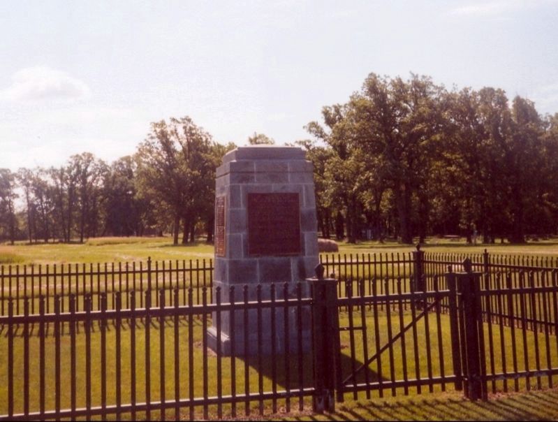
2. The March West/La Marche Vers L'ouest Marker
This marker is on the front.
More about this marker. Per waymarking.com, this plaque was still in place on June 21,2010 but had been replaced by "Fort Dufferin" marker by June 24, 2013, when I took a picture of it.
Also see . . . March West (Wikipedia). Overview:
The March West was the initial journey of the North-West Mounted Police (NWMP) to the Canadian prairies, made between July 8 and October 9, 1874.(Submitted on July 26, 2026.)
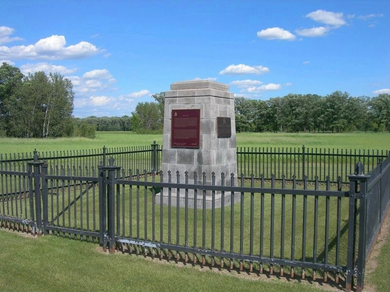
It was the result of the force being deployed to what is now southern Alberta in response to the Cypress Hills Massacre and subsequent fears of a US military intervention. Their ill-planned and arduous journey of nearly 1,400 kilometres (900 mi) became known as the"March West" and was later portrayed by the force as an epic journey of endurance.Photographed by Jimmy Emerson, June 14, 20133. The March West/La Marche Vers L'ouest Marker MissingThe March West marker had been on the front side of the monument but had been replaced by the "Fort Dufferin" marker.
Credits. This page was last revised on July 27, 2026. It was originally submitted on July 25, 2026, by Jimmy Emerson of Dalton, Georgia. This page has been viewed 16 times since then. Photos: 1, 2, 3. submitted on July 25, 2026, by Jimmy Emerson of Dalton, Georgia. • Andrew Ruppenstein was the editor who published this page.
