Kelleys Island in Erie County, Ohio — The American Midwest (Great Lakes)
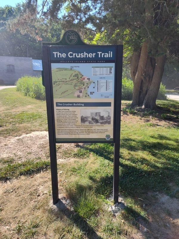
The Crusher Trail
Kelleys Island State Park

Photographed by Craig Doda, July 4, 2026
1. The Crusher Trail Marker
The Crusher Building
History of Mining
In 1886, local limestone mining companies united to form the Kelleys Island Lime and Transport Company (KIL&T). Their business relied on the structure that stands before you today—the Crusher Building. Inside, a steam-powered crusher smashed large pieces of limestone into smaller chunks—between two to five inches. These chunks were then heated to produce lime, a substance used in products ranging from mortar to steel.
KIL&T quarried limestone on Kelleys Island from 1886 until 1941, when they moved their operations to Marblehead. The Crusher Building is the only remnant of KIL&T's enormous quarrying (rock mining) operation. The Ohio Department of Natural Resources (ODNR) rehabilitated the structure in 2024.
Erected by Ohio Department Of Natural Resources, Ohio State Parks & Watercraft.
Topics. This historical marker is listed in these topic lists: Industry & Commerce • Natural Resources • Parks & Recreational Areas. A significant historical year for this entry is 1886.
Location. 41° 37.075′ N, 82° 42.385′ W. Marker is on Kelleys Island, Ohio, in Erie County. It is
this page online

Regionally, this marker is on the Lake Erie Shore and in the Western Reserve. It is also in the American Midwest and in the Corn Belt. Globally, it is in North America, on the Great Lakes, in the Western Hemisphere, in the Western World, and in the Anglosphere. Historically, it finds itself in what was once the Haudenosaunee (Iroquois) Confederacy, the territory of the Mississippian Culture, and the Northwest Territory.
Other nearby markers. At least 8 other markers are within walking distance of this marker: Columbus Limestone / Kelleys Island Lime & Transport Co. (here, next to this marker); The Crusher Process (a few steps from this marker); The Small, but Mighty (within shouting distance of this marker); Island History (about 600 feet away); Welcome to Glacial Grooves Geological Preserve (about 600 feet away); a different marker also named The Crusher Trail (about
Photographed by Craig Doda, July 4, 2026
2. The Crusher Trail Marker
Another marker is no longer nearby. Glacial Grooves State Memorial (was about 600 feet away, measured in a direct line but has been permanently removed).
Credits. This page was last revised on August 5, 2026. It was originally submitted on July 27, 2026, by Craig Doda of Napoleon, Ohio. This page has been viewed 12 times since then. Photos: 1, 2. submitted on July 27, 2026, by Craig Doda of Napoleon, Ohio. • Devry Becker Jones was the editor who published this page.
