Warren in Warren County, Pennsylvania — The American Northeast (Mid-Atlantic)
Vista View Kiosk
| — | Walkable Warren | — |

Photographed by Mark Parker, July 16, 2026
1. Vista View Kiosk Marker
[Header]
Walkable Warren
Walkable Warren is a local initiative intended to promote healthy lifestyles by encouraging foot travel and bicycling as alternative modes of travel in and around the City of Warren. Warren has a wealth of scenic landscapes, historic architecture, public parks, and trails, all worthy of being showcased and that are best experienced on foot or by bicycle. Recommended routes of travel between the Warren/North Warren Bike/Hike trail, core downtown and a few of our public parks are marked by Walkable Warren signage along our public streets. We encourage you to step out of the automobile as a source of travel, and instead, experience Walkable Warren on foot or by bicycle. Pedestrians should use the sidewalks. Bicyclists must obey all traffic laws.
[Captions, top to bottom]
Pennsylvania Avenue West looking east from Poplar Street. Circa 1910
Pennsylvania Avenue West looking west from Hickory Street. Circa 1910.
Pennsylvania Avenue West on the south side of General Joseph Warren Park. Circa 1910.
Pennsylvania Avenue West at Laurel Street showing Street Car Rail. Circa 1910
Suspension Bridge spanning the Allegheny River at Hickory Street. Circa 1910
Pennsylvania Avenue West looking east from General Joseph Warren Park. Circa 1910
Photos provided by The Warren County Historical Society
Erected by Lumber
this page online
Topics. This historical marker is listed in these topic lists: Notable Places • Waterways & Vessels. A significant historical year for this entry is 1910.
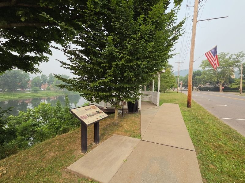
Location. 41° 50.716′ N, 79° 9.137′ W. Marker is in Warren, Pennsylvania, in Warren County. It is on Pennsylvania Avenue West (Business U.S. 6) east of West 3rd Avenue, on the right when traveling east. The market is near the gazebo at the Riverwalk Overlook. Touch for map. Marker is at or near this postal address: 500 Pennsylvania Ave W, Warren PA 16365, United States of America. Touch for directions.

Regionally, this marker is in Northwestern Pennsylvania and specifically in the Pennsylvania Wilds. It is also in the American Northeast, in the Mid-Atlantic, in Appalachia, and specifically in Northern Appalachia. Globally, it is in North America, the Western Hemisphere, the Western World, and the Anglosphere. Historically, it finds itself in what was once the Haudenosaunee (Iroquois) Confederacy and also one of the original Thirteen Colonies.
Other nearby markers. At least 8 other markers
Photographed by Mark Parker, July 16, 2026
2. Vista View Kiosk Marker next to the Riverwalk Overlook across from General Joseph Warren Park
Also see . . . Walkable Warren Kiosks. A map of the Walkable Warren Kiosks (Submitted on July 27, 2026, by Mark Parker of Hickory, North Carolina.)
Credits. This page was last revised on September 17, 2026. It was originally submitted on July 27, 2026, by Mark Parker of Hickory, North Carolina. This page has been viewed 12 times since then. Photos: 1, 2. submitted on July 27, 2026, by Mark Parker of Hickory, North Carolina. • Bill Pfingsten was the editor who published this page.
