Warren in Warren County, Pennsylvania — The American Northeast (Mid-Atlantic)
Celoron's Expedition
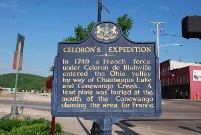
Photographed by Mike Wintermantel, May 22, 2015
1. Celoron's Expedition Marker
In 1749 a French force under Celoron de Blainville entered the Ohio valley by way of Chautauqua Lake and Conewango Creek. A lead plate was buried at the mouth of the Conewango claiming the area for France.
Erected 1947 by Pennsylvania Historical and Museum Commission.
Topics and series. This historical marker is listed in these topic lists: Colonial Era • Exploration. In addition, it is included in the Pennsylvania Historical and Museum Commission (PHMC) series list. A significant historical year for this entry is 1749.
Location. 41° 50.68′ N, 79° 8.965′ W. Marker is in Warren, Pennsylvania, in Warren County. It is at the intersection of Hickory Bridge and Pennsylvania Avenue (Business U.S. 6), on the right when traveling south on Hickory Bridge. Touch for map. Marker is at or near this postal address: 395 Pennsylvania Ave West, Warren PA 16365, United States of America. Touch for directions.

Regionally, this marker is in Northwestern Pennsylvania and specifically in the Pennsylvania Wilds. It is also in the American Northeast, in the Mid-Atlantic, in Appalachia, and specifically in Northern Appalachia.
this page online
Other nearby markers. At least 8 other markers are within walking distance of this marker: Soldiers' and Sailors' Monument (a few steps from this marker); JAZz Amphitheatre (within shouting distance of this marker); Warren Suspension Bridge (within shouting distance of this marker); Soldiers and Sailors Park (within shouting distance of this marker); The "Point"... Yesterday and Today! (about 300 feet away, measured in a direct line); Under Three Flags (about 500 feet away); In Honor (about 600 feet away); Lumber Rafting (about 600 feet away). Touch for a list and map of all markers in Warren.
Related markers. Click here for a list of markers that are related to this marker. To better understand the relationship, study each marker in the order shown.
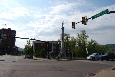
Photographed by Mike Wintermantel, May 22, 2015
2. Celoron's Expedition Marker
Credits. This page was last revised on July 28, 2026. It was originally submitted on September 3, 2012, by Mike Wintermantel of Pittsburgh, Pennsylvania. This page has been viewed 1,002 times since then and 75 times this year. Last updated on July 27, 2026, by Mark Parker of Hickory, North Carolina. Photos: 1, 2. submitted on May 25, 2015, by Mike Wintermantel of Pittsburgh, Pennsylvania. • Devry Becker Jones was the editor who published this page.
