Barnegat Light in Ocean County, New Jersey — The American Northeast (Mid-Atlantic)
Massacre at Long Beach Island
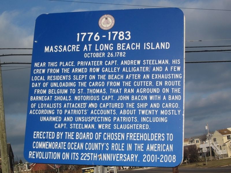
Photographed by Donald B. Caselli (Barry), December 25, 2012
1. Massacre at Long Beach Island Marker
Massacre at Long Beach Island
October 26, 1782
commemorate Ocean County's role in the American
Revolution on its 225th anniversary, 2001-2008
Erected by Ocean County Board of Chosen Freeholders.
Topics. This memorial is listed in these topic lists: War, US Revolutionary • Waterways & Vessels. A significant historical year for this entry is 1782.
Location. 39° 44.93′ N, 74° 6.851′ W. Memorial is in Barnegat Light, New Jersey, in Ocean County. It is at the intersection of Bayview Avenue and 20th Street, on the left when traveling north on Bayview Avenue.
this page online

Regionally, this memorial is on the Jersey Shore and in the New York City Metropolitan Area. It is also in the American Northeast, in the Mid-Atlantic, and on the Eastern Seaboard. Globally, it is in the North Atlantic Region, North America, the Western Hemisphere, the Western World, and the Anglosphere. Historically, it finds itself in what was once New Netherland and also one of the original Thirteen Colonies.
Other nearby markers. At least 8 other markers are within 2 miles of this marker, measured as the crow flies: Andrew Steelman (approx. 0.2 miles away); Massacre at Long Beach (approx. 1.1 miles away); All Shapes, Sizes and Materials (approx. 1.1 miles away); Maritime Sentinels (approx. 1.1 miles away); Maritime Forest Trail (approx. 1.1 miles away); Old Salty Survivors (approx. 1.1 miles away); Lighthouse Keepers of Barnegat Light (approx. 1.1 miles away); Vigilant Guardian (approx. 1.1 miles away). Touch for a list and map of all markers in Barnegat Light.
Credits. This page was last revised on August 5, 2026. It was originally submitted on July 29, 2026, by Donald B. Caselli (Barry) of Hopewell, Virginia. This page has been viewed 47 times since then. Photo 1. submitted on July 29, 2026, by Donald B. Caselli (Barry) of Hopewell, Virginia. • Michael Herrick was the editor who published this page.
Editor’s want-list for this marker. A wide view photo of the marker and its surroundings • Can you help?
