
Orleans in Barnstable County, Massachusetts — The American Northeast (New England)
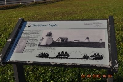
The Nauset Lights
Cape Cod National Seashore
Photographed by Sandra Hughes, September 22, 2012
1. The Nauset Lights Marker
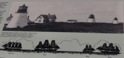
In 1838 the United States Government took action to reduce the number of shipwrecks along this dangerous coast by establishing the Nauset Light. To make the signal easily recognizable three separate lanterns were set on small brick towers about 150 feet (45m) apart.
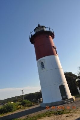
Unfortunately, the brick "Three Sisters" were built too close to the eroding cliff which threatened to undermine them. In 1892 they were replaced by wooden towers built farther back from the edge. Today's Nauset Light is located just north of here. From 1923 until 1981 it carried on the tradition of the retired "Three Sisters" by flashing three times every ten seconds. The present light flashes an alternating red and white pattern.
During the day, lightkeepers kept a "Record of Passing Vessels." This page from August 1870 documents the heavy traffic off the Cape in those days.
Erected by National Park Service, U.S. Department of the Interior.
Topics. This historical marker is listed in these topic lists: Landmarks • Waterways & Vessels. A significant historical year for this entry is 1838.
Location. 41° 51.607′ N, 69° 57.172′ W. Marker is in
this page online

Regionally, this marker is on Massachusetts’ Cape Cod. It is also in the American Northeast, in New England, and on the Eastern Seaboard. Globally, it is in the North Atlantic Region, North America, the Western Hemisphere, the Western World, and the Anglosphere. Historically, it finds itself in what was once one of the original Thirteen Colonies.
Other nearby markers. At least 8 other markers are within 2 miles of this marker, measured as the crow flies: Keeping the Light for 114 Years (within shouting distance of this marker); Nauset Beach Light Station, a Shifting Landmark (within shouting distance of this marker); The Long, Black Cable (within shouting distance of this marker); Pushed Back by the Sea (within shouting distance of this marker); Adapting to Nature (about 600 feet away, measured in a direct line); Three Sisters Lit the Way (approx. ¼ mile away); Doane Rock (approx.

Photographed by J.T. Lambrou
2. The Nauset Lights Marker
Also see . . . Three Sisters of Nauset. Excerpt:
The Three Sisters of Nauset are a trio of historic lighthouses off Cable Road in Eastham, Massachusetts. The original three brick towers fell into the sea due to erosion in 1890 and were replaced with wooden towers on brick foundations in 1892. The Sisters were decommissioned in 1911 but one of them, the Beacon, was moved back from the shoreline and attached to the keeper's house. It continued to operate but was replaced by a new steel tower, the Nauset Light, in 1923.(Submitted on July 31, 2026, by J.T. Lambrou of New Boston, Michigan.)
Additional commentary.
1. National Register of Historic Places
The Three Sisters of Nauset (Twin Lights) were added to the NRHP on June 15, 1987.
— Submitted July 31, 2026, by J.T. Lambrou of New Boston, Michigan.
Photographed by Sandra Hughes, September 22, 2012
3. The Nauset Lights Marker
When this photo was taken in the 1890's, Nauset Light consisted of three small towers called the "Three Sisters." Today the National Park Service maintains the relocated Three Sisters as an historic exhibit.
Photographed by Sandra Hughes, September 22, 2012
4. Record of Passing Vessels
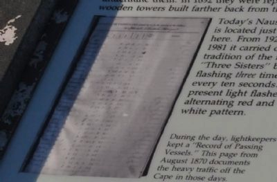
During the day, lightkeepers kept a "Record of Passing Vessels." This page from August 1870 documents the heavy traffic off the Cape in those days.
Photographed by Sandra Hughes, September 22, 2012
5. The Nauset Lighthouse
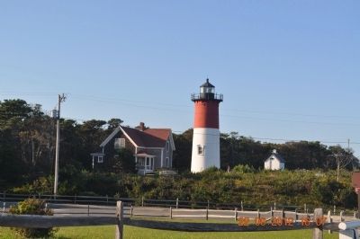
Photographed by Sandra Hughes, September 22, 2012
6. The Nauset Lighthouse
Credits. This page was last revised on August 1, 2026. It was originally submitted on February 17, 2013, by Sandra Hughes Tidwell of Killen, Alabama, USA. This page has been viewed 919 times since then and 28 times this year. Last updated on July 31, 2026, by Daniel Holbrook of Huntington, West Virginia. Photos: 1. submitted on February 17, 2013, by Sandra Hughes Tidwell of Killen, Alabama, USA. 2. submitted on July 26, 2024, by J.T. Lambrou of New Boston, Michigan. 3, 4, 5, 6. submitted on February 17, 2013, by Sandra Hughes Tidwell of Killen, Alabama, USA. • Devry Becker Jones was the editor who published this page.
