Sandy in Central Bedfordshire, England, United Kingdom — Northwestern Europe (the British Isles)
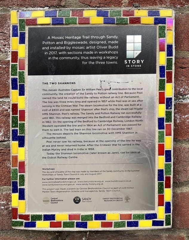
The Two Shannons
| — | Mosaic Heritage Trail | — |
Photographed by Ray Gurganus, May 6, 2026
1. The Two Shannons Marker
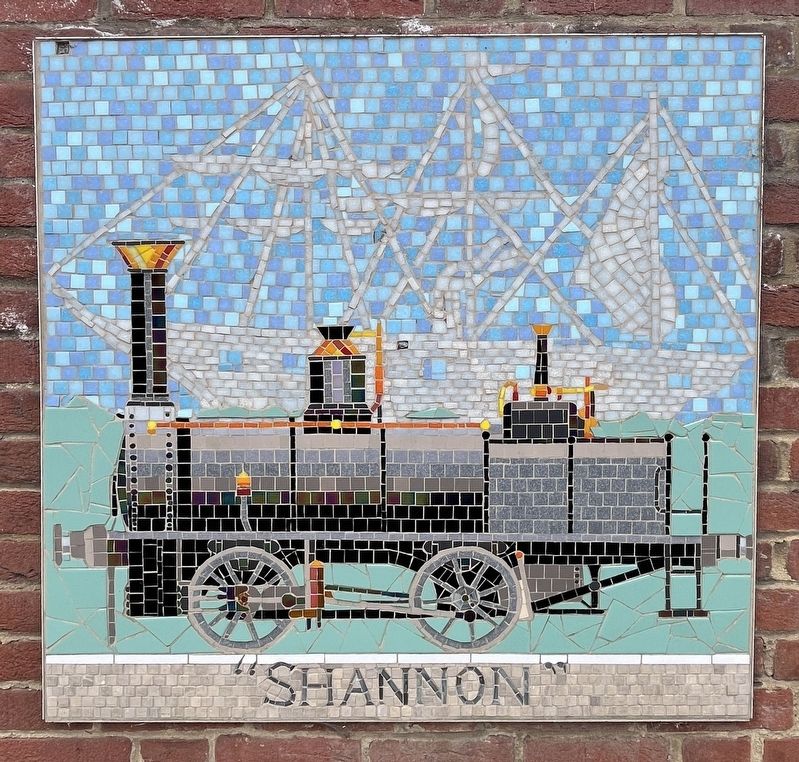
The mosaic depicts the Shannon locomotive with HMS Shannon in silhouette behind.
Peel never saw his railway, because at the opening of the line he was at sea and never returned home. After the Crimean War he served in the Indian Mutiny and died in India in 1858.
Today the Shannon locomotive (later
this page online
Workshops:
The sky and silhouette of the ship was made by members of the Sandy community in the Summer Workshops at Sandy Town Council in July and August 2017
Erected by Central Bedfordshire Council.
Topics. This historical marker is listed in these topic lists: Railroads & Streetcars • Waterways & Vessels. A significant historical year for this entry is 1857.
Location. 52° 7.638′ N, 0° 17.11′ W. Marker is in Sandy, England, in Central Bedfordshire. It is on High Street, on the right when traveling east. Touch for map. Marker is at or near this postal address: 59 High Street, Sandy, England SG19 1AJ, United Kingdom. Touch for directions.

Regionally, it is on the Atlantic Ocean, in the North Atlantic Region, in Europe, in Atlantic Europe, on one of the British Isles, in the Western World, and in the Anglosphere. Historically, it finds itself in what was once the Roman Empire.
Other nearby markers. At least 8 other markers are within 21 kilometers of this marker, measured as the crow flies: Captain Sir William Peal (here, next to this marker); The Sandy Show
Photographed by Ray Gurganus, May 6, 2026
2. The Two Shannons mosaic
Credits. This page was last revised on July 31, 2026. It was originally submitted on July 31, 2026, by Ray Gurganus of Washington, District of Columbia. This page has been viewed 11 times since then. Photos: 1, 2. submitted on July 31, 2026, by Ray Gurganus of Washington, District of Columbia. • Andrew Ruppenstein was the editor who published this page.
