
Marble Hill in Bollinger County, Missouri — The American Midwest (Upper Plains)
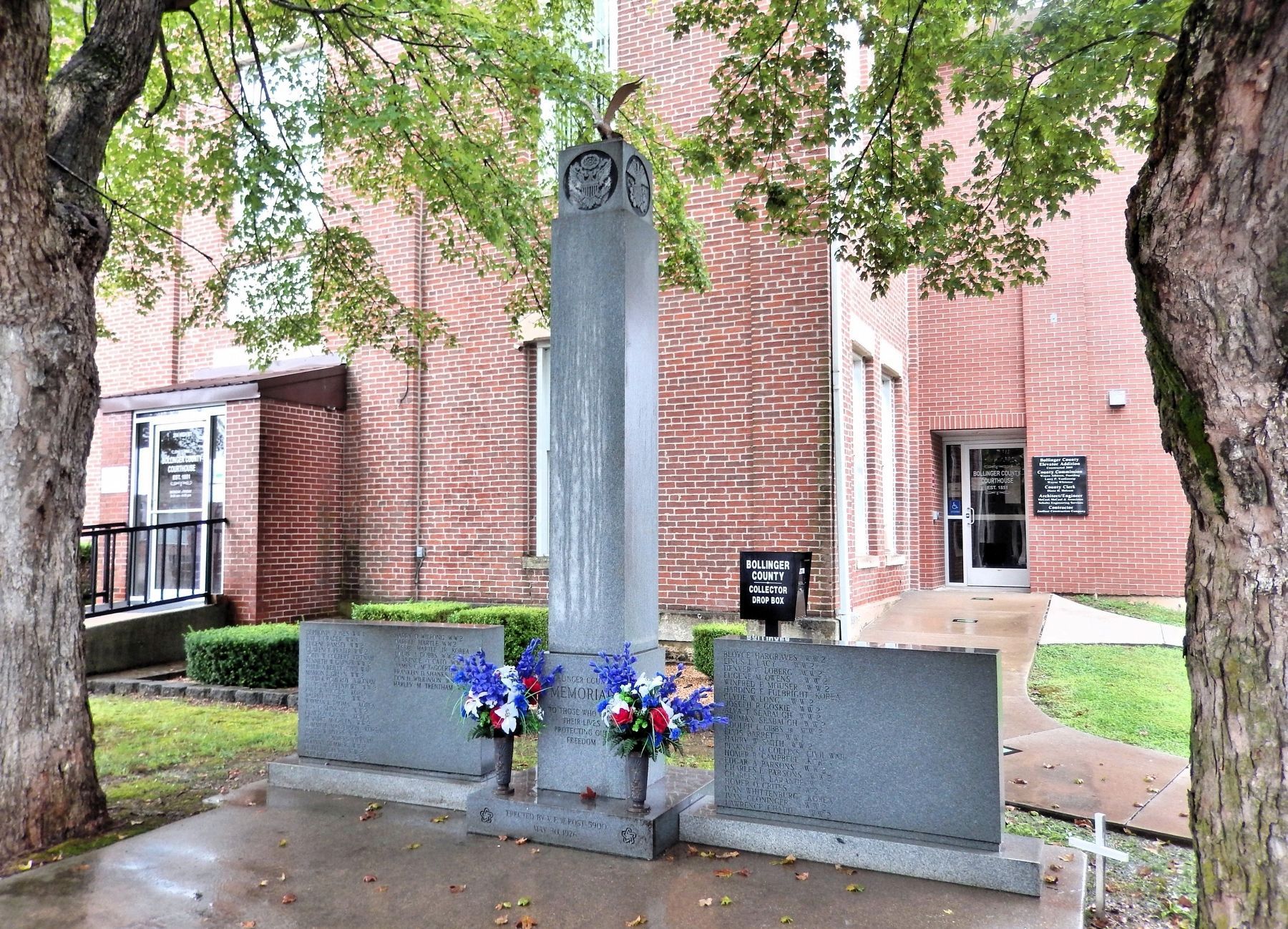
Bollinger County Memorial
To Those Who Gave Their Lives Protecting Our Freedom
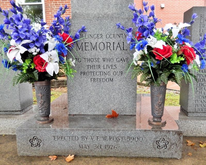
Photographed by Cosmos Mariner, August 20, 2021
1. Bollinger County Memorial
Dephonia Jones WW1 • Ray T. Crader WW1 • Eugene Ramsey WW2 • Clarence Prater WW2 • John W. Colbert Vietnam • Kenneth W. Garner WW2 • Philip A. Reilly Civil War • Marion L. Green WW2 • David K. Pomeroy Vietnam • Floyd M. Devenport WW2 • Paul R. Rhodes Korea • Ralph E. Guthrie WW2 • Wayman L. Thomas Korea • Von O. Slinkard WW2 • Clayton Guinn Korea • Bennett M. Green WW2 • Tommy E. Masterson Korea • James W. Myers WW2 • Phillip Summers Vietnam • Johnny Demmer WW2 • Doyle J. Clubb WW2 • Hobert E. Crites WW2 • Harry D. Wilfong WW2 • Darrel Hartle WW2 • Jessie Hartle Jr. Korea • Louis J. Dobbs WW2 • Clarence O. Cato WW1 • James C. McTaggert WW2 • Franklin D. Shanks Civil War • Don H. Wilkinson WWII • Harley M. Trentham WW1 • Bloyce Hargraves WW2 • Linus L. Lacy WW2 • Denver C. Loberg WW2 • Eugene M. Owens WW2 • Winfred F. Mouser WW2 • Harding E. Fulbright Korea • Clyde W. Long WW2 • Joseph R. Goskie WW2 • Alva T. Seabaugh WW2 • Truman Seabaugh WW2 • Adolph L. Gibbs Jr. WW2 • Elvis Barrett WW1 • Harry W. Smith WW2 • Pinkney Q. Collins Civil
this page online
Erected 1976 by V.F.W. Post 5900.
Topics and series. This memorial is listed in these topic lists: War, Korean • War, US Civil • War, World I • War, World II. In addition, it is included in the The Spirit of ’76, America’s Bicentennial Celebration series list.
Location. 37° 18.343′ N, 89° 58.205′ W. Memorial is in Marble Hill, Missouri, in Bollinger County. It is on High Street just south of Water Street, on the left when traveling south. The memorial is near the northwest corner of the Bollinger County Courthouse. Touch for map. Memorial is at or near this postal address: 204 High Street, Marble Hill MO 63764, United States of America. Touch for directions.

Regionally, this memorial is in Southeast Missouri. It is also in the American Lewis & Clark Corridor and in the Corn Belt. Globally, it is in North America, the Western Hemisphere, the Western World,
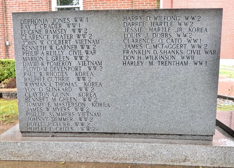
Photographed by Cosmos Mariner, August 20, 2021
2. Bollinger County Memorial (left panel)
Other nearby markers. At least 8 other markers are within 11 miles of this marker, measured as the crow flies: Mineral Well (here, next to this marker); Marble Hill (within shouting distance of this marker); Covered Bridges in Missouri (approx. 10.1 miles away); Restoration of the Burfordville Covered Bridge (approx. 10.1 miles away); History of Burfordville Covered Bridge (approx. 10.1 miles away); Genealogy of Howe Truss Design (approx. 10.1 miles away); Basic Truss Designs for Covered Bridges (approx. 10.1 miles away); Bollinger Mill / Burfordville Covered Bridge (approx. 10.1 miles away). Touch for a list and map of all markers in Marble Hill.
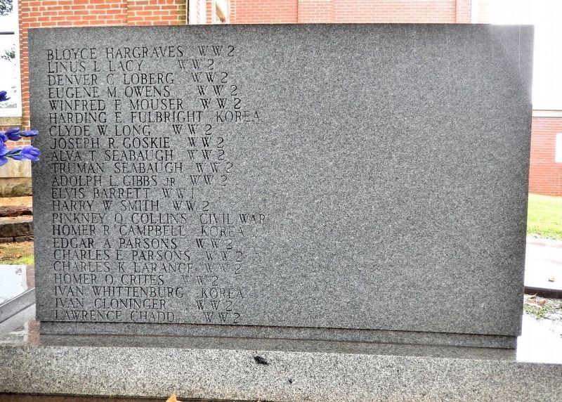
Photographed by Cosmos Mariner, August 20, 2021
3. Bollinger County Memorial (right panel)
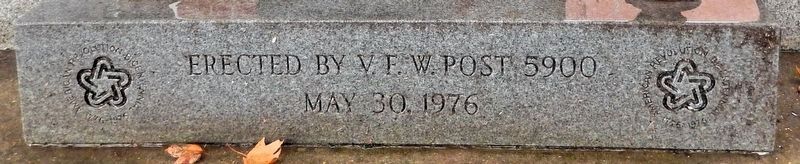
Photographed by Cosmos Mariner, August 20, 2021
4. Bollinger County Memorial — Spirit of '76
Photographed by Cosmos Mariner, August 20, 2021
5. Bollinger County Memorial
Looking southeast from Hight Street. The northwest corner of the Bollinger County Courthouse is in the background.
Credits. This page was last revised on August 4, 2026. It was originally submitted on August 1, 2026, by Cosmos Mariner of Cape Canaveral, Florida. This page has been viewed 11 times since then. Photos: 1, 2, 3, 4, 5. submitted on August 4, 2026, by Cosmos Mariner of Cape Canaveral, Florida.
