Williamsburg in James City County, Virginia — The American South (Mid-Atlantic)
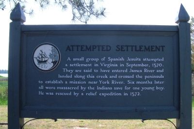
Attempted Settlement
Topics. This historical marker is listed in these topic lists: Churches & Religion • Exploration • Native Americans • Settlements & Settlers. A significant historical month for this entry is September 1570.
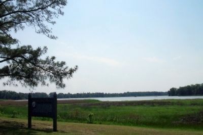
Location. 37° 13.436′ N, 76° 41.758′ W. Marker is in Williamsburg, Virginia, in James City County. Marker can be reached from Colonial National Historic Parkway, 1.7 miles Virginia Route 199. Touch for map. Marker is in this post office area: Williamsburg VA 23185, United States of America. Touch for directions.
Other nearby markers. At least 8 other markers are within 3 miles of this marker, measured as the crow flies. College Creek (a few steps from this marker); James River (approx. 0.3 miles away); Saint-Simon (approx. 0.3 miles away); Archers Hope (approx. 1.2 miles away); A Famous African-American Dream (approx. 1.3 miles away); Princess Anne Port (approx. 2.1 miles away); Battle of Williamsburg (approx. 2.1 miles away); Quarterpath Road (approx. 2.2 miles away). Touch for a list and map of all markers in Williamsburg.
Also see . . .
1. Colonial Parkway. (Submitted on May 15, 2010.)
2. Ajacán Mission. “In August 1570, Father Segura, Father Luis de Quirós, former head of the Jesuit college among the Moors in Spain, and six Jesuit brothers set forth from their base in Havana on their Ajacán Mission. The young Spanish boy Alonso Olmos, called Aloncito, also accompanied the priests. Don Luis served as their guide and interpreter. They stopped partway at Santa Elena for provisioning. On September 10, the party of 10 landed in Ajacán. Some say that the location they chose was at Queen's Creek on the north side of the Virginia Peninsula, near the York River. Recent findings suggest that St. Mary's Mission may have been in the village of Axacam on the New Kent side of Diascund Creek, near its confluence with the Chickahominy River.Others speculate that the location was on the Delaware Bay. ... Another theory places the Jesuit Mission at Aquia Creek, in Patawomeck territory.” (Submitted on August 19, 2011.)
Credits. This page was last revised on November 9, 2021. It was originally submitted on May 15, 2010, by Bernard Fisher of Richmond, Virginia. This page has been viewed 1,719 times since then and 69 times this year. Photos: 1, 2. submitted on May 15, 2010, by Bernard Fisher of Richmond, Virginia.

