
Moulineaux in Seine-Maritime, Normandy, France — Western Europe
Le panorama du château de Robert le Diable
⎯⎯⎯
The View from Robert the Devil’s Castle
Moulineaux
| — | Agglo Balades / Agglo Walks | — |
Photographed by James Hulse, July 31, 2026
1. Le panorama du château de Robert le Diable / The View from Robert the Devil’s Castle Marker

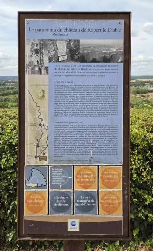
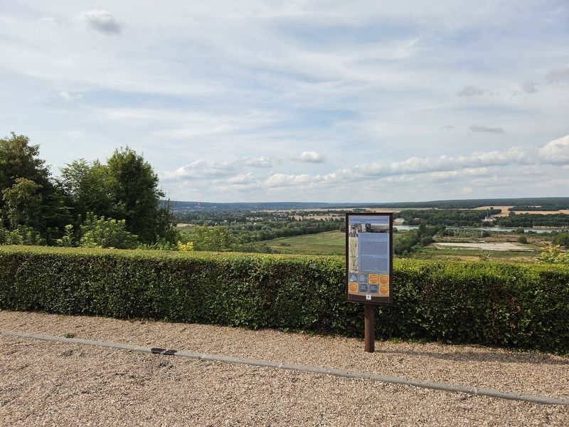
Situé à une altitude de 100 m, le panorama du monument aux morts du château de Robert le Diable offre l'un des plus beaux points de vue sur la vallée de la Seine en aval de Rouen et permet de découvrir le paysage de l'agglomération rouennaise dans toute sa diversité.
D'une rive à l'autre
Contrairement aux autres panoramas qui existent le long du fleuve, celui du château de Robert le Diable permet d'embrasser d'un seul regard l'ensemble des éléments qui caractérisent le mieux l'agglomération rouennaise, à savoir la Seine, la forêt, les terres agricoles, le patrimoine architectural et l'industrie. En contrebas de ce point de vue, on peut en effet apercevoir, sur les terrains réservés à l'expansion du port de Rouen, les bâtiments de l'usine Renault installée à Grand-Couronne. Inaugurée le 4 juin 1975, celle-ci est employée comme plate-forme logistique pour le conditionnement et l'expédition de pièces détachées servant à alimenter les usines d'assemblage de la marque dans le monde entier. De l'autre côté du fleuve, c'est la dimension agricole de l'agglomération qui s'offre au regard du promeneur avec ses champs et ses prairies. Consacrés à l'élevage et à la culture du blé et du maïs, ceux-ci se répartissent sur les riches terres alluvionnaires situées entre les communes d'Hautot-sur-Seine et de Sahurs. Au-delà, barrant l'horizon, c'est la forêt domaniale de Roumare, véritable poumon vert à l'ouest de Rouen, composée de résineux et de futaies de feuillus, qui s'étend sur une surface de 3 991 hectares. Enfin, la dimension architecturale est représentée par le château de Soquence, de style néo-Renaissance, construit en 1840, le château de Trémauville, bâtisse en pierre de Caumont aux nombreuses fenêtres, bâti à la fin du XVIIIᵉ siècle, ou l'église Saint-Sauveur, ancienne chapelle du château de Brédevent édifiée entre le XIᵉ et le XVᵉ siècle et aujourd'hui église paroissiale de Sahurs.
Souvenir de la guerre de 1870
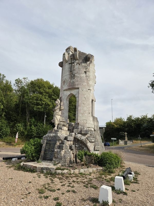
Lors de la guerre de 1870-1871 qui oppose la France et l'Allemagne, Moulineaux et le château de Robert le Diable sont le cadre des plus importants combats que l'agglomération rouennaise ait à subir. La situation dominante des ruines de la vieille forteresse normande constitue en effet une position stratégique que les deux armées vont se disputer furieusement entre le 30 décembre 1870 et le 4 janvier 1871, opposant plusieurs milliers de soldats prussiens à quelques centaines de soldats français. Malgré la résistance héroïque menée par ces mobiles originaires d'Ardèche, du Calvados, de l'Eure, des Landes et de Loire-Inférieure pour défendre cette position, les troupes françaises, écrasées par la supériorité de l'ennemi, seront obligées d'abandonner le champ de bataille. Afin de commémorer l'un des faits d'armes les plus glorieux de cette guerre perdue par la France, une collecte permet, en 1901, d'élever sur le lieu même des combats un monument commémoratif. Conçu par l'architecte Eugène Fauquet, ce mémorial sculpté par Auguste Foucher et Albert Lambert représente un mobile gardant l'entrée du château de Robert le Diable. Endommagé durant la Seconde Guerre mondiale, le monument intitulé « Qui vive ? » est restauré en 1959 par les artistes rouennais Jean Linot et Fernand Donett. À cette occasion, un ossuaire contenant les restes de deux soldats tués lors des combats de 1870 et provenant du cimetière de Moulineaux est aménagé dans la base de l'édifice, qui sert également de monument aux morts pour la commune de Moulineaux.
Source : Le patrimoine des communes de la Seine-Maritime, Flohic éditions, 1997.
Rédaction : Michel Croguennec. Crédits photos : Direction de l'environnement urbain, Agglo de Rouen.
Located at an elevation of 100 metres, the panorama from the war memorial at Robert the Devil’s Castle offers one of the finest views over the Seine Valley downstream from Rouen and provides an opportunity to see the landscape of the Rouen metropolitan area in all its diversity.
From One Bank to the Other
Unlike the other panoramic viewpoints along the river, the one at Robert the Devil’s Castle makes it possible to take in at a single glance all the features that best characterize the Rouen metropolitan area: the Seine, the forest, agricultural land, architectural heritage and industry. Below this viewpoint, on land reserved for the expansion of the Port of Rouen, the buildings of the Renault plant at Grand-Couronne can be seen. Inaugurated on June 4, 1975, it is used as a logistics platform for packaging and shipping spare parts to supply the company’s assembly plants throughout the world. On the other side of the river, the agricultural character of the metropolitan area comes into view, with its fields and meadows. Used for livestock farming and the cultivation of wheat and corn, they extend across the rich alluvial lands between the municipalities of Hautot-sur-Seine and Sahurs. Beyond them, forming a barrier across the horizon, lies the Roumare State Forest, a true green lung west of Rouen. Composed of conifers and stands of mature deciduous trees, it covers an area of 3,991 hectares. Finally, the area’s architectural heritage is represented by the Château de Soquence, built in the Neo-Renaissance style in 1840; the Château de Trémauville, a Caumont-stone building with numerous windows, constructed at the end of the 18th century; and the Church of Saint-Sauveur, the former chapel of the Château de Brédevent, built between the 11th and 15th centuries and now serving as the parish church of Sahurs.
Remembrance of the War of 1870
During the Franco-Prussian War of 1870–1871, Moulineaux and Robert the Devil’s Castle were the scene of the most significant fighting endured by the Rouen metropolitan area. The commanding position of the ruins of the old Norman fortress formed a strategic location that the two armies fought fiercely over between December 30, 1870, and January 4, 1871. Several thousand Prussian soldiers faced a few hundred French soldiers. Despite the heroic resistance of these National Guard troops from Ardèche, Calvados, Eure, Landes and Loire-Inférieure, who defended the position, the French forces, overwhelmed by the enemy’s superiority, were forced to abandon the battlefield. To commemorate one of the most glorious feats of arms of this war, which France lost, a fundraising campaign made it possible in 1901 to erect a memorial on the actual site of the fighting. Designed by the architect Eugène Fauquet, the memorial, sculpted by Auguste Foucher and Albert Lambert, depicts a National Guard soldier guarding the entrance to Robert the Devil’s Castle. Damaged during the Second World War, the monument, entitled “Who Goes There?”, was restored in 1959 by the Rouen artists Jean Linot and Fernand Donett. At that time, an ossuary containing the remains of two soldiers killed during the fighting in 1870 and transferred from the cemetery of Moulineaux was installed in the base of the structure. The monument also serves as the war memorial for the municipality of Moulineaux.
Source: The Heritage of the Municipalities of Seine-Maritime, Flohic Editions, 1997.
Text: Michel Croguennec. Photo credits: Urban Environment Department, Rouen Metropolitan Area.
Erected by Métropole
this page online
Topics. This historical marker is listed in these topic lists: Forts and Castles • Industry & Commerce • War, World II • Wars, Non-US. A significant historical date for this entry is January 4, 1871.
Location. 49° 20.394′ N, 0° 57.69′ E. Marker is in Moulineaux, Normandie (Normandy), in Seine-Maritime. It is at the intersection of D67A and Rue Pierre Gosselin (Normandie Road D67A), on the left when traveling south on D67A. Touch for map. Marker is in this post office area: Moulineaux, Normandie 76530, France. Touch for directions.

Regionally, it is in the North Atlantic Region, Europe, the European Union, Atlantic Europe, the Schengen Area, Western Europe, a coastal Mediterranean country, and the Western World. Historically, it finds itself in what was once a French colony and also the Roman Empire.
Other nearby markers. At least 8 other markers are within walking distance of this marker: Moulineaux Memorial (a few steps from this marker); Deux mobiles de 1870 / Two Mobile Guard Soldiers of 1870 (a few steps from this marker); Combat du château Robert le Diable / The Battle of Robert the Devil’s Castle
Photographed by James Hulse, July 31, 2026
2. Le panorama du château de Robert le Diable / The View from Robert the Devil’s Castle Marker
Photographed by James Hulse
3. Le panorama du château de Robert le Diable / The View from Robert the Devil’s Castle Marker
The memorial guarding the entrance to the castle.
Photographed by James Hulse, July 31, 2026
4. Le panorama du château de Robert le Diable / The View from Robert the Devil’s Castle Marker
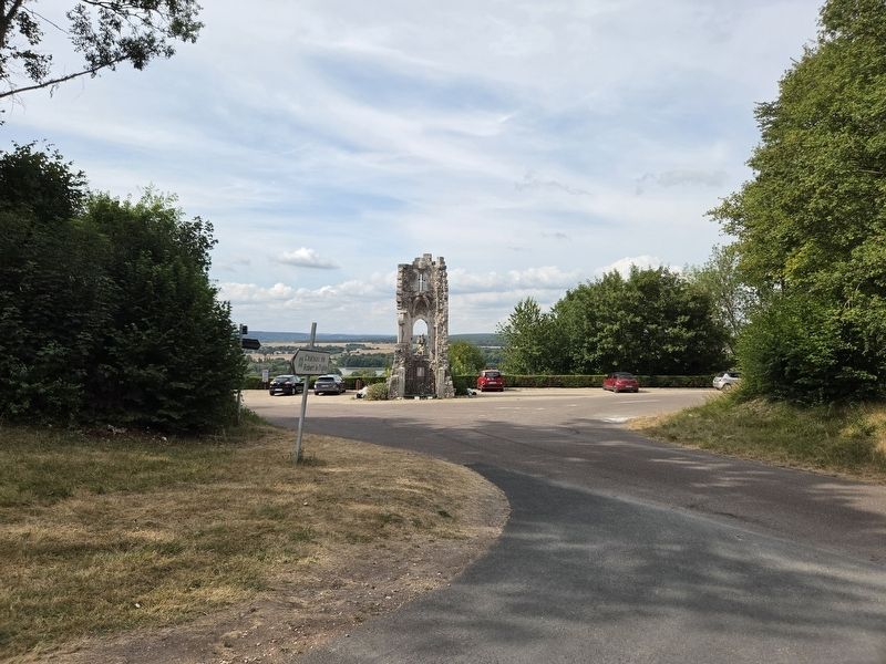
The view of the marker and memorial from the approach to the castle’s entrance.
Credits. This page was last revised on August 4, 2026. It was originally submitted on August 2, 2026, by James Hulse of Medina, Texas. This page has been viewed 11 times since then. Photos: 1, 2, 3, 4. submitted on August 4, 2026, by James Hulse of Medina, Texas.
