Near Hardy in Franklin County, Virginia — The American South (Mid-Atlantic)
Curing Tobacco
| — | Booker T. Washington National Monument | — |
Photographed by Tom Bosse, July 5, 2026
1. Curing Tobacco Marker
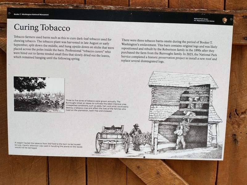
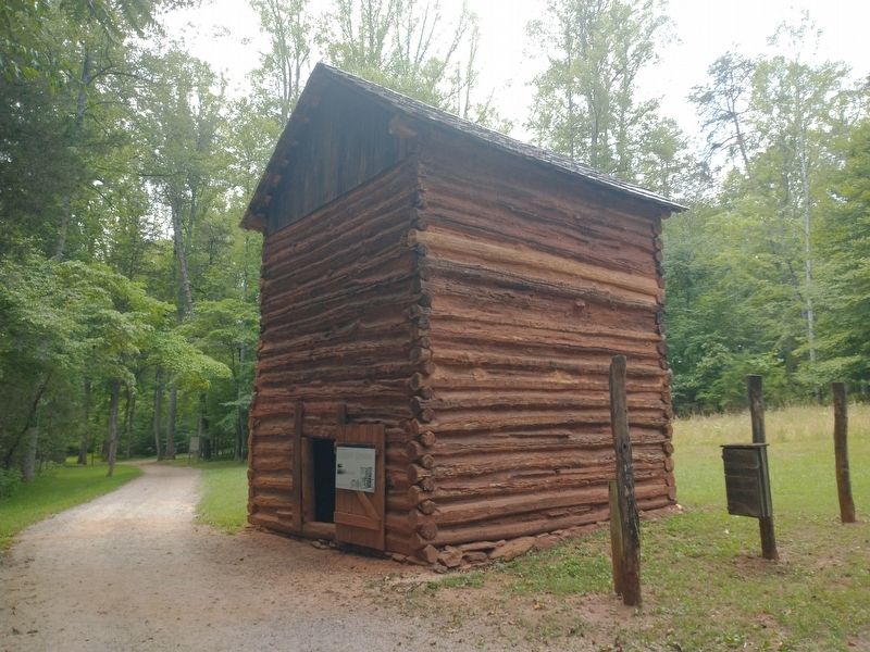
There were three tobacco barns onsite during the period of Booker T. Washington’s enslavement. This barn contains original logs and was likely repositioned and rebuilt by the Robertson family in the 1980s after they purchased the farm from the Burroughs family. In 2023, the National Park Service completed a historic preservation project to install a new roof and replace several disintegrated logs.
(captions)
Three to five acres of tobacco were grown annually. The Burroughs relied on slaves to cultivate the labor-intensive crop. Unexpected conditions, such as pests, hail, and wind, could easily destroy a tobacco crop and affect the lives of the families who lived on the plantation, both free and enslaved.
A wagon hauled the tobacco from the field to the barn to be housed to cure. Careful attention was used in handling the plants so the leaves would not be damaged.
Erected by National
this page online
Topics. This historical marker is listed in these topic lists: African Americans • Agriculture.
Location. 37° 6.982′ N, 79° 43.816′ W. Marker is near Hardy, Virginia, in Franklin County. It can be reached from Booker T Washington Highway (Virginia Route 122) 0.2 miles east of Lost Mountain Road ( Route 636), on the right when traveling east. Loacted along the Jack-O-Lantern Branch Heritage National Recreation Trail. Touch for map. Marker is at or near this postal address: 12130 Booker T Washington Hwy, Hardy VA 24101, United States of America. Touch for directions.

Regionally, this marker is in Southern Virginia. It is also in the American South and specifically in the Upper South. Globally, it is in North America, the Western Hemisphere, the Western World, and the Anglosphere. Historically, it finds itself in what was once the territory of the Mississippian Culture, one of the original Thirteen Colonies, one of the Confederate States of America, and the Antebellum South.
Other nearby markers. At least 8 other markers
Photographed by Tom Bosse, July 5, 2026
2. Curing Tobacco Marker
Other markers no longer nearby. Carry Me Home (was within shouting distance of this marker but has been permanently removed); Freed Here, At Last (was approx. 0.2 miles away but has been replaced with another marker now near it); How Tobacco Farms Used Slavery (was approx. 0.2 miles away but has been replaced with another marker now near it); The Landscape of Slavery (was approx. ¼ mile away but has been replaced with another marker now near it); Slavery on the Plantation (was approx. ¼ mile away but has been replaced with another marker now near it).
Also see . . . Booker T. Washington National Monument. National Park Service (Submitted on August 4, 2026.)
Credits. This page was last revised on August 4, 2026. It was originally submitted on August 2, 2026, by Tom Bosse of Jefferson City, Tennessee. This page has been viewed 16 times since then. Photos: 1, 2. submitted on August 2, 2026, by Tom Bosse of Jefferson City, Tennessee. • Bernard Fisher was the editor who published this page.
