Huntingtown in Calvert County, Maryland — The American Northeast (Mid-Atlantic)
Camp Mohawk
Discover Calvert County
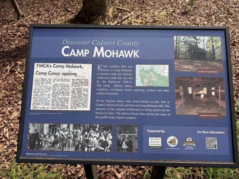
Kings Landing Park was home of Camp Mohawk, a summer camp for African-American youth that was run by the Baltimore YMCA. The camp offered cabins, campfires, swimming, tennis, canoeing, archery and other outdoor recreation.
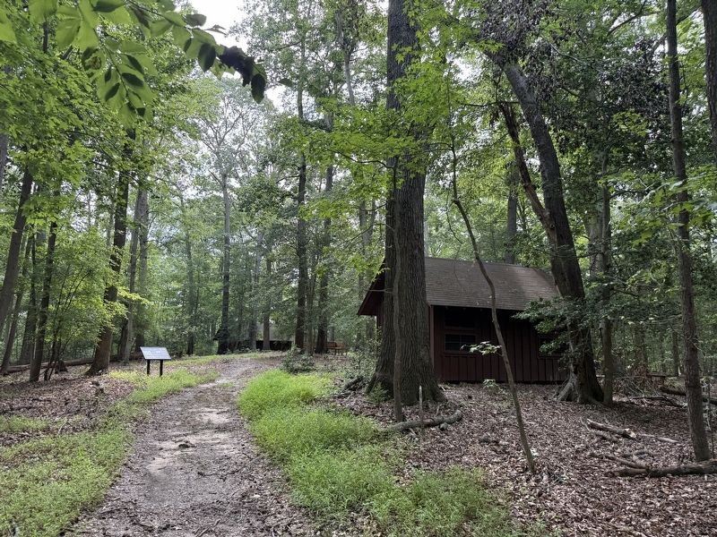
Of the original cabins, only seven remain on site; four at Camp Cocktown Creek and three at Camp Mohawk Hill. The integrity of the original architecture is being preserved for historical value. The interior beams have preserved some of the graffiti from original campers.
Erected by Battle Creek Nature Education Society/Calvert Nature Society; Calvert County Natural Resources Division; Southern Maryland Heritage Area Consortium.
Topics. This historical marker is listed in these topic lists: African Americans • Parks & Recreational Areas.
Location. 38° 37.407′ N, 76° 40.232′ W. Marker is in Huntingtown, Maryland, in Calvert County. It can be reached from Kings Landing Court south of Kings Landing Road, on the left when traveling south. Touch for map. Marker is at or near this postal address: 3255 Kings Landing Ct, Huntingtown MD 20639,
this page online

Regionally, this marker is in Southern Maryland. It is also in the American South, specifically in the Upper South, in the Mid-Atlantic, in the Tidewater, in the Chesapeake Bay Region, and on the Eastern Seaboard. Globally, it is in the North Atlantic Region, North America, the Western Hemisphere, the Western World, and the Anglosphere. Historically, it finds itself in what was once one of the original Thirteen Colonies and also the Antebellum South.
Other nearby markers. At least 8 other markers are within 5 miles of this marker, measured as the crow flies: Warships and Raids (approx. 0.3 miles away); Up in Flames (approx. 1.7 miles away); Lower Marlboro Town (approx. 2.3 miles away); Town Ravaged (approx. 2.3 miles away); Woodville School (approx. 3½ miles away); Brig Gen Leonard Covington (approx. 3.9 miles away); Alarming Sight (approx. 4 miles away); All Saints Episcopal Church (approx. 4.3 miles away).
Another marker is no longer nearby. Lower Marlboro (was approx. 2.3 miles away but has been confirmed missing).
Photographed by Devry Becker Jones (CC0), August 1, 2026
2. Camp Mohawk Marker and Site along the Hiking Trail
Credits. This page was last revised on August 2, 2026. It was originally submitted on August 2, 2026, by Devry Becker Jones of Washington, District of Columbia. This page has been viewed 14 times since then. Photos: 1, 2. submitted on August 2, 2026, by Devry Becker Jones of Washington, District of Columbia.
