Kennesaw in Cobb County, Georgia — The American South (South Atlantic)
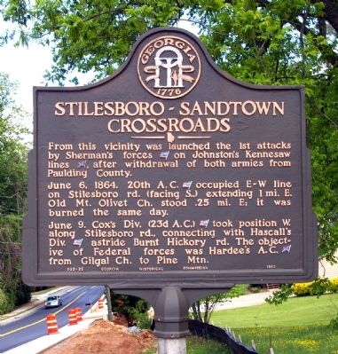
Stilesboro-Sandtown Crossroads
June 6, 1864. 20th A. C. [US] occupied E-W line on Stilesboro rd. (facing S.,) extending 1 mi. E. Old Mt. Olivet Ch. stood .25 mi. E; it was burned the same day.
June 9. Cox’s Div. (23d A. C.) [US] took position W. along Stilesboro rd., connecting with Hascall’s Div. [US] astride Burnt Hickory rd. The objective of Federal forces was Hardee’s A. C. [CS] from Gilgal Ch. to Pine Mtn.
Erected 1953 by Georgia Historical Commission. (Marker Number 033-25.)
Topics and series. This historical marker is listed in this topic list: War, US Civil. In addition, it is included in the Georgia Historical Society series list. A significant historical month for this entry is June 1917.
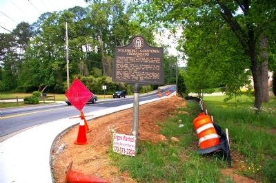
Location. 33° 59.895′ N, 84° 40.53′ W. Marker is in Kennesaw, Georgia, in Cobb County. Marker is at the intersection of Acworth-Due West Road and Stilesboro Road, on the left when traveling south on Acworth-Due West Road. Touch for map. Marker is in this post office area: Kennesaw GA 30152, United States of America. Touch for directions.
Other nearby markers. At least 8 other markers are within 2 miles of this marker, measured as the crow flies. Durham House (approx. 1.4 miles away); Site of the Dickson House (approx. 1½ miles away); Davis' Cross Roads (approx. 1.6 miles away); General Leonidas Polk Memorial (approx. 1.8 miles away); The Reversed Trench (approx. 1.8 miles away); Pine Mountain (approx. 1.8 miles away); Battle of Gilgal Church (approx. 2 miles away); Due West Community (approx. 2.1 miles away). Touch for a list and map of all markers in Kennesaw.
Credits. This page was last revised on October 2, 2018. It was originally submitted on May 16, 2010, by David Seibert of Sandy Springs, Georgia. This page has been viewed 1,399 times since then and 35 times this year. Photos: 1, 2, 3. submitted on May 16, 2010, by David Seibert of Sandy Springs, Georgia. • Craig Swain was the editor who published this page.


