Kincardine in Bruce County, Ontario — Central Canada (North America)
Lighthouses of the Bruce Coast
Photographed by Tim Boyd, July 16, 2026
1. Lighthouses of the Bruce Coast Marker
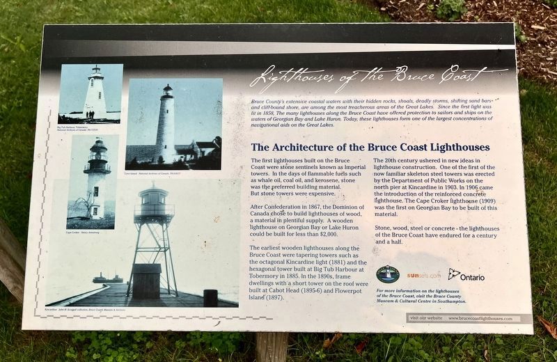
Bruce County's extensive coastal waters with their hidden rocks, shoals, deadly storms, shifting sand bars and cliff-bound shore, are among the most treacherous areas of the Great Lakes. Since the first light was lit in 1858, The many lighthouses along the Bruce Coast have offered protection to sailors and ships on the waters of Georgian Bay and Lake Huron. Today, these lighthouses form one of the largest concentrations of navigational aids on the Great Lakes.
The Architecture of the Bruce Coast Lighthouses
The first lighthouses built on the Bruce Coast were stone sentinels known as Imperial towers. In the days of flammable fuels such as whale oil, coal oil, and kerosene, stone was the preferred building material. But stone towers were expensive.
After Confederation in 1867, the Dominion of Canada chose to build lighthouses of wood, a material in plentiful supply. A wooden lighthouse on Georgian Bay or Lake Huron could be built for less than $2,000.
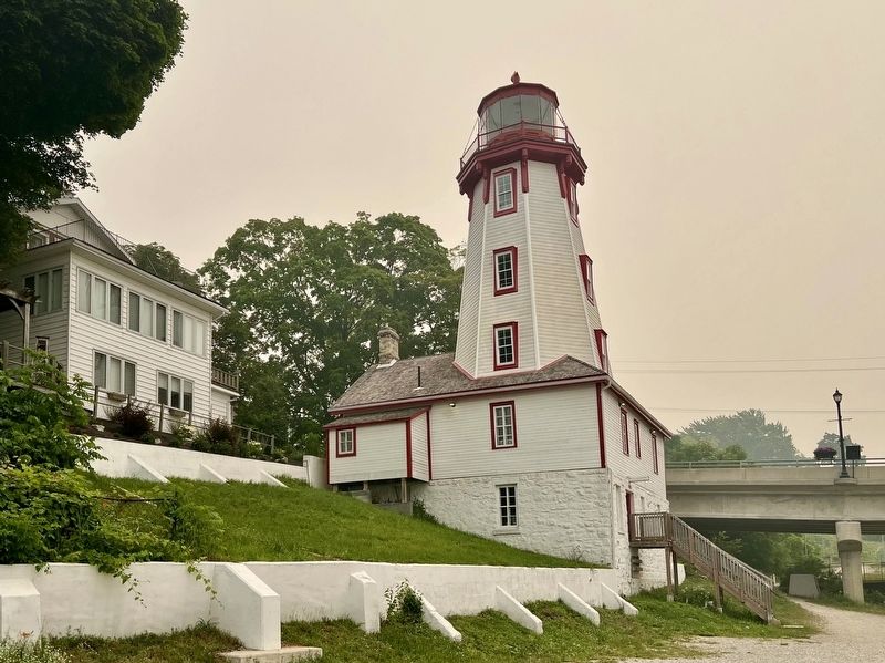
The earliest wooden lighthouses along the Bruce Coast were tapering towers such as the octagonal Kincardine light (1881) and the hexagonal tower built at Big Tub Harbour
this page online
The 20th century ushered in new ideas in lighthouse construction. One of the first of the now familiar skeleton steel towers was erected by the Department of Public Works on the north pier at Kincardine in 1903. In 1906 came the introduction of the reinforced concrete lighthouse. The Cape Croker lighthouse (1909) was the first on Georgian Bay to be built of this material.
Stone, wood, steel or concrete - the lighthouses of the Bruce Coast have endured for a century and a half.
Topics and series. This historical marker is listed in these topic lists: Architecture • Waterways & Vessels. In addition, it is included in the Lighthouses series list. A significant historical year for this entry is 1858.
Location. 44° 10.637′ N, 81° 38.274′ W. Marker is in Kincardine, Ontario, in Bruce County. It is at the intersection of Harbour Street and Huron Terrace, on the left when traveling west on Harbour Street. Touch for map. Marker is at or near this postal address: 236 Harbour St, Kincardine
Photographed by Tim Boyd, July 16, 2026
2. Lighthouses of the Bruce Coast Marker
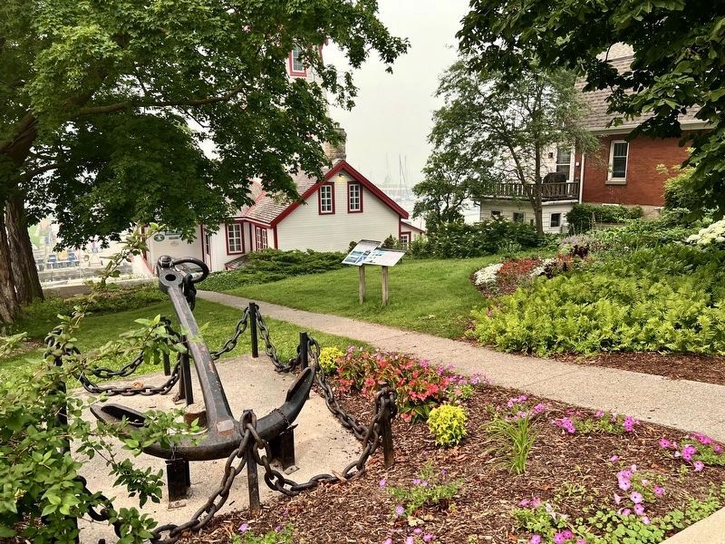
The marker on the right of the two

Regionally, this marker is in Georgian Bay Country and in Southwestern Ontario. It is also in Central Canada. Globally, it is in North America, on the Great Lakes, in the Western Hemisphere, in the Western World, and in the Anglosphere. Historically, it finds itself in what was once a British colony, the Viceroyalty of New France, the Haudenosaunee (Iroquois) Confederacy, and Rupert’s Land.
Other nearby markers. At least 7 other markers are within 18 kilometers of this marker, measured as the crow flies: The Phantom Piper (here, next to this marker); The Kincardine Lighthouse (a few steps from this marker); Paddy’s Stone (within shouting distance of this marker); The Salt Block (about 150 meters away, measured in a direct line); Sergeant Charles William Mann (about 180 meters away); Point Clark Lighthouse / Phare de la Pointe Clark (approx. 15 kilometers away); Douglas Point Nuclear Power Plant / Centrale Nucléaire de Douglas Point (approx. 16.8 kilometers away).
Photographed by Tim Boyd, July 16, 2026
3. The Kincardine Lighthouse in 2026
Credits. This page was last revised on August 3, 2026. It was originally submitted on August 3, 2026, by Tim Boyd of Hamilton, Ontario. This page has been viewed 8 times since then. Photos: 1, 2, 3. submitted on August 3, 2026, by Tim Boyd of Hamilton, Ontario. • Andrew Ruppenstein was the editor who published this page.
