
Moulineaux in Seine-Maritime, Normandy, France — Western Europe
Le château de Robert le Diable
⎯⎯⎯
Robert the Devil’s Castle
Moulineaux
| — | Agglo Balades / Agglo Walks | — |
Photographed by James Hulse, July 31, 2026
1. Le château de Robert le Diable / Robert the Devil’s Castle Marker

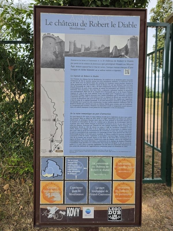
Dominant la Seine et l’autoroute A13, le château de Robert le Diable fait partie de la ceinture de forteresses qui protégeait Rouen au Moyen Âge. Réduit aujourd’hui à l’état de ruines, l’antique château témoigne d’une longue et riche histoire où se mêlent réalités et légendes.
La légende de Robert le Diable
Sur l’histoire du château fort de Moulineaux, les archives ne se montrent guère bavardes, renforçant de fait le mystère autour de cette installation militaire. La forteresse, élevée au XIᵉ siècle avec les pierres tirées des carrières de Caumont, toutes proches, domine la Seine, permettant ainsi de contrôler l’accès à Rouen. On sait que Richard Cœur de Lion, duc de Normandie de 1189 à 1199, y fit faire d’importants travaux, notamment autour de l’aménagement du puits d’une centaine de mètres de profondeur qui alimente en eau la forteresse. Son successeur, Jean sans Terre, y séjourna à plusieurs reprises et poursuivit son aménagement. Mais lors de la conquête de la Normandie par le roi de France Philippe Auguste en 1204, le duc Jean ordonne, avant son départ pour l’Angleterre, que le château soit détruit. Philippe Auguste, mesurant tout l’intérêt stratégique que la forteresse représente, commande alors que celle-ci soit remise en état. Le château est détruit une nouvelle fois en 1418 par les Rouennais afin qu’il ne tombe pas entre les mains des Anglais, qui s’apprêtent à faire le siège de la capitale normande. À ces faits historiques viennent se greffer quantité de légendes sur le passé de cette construction. La plus connue demeure évidemment celle de Robert le Diable, qui a donné son nom au château. Mythe pour certains, père de Guillaume le Conquérant pour d’autres, l’homme à la réputation cruelle et sanguinaire aurait séjourné dans cet endroit, marquant à tout jamais de son empreinte ce lieu de désolation.
De la ruine romantique au parc d’attractions
En ruine depuis le XVᵉ siècle, le vieux château, envahi par la végétation, est peu à peu oublié des hommes. Mais au début du XIXᵉ siècle, la vague romantique qui balaye les milieux intellectuels et artistiques français attire dans ces lieux peintres et écrivains, fascinés par le mystère et l’atmosphère du lieu. Les combats qui se déroulent du 30 décembre 1870 au 4 janvier 1871 entre soldats français et prussiens accentuent encore un peu plus l’état de ruine du château. Passionné par l’histoire de cette antique forteresse, Oscar Cosserat, son propriétaire, décide en 1903 de relever ces ruines à l’aide de l’architecte rouennais Lucien Lefort. Après avoir dégagé celles-ci de la végétation qui les recouvrait, le château renaît peu à peu. Mais le projet de reconstruction de la forteresse ne peut être poussé à son terme, et seuls la consolidation des souterrains et le remontage de deux tours peuvent être effectués. Endommagé pendant la Seconde Guerre mondiale, le château semble de nouveau condamné à retourner à l’état de ruines. Cependant, le journaliste rouennais Roger Parment décide en 1953 de lui donner une seconde chance et d’en faire l’un des hauts lieux touristiques de la région de Rouen. Afin de renforcer l’intérêt de la visite du château, celui-ci est complété par l’aménagement d’un musée historique, la présentation de la réplique du drakkar d’Oseberg, l’installation d’une buvette et la construction d’un terrain de minigolf. Le site est ouvert au public le 12 avril 1954 et devient rapidement l’un des buts de promenade dominicale les plus prisés des habitants de l’agglomération rouennaise, jusqu’à sa fermeture en 2004.
Source : La Bouille, perle de la Seine, Association La Bouillotte, Lecerf, Rouen, 1995, p. 209-212.
Rédaction : Michel Croguennec. Crédits photos : Direction de l’environnement urbain, Agglo de Rouen, Archives départementales de la Seine-Maritime.
Overlooking the Seine and the A13 motorway, Robert the Devil’s Castle formed part of the ring of fortresses that protected Rouen during the Middle Ages. Now reduced to ruins, the ancient castle bears witness to a long and rich history in which fact and legend are intertwined.
The Legend of Robert the Devil
The archives reveal very little about the history of the fortified castle of Moulineaux, thereby increasing the mystery surrounding this military installation. Built in the 11th century with stone taken from the nearby quarries of Caumont, the fortress overlooks the Seine and made it possible to control access to Rouen. Richard the Lionheart, Duke of Normandy from 1189 to 1199, ordered major work to be carried out there, particularly the construction of a well approximately one hundred metres deep that supplied the fortress with water. His successor, John Lackland, stayed there several times and continued its development. During the conquest of Normandy by King Philip Augustus of France in 1204, Duke John ordered the castle to be destroyed before leaving for England. Recognizing the fortress’s strategic importance, Philip Augustus then ordered it to be restored. The castle was destroyed again in 1418 by the people of Rouen to prevent it from falling into the hands of the English, who were preparing to lay siege to the Norman capital. Numerous legends about the building’s past became attached to these historical events. The best known is, of course, the legend of Robert the Devil, after whom the castle was named. Considered a mythical figure by some and the father of William the Conqueror by others, this man, known for his cruel and bloodthirsty reputation, is said to have stayed here, forever leaving his mark upon this desolate place.
From Romantic Ruin to Amusement Park
In ruins since the 15th century, the old castle was gradually overgrown with vegetation and forgotten. At the beginning of the 19th century, however, the Romantic movement sweeping through French intellectual and artistic circles attracted painters and writers who were fascinated by the mystery and atmosphere of the site. The fighting between French and Prussian soldiers from December 30, 1870, to January 4, 1871, further worsened the castle’s ruined condition. Fascinated by the history of this ancient fortress, its owner, Oscar Cosserat, decided in 1903 to restore the ruins with the assistance of the Rouen architect Lucien Lefort. After the vegetation covering the remains had been cleared away, the castle gradually began to re-emerge. However, the reconstruction project could not be completed, and only the underground passages were reinforced and two towers rebuilt. Damaged during the Second World War, the castle once again appeared destined to return to ruins. In 1953, however, the Rouen journalist Roger Parment decided to give it a second chance and turn it into one of the leading tourist attractions in the Rouen region. To make a visit to the castle more appealing, a historical museum was created, a replica of the Oseberg Viking ship was displayed, a refreshment stand was installed, and a miniature-golf course was built. The site opened to the public on April 12, 1954, and quickly became one of the most popular destinations for Sunday outings among residents of the Rouen metropolitan area, remaining so until its closure in 2004.
Source: La Bouille, Pearl of the Seine, Association La Bouillotte, Lecerf, Rouen, 1995, pp. 209-212.
Text: Michel Croguennec. Photo credits: Urban Environment Department, Agglo de Rouen, Seine-Maritime Departmental Archives.
Erected by Métropole
this page online
Topics. This historical marker is listed in these topic lists: Entertainment • Forts and Castles • Wars, Non-US. A significant historical date for this entry is January 4, 1871.
Location. 49° 20.37′ N, 0° 57.685′ E. Marker is in Moulineaux, Normandie (Normandy), in Seine-Maritime. It is at the intersection of State Road D64 and Rue Pierre Gosselin (Route D67A) on State Road D64. Touch for map. Marker is in this post office area: Moulineaux, Normandie 76530, France. Touch for directions.

Regionally, it is in the North Atlantic Region, Europe, the European Union, Atlantic Europe, the Schengen Area, Western Europe, a coastal Mediterranean country, and the Western World. Historically, it finds itself in what was once a French colony and also the Roman Empire.
Other nearby markers. At least 8 other markers are within 16 kilometers of this marker, measured as the crow flies: To Lieutenant Conrad Bochard (within shouting distance of this marker); Moulineaux Memorial (within shouting distance of this marker); Le panorama du château de Robert le Diable / The View from Robert the Devil’s Castle (within shouting distance of this marker); Les ruines du château de Robert le Diable / The ruins of Robert the Devil’s Castle (within shouting distance of this marker); Une forteresse médiévale / A Medieval Fortress (about 90 meters away, measured in a direct line); Entre ruine romantique et site archéologique / Between Romantic Ruin and Archaeological Site (about 120 meters away); La renaissance du château / The Restoration of the Castle (about 150 meters away); Le Bucher (approx. 14.8 kilometers away). Touch for a list and map
Photographed by James Hulse, July 31, 2026
2. Le château de Robert le Diable / Robert the Devil’s Castle Marker
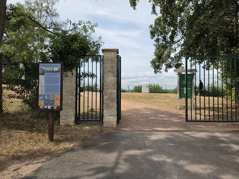
The view of the marker at the castle’s entrance gate.
Photographed by James Hulse, July 31, 2026
3. Le château de Robert le Diable / Robert the Devil’s Castle Marker
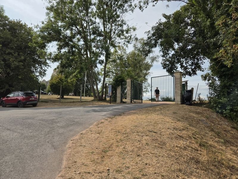
The view of the marker from the street.
Photographed by James Hulse
4. Le château de Robert le Diable / Robert the Devil’s Castle Marker
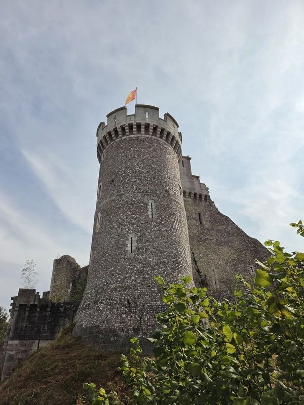
The view of the castle from the approach of the entrance.
Photographed by James Hulse, July 31, 2026
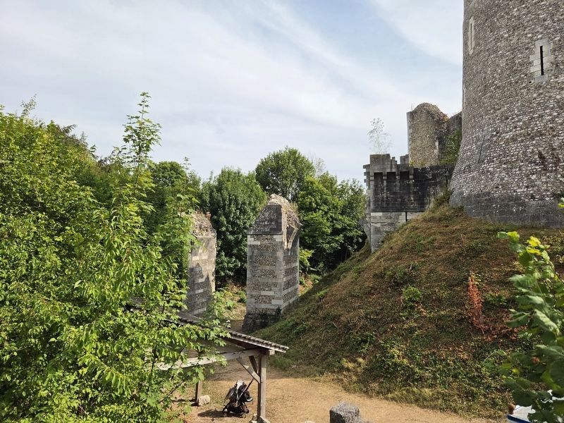
5. Le château de Robert le Diable / Robert the Devil’s Castle Marker
The view of the ruins of the draw bridge.
Photographed by James Hulse
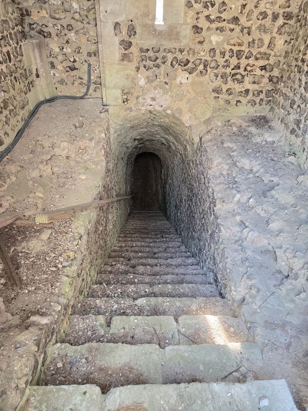
6. Le château de Robert le Diable / Robert the Devil’s Castle Marker
A pathway under the castle.
circa 1905
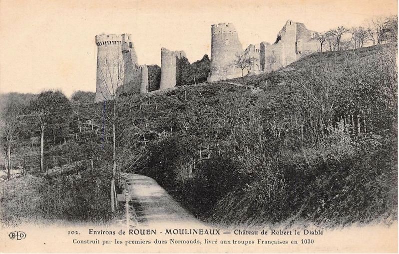
7. Le château de Robert le Diable
Credits. This page was last revised on August 5, 2026. It was originally submitted on August 3, 2026, by James Hulse of Medina, Texas. This page has been viewed 16 times since then. Photos: 1, 2, 3, 4, 5, 6. submitted on August 4, 2026, by James Hulse of Medina, Texas. 7. submitted on August 5, 2026.
