Ransom in Pike County, Kentucky — The American South (East South Central)
Hatfield/McCoy Monument
Photographed by Mark Parker, July 12, 2026
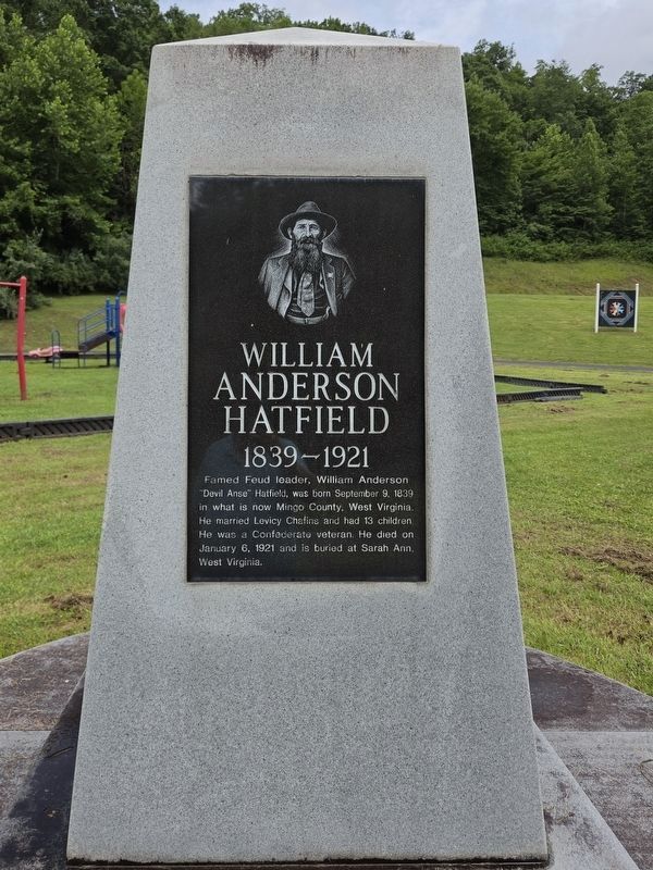
1. William Hatfield side of the Monument
William Anderson Hatfield
1839-1921
Famed Feud leader, William Anderson "Devil Anse" Hatfield, was born September 9, 1839 in what is now Mingo County, West Virginia. He married Levicy Chafins and had 13 children. He was a Confederate veteran. He died on January 6, 1921 and is buried at Sarah Ann, West Virginia.
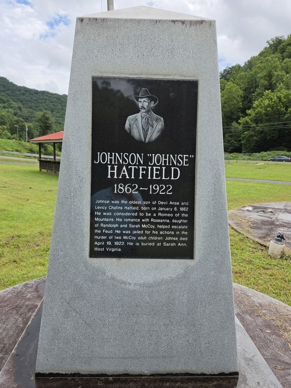
Johnson "Johnse" Hatfield
1862-1922
Johnse was the oldest son of Devil Anse and Levicy Chafins Hatfield, born on January 6, 1862. He was considered to be a Romeo of the Mountains. His romance with Roseanna, daughter of Randolph and Sarah McCoy, helped escalate the Feud. He was jailed for his actions in the murder of two McCoy adult children. Johnse died April 19, 1922. He is buried at Sarah Ann, West Virginia.
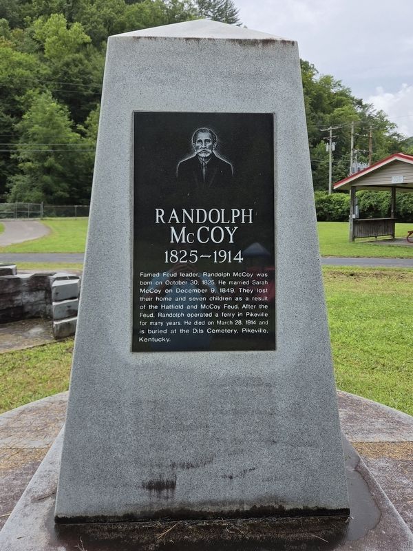
Randolph McCoy
1825-1914
Famed Feud leader, Randolph McCoy was born on October 30. 1825. He married Sarah McCoy on December 9, 1849. They lost their home and seven children as a result of the Hatfield and McCoy Feud. After the Feud, Randolph operated a ferry in Pikeville for many years. He died on March 28, 1914 and is buried at the Dils Cemetery, Pikeville Kentucky.
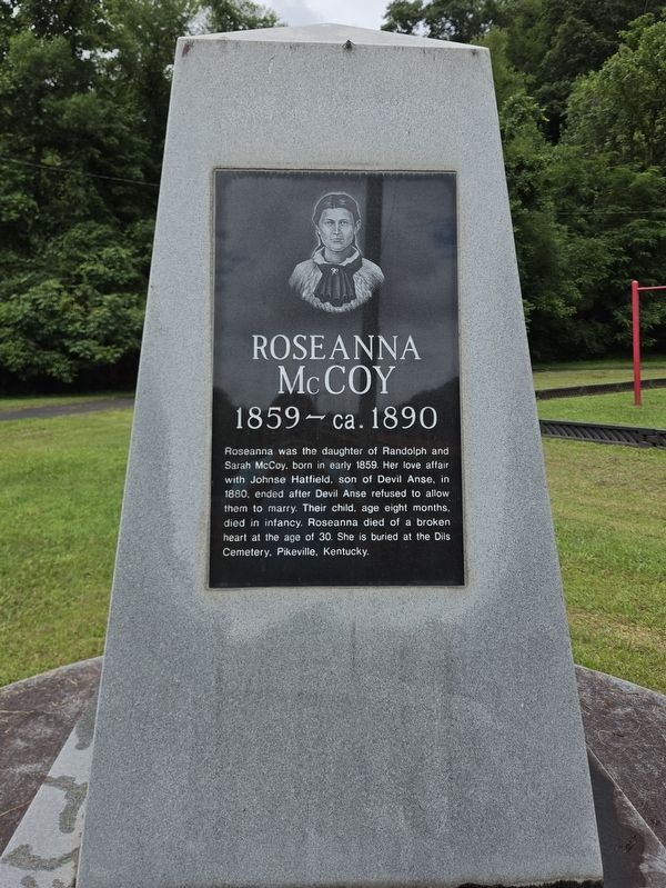
Roseanna McCoy
1859-ca. 1899
Roseanna
this page online
Topics and series. This historical marker and monument is listed in this topic list: Notable Events. In addition, it is included in the The Hatfield-McCoy Feud series list. A significant historical date for this entry is September 9, 1839.
Location. 37° 33.453′ N, 82° 11.776′ W. Marker is in Ransom, Kentucky, in Pike County. It is on State Highway 1056 0.4 miles north of Left Fork Blackberry Road (State Road 3149), on the left. Touch for map. Marker is at or near this postal address: 4896 State Hwy 1056, Ransom KY 41558, United States of America. Touch for directions.

Regionally, this marker and monument is in Eastern Kentucky. It is also in the American South, specifically in the Upper South, in Appalachia, and specifically in Southern Appalachia. Globally, it is in North America, the Western Hemisphere,
Photographed by Mark Parker, July 12, 2026
2. Johnson Hatfield side of the Monument
Other nearby markers. At least 8 other markers are within 4 miles of this marker, measured as the crow flies: Site of Killing of Asa Harmon McCoy (approx. ¼ mile away); Hog Trial / Election Fight (approx. 1.8 miles away); Hog Trial Site (approx. 1.8 miles away); McCoy Cemetery (approx. 1.8 miles away); Hatfield McCoy Feud (approx. 3 miles away in West Virginia); Randal McCoy's Well (approx. 3.3 miles away); The Real McCoy Homestead Uncovered (approx. 3.3 miles away); McCoy Well (approx. 3.3 miles away).
Photographed by Mark Parker, July 12, 2026
3. Randolph McCoy side of the Monument
Photographed by Mark Parker, July 12, 2026
4. Roseanna McCoy side of the Monument
Photographed by Mark Parker, July 12, 2026
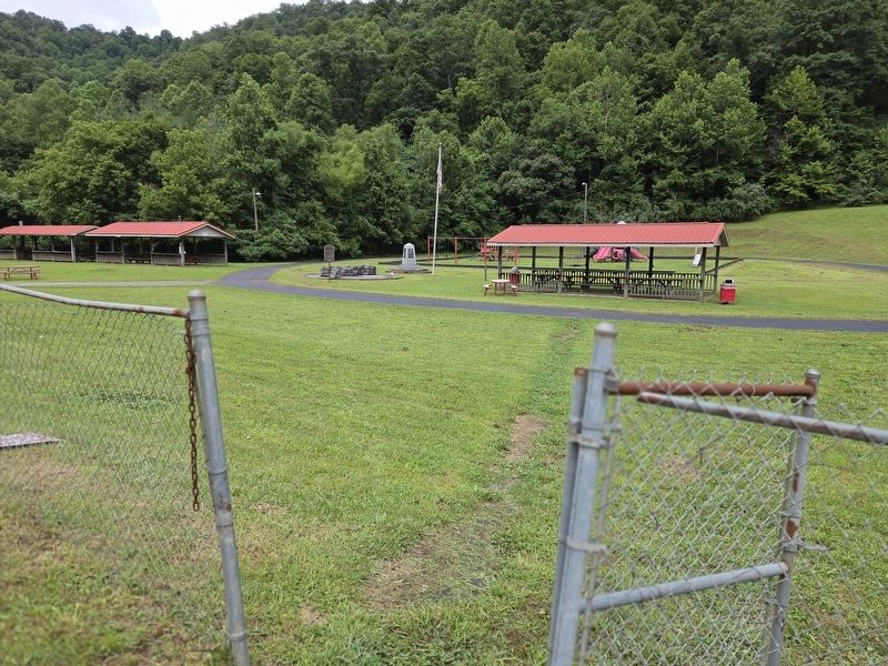
5. Hatfield / McCoy Monument near a picnic shelter at the park
Credits. This page was last revised on August 4, 2026. It was originally submitted on August 3, 2026, by Mark Parker of Hickory, North Carolina. This page has been viewed 14 times since then. Photos: 1, 2, 3, 4, 5. submitted on August 3, 2026, by Mark Parker of Hickory, North Carolina. • Andrew Ruppenstein was the editor who published this page.
