Millbrook in Dutchess County, New York — The American Northeast (Mid-Atlantic)
Athletics and Community
⎯⎯⎯
Sport e Comunità
Millbrook, New York
| — | The Museum in the Streets | — |
Photographed by Michael Herrick, September 8, 2019
1. Athletics and Community Marker

Athletics and Community
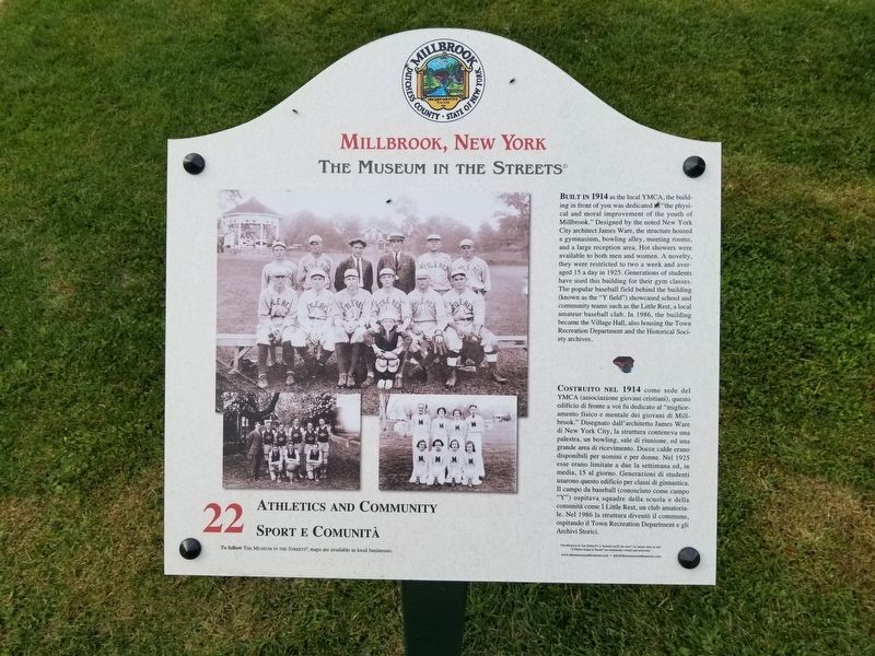
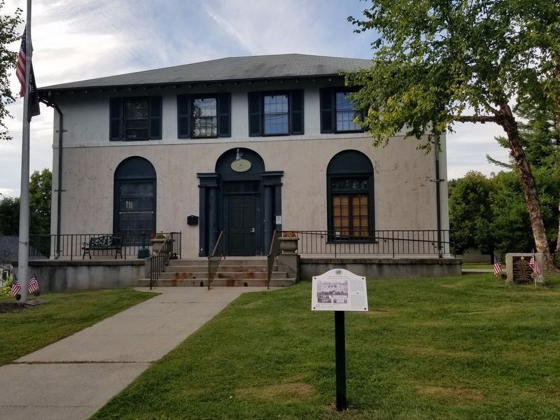
Built in 1914 as the local YMCA, the building in front of you was dedicated 6 "the physical and moral improvement of the youth of Millbrook." Designed by the noted New York City architect James Ware, the structure housed a gymnasium, bowling alley, meeting rooms, and a large reception area. Hot showers were available to both men and women. A novelty, they were restricted to two a week and averaged 15 a day in 1925. Generations of students have used this building for their gym classes. The popular baseball field behind the building (known as the "Y field") showcased school and community teams such as the Little Rest, a local amateur baseball club. In 1986, the building became the Village Hall, also housing the Town Recreation Department and the Historical Society archives.
Costruito nel 1914 come sede del YMCA (associazione giovani cristiani), questo edificio di fronte a voi fu dedicato al "miglioramento fisico e mentale dei giovani di Millbrook." Disegnato dall' architetto James Ware di New York City, la struttura conteneva una palestra, un bowling, sale di riunione,
this page online
Erected 2014 by The Museum in the Streets. (Marker Number 22.)
Topics and series. This historical marker is listed in these topic lists: Parks & Recreational Areas • Sports. In addition, it is included in the The Museum in the Streets: Millbrook, New York series list. A significant historical year for this entry is 1914.
Location. 41° 47.189′ N, 73° 41.527′ W. Marker is in Millbrook, New York, in Dutchess County. It is at the intersection of Merritt Avenue and Friendly Lane, on the right when traveling west on Merritt Avenue. Touch for map. Marker is at or near this postal address: 35 Merritt Avenue, Millbrook NY 12545, United States of America. Touch for directions.

Regionally,
Photographed by Michael Herrick, September 8, 2019
2. Athletics and Community Marker in front of the Millbrook Police Station
Other nearby markers. At least 8 other markers are within walking distance of this marker: Millbrook Veterans Memorial (a few steps from this marker); To Honor All Those Who Served (about 400 feet away, measured in a direct line); A World of Information / Un Mondo di Informazioni (about 400 feet away); Strike Up the Band! / La Banda Musicale (about 500 feet away); Blown Away / Volatilizzata (about 500 feet away); The School That Launched a Village / La Scuola Chester Creò il Villaggio (about 600 feet away); Tents and Togas / Tende e Toghe (about 700 feet away); "Downstreet" / Centro Città (about 700 feet away). Touch for a list and map of all markers in Millbrook.
Also see . . . Village of Milbrook. (Submitted on September 26, 2019, by Michael Herrick of Southbury, Connecticut.)
Credits. This page was last revised on August 3, 2026. It was originally submitted on September 26, 2019, by Michael Herrick of Southbury, Connecticut. This page has been viewed 273 times since then and 43 times this year. Last updated on August 3, 2026, by Carl Gordon Moore Jr. of North East, Maryland. Photos: 1, 2. submitted on September 26, 2019, by Michael Herrick of Southbury, Connecticut. • Devry Becker Jones was the editor who published this page.
