
Moulineaux in Seine-Maritime, Normandy, France — Western Europe
La renaissance du château
⎯⎯⎯
The Restoration of the Castle
Photographed by James Hulse
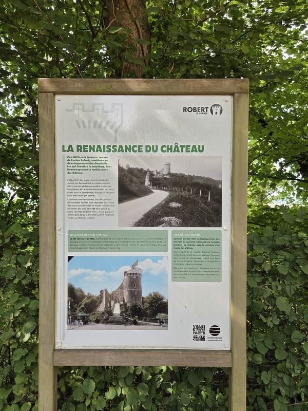
1. La renaissance du château / The Restoration of the Castle Marker

Ces différents travaux, œuvre de Lucien Lefort, combinés au développement du chemin de fer qui favorise le tourisme, font beaucoup pour la renaissance du château.
L’apparition des guides imprimés (Guides Joanne qui deviendront les célèbres Guides Bleus) permet de faire connaître le château. Moulineaux et La Bouille deviennent des lieux prisés pour la promenade, d’accès facile par le train mais aussi par bateau.
Les ruines sont restaurées. Les découvertes de nouvelles fouilles sont exposées dans l’une des tours transformées en musée : des boulets en pierre, des clés, la corde et la poulie du puits, l’anneau du pont-levis… Mais quelques années plus tard, la Seconde Guerre mondiale éclate. Le château est pillé.
Le classement du château
Le site est classé en 1935, à la demande de son propriétaire Maurice Cosserat. L’arrêté de protection souligne le caractère artistique et historique de l’implantation de l’ancienne forteresse et de son paysage. Cette protection permet d’assurer la pérennité et la mise en valeur du château afin que les aménagements futurs ne dénaturent pas le site.
Un château-musée
Dans les années 1950, le développement des loisirs et du tourisme redonnent une nouvelle jeunesse au château avec la création d’un musée des Vikings.
Sous l’égide de la famille Cosserat toujours propriétaire, André Cosserat et Roger Parment, alors maire de Moulineaux, créent une base de loisirs (buvette, attraction et minigolfs) à l’ombre du chêne du château.
Beaucoup de familles et d’écoliers ont pu le visiter pendant plus de 50 ans contribuant ainsi à sa notoriété et à l’attachement des habitants pour ce lieu.
Métropole Rouen Normandie — Photos © Archives départementales et carte postale © collection privée Béatrice Bourguignon.
These various works, the work of Lucien Lefort, combined with the development of the railway, which encouraged tourism, contributed greatly to the revival of the castle.
The appearance of printed guidebooks—the Guides Joanne, which would become the famous Guides Bleus—helped make the castle known. Moulineaux and La Bouille became popular places for outings, easily accessible by train as well as by boat.
The ruins were restored. Discoveries from new excavations were displayed in one of the towers, which was converted into a museum: stone cannonballs, keys, the rope and pulley from the well, the ring from the drawbridge… But a few years later, the Second World War broke out. The castle was looted.
The Castle’s Protected Status
The site was officially protected in 1935 at the request of its owner, Maurice Cosserat. The protection order emphasized the artistic and historical character of the former fortress’s location and its landscape. This protection helps ensure the preservation and enhancement of the castle so that future developments do not alter the character of the site.
A Castle Museum
In the 1950s, the development of leisure activities and tourism gave the castle new life with the creation of a Viking museum.
Under the leadership of the Cosserat family, who still owned the property, André Cosserat and Roger Parment, then mayor of Moulineaux, created a recreation area—with a refreshment stand, an attraction, and miniature-golf courses—in the shade of the castle’s oak tree.
Many families and schoolchildren were able to visit it for more than 50 years, thus contributing to its fame and to the affection local residents felt for the site.
Métropole Rouen Normandie — Photographs © Departmental Archives and postcard © Béatrice Bourguignon Private Collection.
Erected by Métropole
this page online
Topics. This historical marker is listed in these topic lists: Forts and Castles • Parks & Recreational Areas. A significant historical year for this entry is 1935.
Location. 49° 20.399′ N, 0° 57.572′ E. Marker is in Moulineaux, Normandie (Normandy), in Seine-Maritime. It is at the intersection of State Road D64 and Rue Pierre Gosselin (State Road D67A) on State Road D64. Touch for map. Marker is in this post office area: Moulineaux, Normandie 76530, France. Touch for directions.

Regionally, it is in the North Atlantic Region, Europe, the European Union, Atlantic Europe, the Schengen Area, Western Europe, a coastal Mediterranean country, and the Western World. Historically, it finds itself in what was once a French colony and also the Roman Empire.
Other nearby markers. At least 8 other markers are within 16 kilometers of this marker, measured as the crow flies: Entre ruine romantique et site archéologique / Between Romantic Ruin and Archaeological Site (within shouting distance of this marker); Une forteresse médiévale / A Medieval Fortress (within shouting distance of this marker); Les ruines du château de Robert le Diable / The ruins of Robert the Devil’s Castle
Photographed by James Hulse
2. La renaissance du château / The Restoration of the Castle Marker

Photographed by James Hulse, July 31, 2026
3. La renaissance du château / The Restoration of the Castle Marker
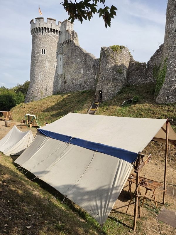
The view of the marker along the outer wall.
Credits. This page was last revised on August 6, 2026. It was originally submitted on August 4, 2026, by James Hulse of Medina, Texas. This page has been viewed 9 times since then. Photos: 1, 2, 3. submitted on August 5, 2026, by James Hulse of Medina, Texas.
