Yulee in Nassau County, Florida — The American South (South Atlantic)
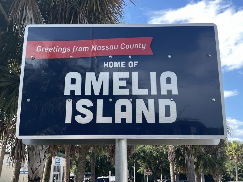
Home of Amelia Island
Greetings from Nassau County
Photographed by Tim Fillmon, July 26, 2026
1. Home of Amelia Island Marker, Side One
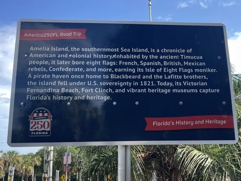
Amelia Island, the southernmost Sea Island, is a chronicle of American and colonial history. Inhabited by the ancient Timucua people, it later bore eight flags: French, Spanish, British, Mexican rebels, Confederate, and more, earning its Isle of Eight Flags moniker. A pirate haven once home to Blackbeard and the Lafitte brothers, the island fell under U.S. sovereignty in 1821. Today, its Victorian Fernandina Beach, Fort Clinch, and vibrant heritage museums capture Florida's history and heritage.
Florida’s History and Heritage
Erected 2026 by America250FL Road Trip.
Topics. This historical marker is listed in these topic lists: Architecture • Colonial Era • Forts and Castles. A significant historical year for this entry is 1821.
Location. 30° 41.829′ N, 81° 40.674′ W. Marker is in Yulee, Florida, in Nassau County. It is on Interstate 95 half a mile south of U.S. 17, on the right when traveling south. Located in the Florida Welcome Center. Touch for map. Marker is at or near this postal address: 751829 I-95, Yulee FL 32097, United States of America. Touch for directions.

Regionally, this marker is in
this page online
Other nearby markers. At least 8 other markers are within 6 miles of this marker, measured as the crow flies: Florida Honors and Remembers our POW’s and MIA’s (a few steps from this marker); Home of Fernandina Beach (within shouting distance of this marker); The State Of Georgia Salutes (approx. 4.2 miles away in Georgia); WW II Torpedo (approx. 4.2 miles away in Georgia); Cumberland Island National Seashore (approx. 4.3 miles away in Georgia); Battle for Georgia (approx. 4.3 miles away in Georgia); Florida's First Cross-Peninsula Railroad (approx. 5.7 miles away); John Muir's Walk on the Florida Railroad (approx. 5.7 miles away). Touch for a list and map of all markers in Yulee.
Photographed by Tim Fillmon, July 26, 2026
2. Home of Amelia Island Marker, Side Two

Photographed by Tim Fillmon, July 26, 2026
3. Home of Amelia Island Marker
Credits. This page was last revised on August 4, 2026. It was originally submitted on August 4, 2026, by Tim Fillmon of Webster, Florida. This page has been viewed 17 times since then. Photos: 1, 2, 3. submitted on August 4, 2026, by Tim Fillmon of Webster, Florida.
