Steubenville in Jefferson County, Ohio — The American Midwest (Great Lakes)
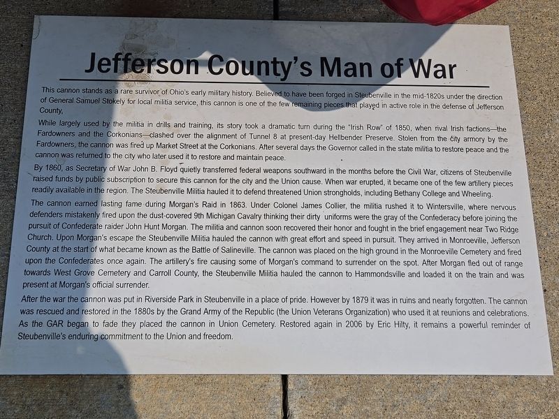
Jefferson County's Man of War
Photographed by Mark Parker, July 14, 2026
1. Jefferson County's Man of War Marker
While largely used by the militia in drills and training, its story took a dramatic turn during the "Irish Row" of 1850, when rival Irish factions — the Fardowners and the Corkonians — clashed over the alignment of Tunnel 8 at present-day Hellbender Preserve. Stolen from the city armory by the Fardowners, the cannon was fired up Market Street at the Corkonians. After several days the Governor called in the state militia to restore peace and the cannon was returned to the city who later used it to restore and maintain peace.
By 1860, as Secretary of War John B. Floyd quietly transferred federal weapons southward in the months before the Civil War, citizens of Steubenville raised funds by public subscription to secure this cannon for the city and the Union cause. When war erupted, it became one of the few
this page online
The cannon earned lasting fame during Morgan's Raid in 1863. Under Colonel James Collier, the militia rushed it to Wintersville, where nervous defenders mistakenly fired upon the dust-covered 9th Michigan Cavalry thinking their dirty uniforms were the gray of the Confederacy before joining the pursuit of Confederate raider John Hunt Morgan. The militia and cannon soon recovered their honor and fought in the brief engagement near Two Ridge Church. Upon Morgan's escape the Steubenville Militia hauled the cannon with great effort and speed in pursuit. They arrived in Monroeville, Jefferson County at the start of what became known as the Battle of Salineville. The cannon was placed on the high ground in the Monroeville Cemetery and fired upon the Confederates once again. The artillery's fire causing some of Morgan's command to surrender on the spot. After Morgan fled out of range towards West Grove Cemetery and Carroll County, the Steubenville Militia hauled the cannon to
Photographed by Mark Parker, July 14, 2026
2. Jefferson County's Man of War Marker
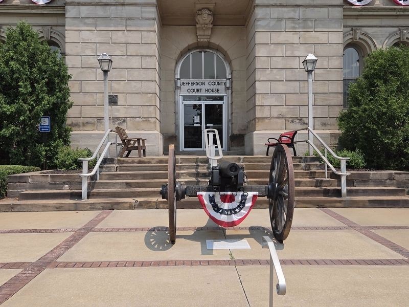
Ground level in front of the cannon at the main entrance to Jefferson County Courthouse.
After the war the cannon was put in Riverside Park in Steubenville in a place of pride. However by 1879 it was in ruins and nearly forgotten. The cannon was rescued and restored in the 1880s by the Grand Army of the Republic (the Union Veterans Organization) who used it at reunions and celebrations. As the GAR began to fade they placed the cannon in Union Cemetery. Restored again in 2006 by Eric Hilty, it remains a powerful reminder of Steubenville's enduring commitment to the Union and freedom.
Topics. This historical marker is listed in these topic lists: Military • War, US Civil. A significant historical year for this entry is 1850.
Location. 40° 21.588′ N, 80° 36.838′ W. Marker is in Steubenville, Ohio, in Jefferson County. It is on Market Street west of North 3rd Street, on the right when traveling west. The marker is at ground level in front of the cannon in front of the main entrance to Jefferson County Courthouse. Touch for map. Marker is at or near this postal address: 301 Market St, Steubenville OH 43952, United States of America. Touch for directions.

Regionally, this marker is in the High Valley. It is also in the American Midwest, in the Ohio River Valley, in Appalachia, and specifically in Northern Appalachia. Globally, it is in North America, the Western Hemisphere, the Western World, and the Anglosphere. Historically, it finds itself in what was once the Viceroyalty of New France, the Haudenosaunee (Iroquois) Confederacy, the territory of the Mississippian Culture, and the Northwest Territory.
Other nearby markers. At least 8 other markers are within walking distance of this marker: U.S.S. Maine Memorial (a few steps from this marker); Veterans Memorial (a few steps from this marker); Secretary of War Edwin M. Stanton (a few steps from this marker); Edwin McMasters Stanton (a few steps from this marker); Abraham Lincoln's Visit to Steubenville (within shouting distance of this marker); The Steubenville Building and Loan Association Building (within shouting distance of this marker); Guy W. Jacobs (1888 - 1973) / Steubenville Rotary Club (April 20, 1921) (within shouting distance of this marker); 328 Market Street (within shouting distance of this marker). Touch for a list and map of all markers in Steubenville.
Credits. This page was last revised on August 5, 2026. It was originally submitted on August 4, 2026, by Mark Parker of Hickory, North Carolina. This page has been viewed 16 times since then. Photos: 1, 2. submitted on August 4, 2026, by Mark Parker of Hickory, North Carolina. • Andrew Ruppenstein was the editor who published this page.
