Melton Mowbray in Leicestershire, England, United Kingdom — Northwestern Europe (the British Isles)
King Street
| — | Melton Mowbray Heritage Trail | — |
Photographed by Ray Gurganus, May 5, 2026
1. King Street Marker
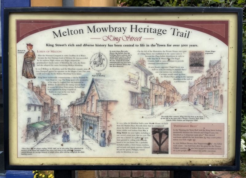
King Street's rich and diverse history has been central to life in the Town for over 5000 years.
Lords of Melton
After the Norman Conquest in 1066, Geoffrey de la Wirce became the first Norman Lord of Melton. He was succeeded by his nephew, Nigel, whose son, Roger, adopted his grandmother's family name of Mowbray. By 1282, the Town had also adopted the name, becoming Melton Mowbray.
In 1215, William de Mowbray used the Mowbray crusader arms, a Lion Rampant, against his signature on the Magna Carta. This crest is still used today by the Melton Mowbray Town Estate.
King Street traditionally commemorates a visit by Richard the Lion Heart in 1194. The King spent only six months of his reign in England, but was indebted to William de Mowbray for raising ransom funds to secure his release from prison. Richard had been captured by King Leopold of Austria in 1192 on his way back from the Crusades.
'Three Tuns' and the plaque reading 'WAH 1898' can be seen today. These advertised the business of Mr Heap who supplied 'fine wines and clarets to the nobility Customers entered through the carriage archway to sample wines, often ordering enough for the whole hunting season.
In recent times, flint tools, Bronze Age burials, Iron Age buildings, Roman pottery and a spindle whorl used by a Saxon weaver have all been found in the area. Under WH Smith, stonework that may have been part of a Norman Manor, has also been discovered.
On
this page online
A new theatre, opposite Chapel Street, was built in 1778, becoming so popular that a one-way system was introduced. Carriages would travel up from the Market Place, going in the opposite direction at the end of a performance.
For nearly three centuries, King street has been at the heart of civic life in the town with a Theatre, Cinemas, Town Hall, Schools, Police Station and Temperance Hall.
In 1313, John de Mowbray built a new Manor House, set back from the Market Place. Records show that he complained about the theft of timber from his new home, whilst roof timbers from No. 7 King Street (to your right), including a rare carved crown post, date to 1330. The post was a feature of a grand hall open from ground to ceiling with a smoke hood to let out fumes. No. 7 probably included stables, a brew house, smithies, and servants and guests quarters. Edward III
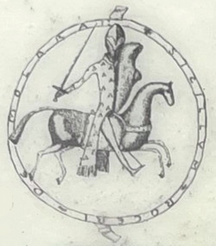
Illustration from the marker, May 5, 2026
2. Seal of Roger de Mowbray
'Peppermint Billy'
In the 'Painting the Town Red' trial the King Street lockup (bridewell), between the Schools and Chapel Lane, was described as, "a desperate nasty place". Two elected watchman upheld the law from here. In 1843 a new police station was built on the site.
In 1856, William Brown, alias 'Peppermint Billy' - his father made mints was held here after his arrest for the Thorpe Tollgate murders. He was later hanged in Leicester in front of 25,000 people, the County's last public execution.
Topics. This historical marker is listed in this topic list: Roads & Vehicles.
Location. 52° 45.909′ N, 0° 53.171′ W. Marker is in Melton Mowbray, England, in Leicestershire. It is on King Street, on the right when traveling west. Touch for map. Marker is at or near this postal address: 7 King Street, Melton Mowbray, England LE13 1XD, United Kingdom. Touch for directions.

Regionally, this marker is in the Midlands. Globally, it is on the Atlantic Ocean, in the North Atlantic Region, in Europe, in Atlantic Europe, on one of the British Isles, in the Western World, and in the Anglosphere. Historically, it finds itself in what was once the Roman Empire.
Other nearby markers. At least 8 other markers are within 16 kilometers of this marker, measured as the crow flies: The Medieval Garden King Street (a few steps from this marker); Hudson's Cottage (approx. 14.7 kilometers away); Fit for a King (approx. 15 kilometers away); Friends Meeting House - Oakham (approx. 15 kilometers away); Ancient Customs (approx. 15 kilometers away); Deer, Cattle, and Horses (approx. 15 kilometers away); Oakham Castle (approx. 15 kilometers away); Conquest & Castles (approx. 15 kilometers away).
Credits. This page was last revised on August 5, 2026. It was originally submitted on August 5, 2026, by Ray Gurganus of Washington, District of Columbia. This page has been viewed 8 times since then. Photos: 1, 2. submitted on August 5, 2026, by Ray Gurganus of Washington, District of Columbia. • Andrew Ruppenstein was the editor who published this page.
Editor’s want-list for this marker. photo of the marker with its surroundings • Can you help?
