Stamford in Lincolnshire, England, United Kingdom — Northwestern Europe (the British Isles)
Stamford's Stone Heritage
by Jason Duckmanton
Photographed by Ray Gurganus, May 5, 2026
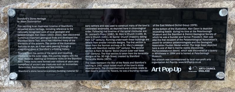
1. Stamford's Stone Heritage Marker
Starting from the centre of the spiral and travelling clockwise to the outer edge, this journey begins with the River Welland, washing up limestone rocks on the Stamford ford. These rocks were formed over millions of years and comprised of ancient sea creatures such as Ammonites, Belemnites, Brachiopods and Sea Urchins.
Stamford's stone became a primary building material for early settlers and was used to construct many of the town's celebrated landmarks, as depicted here in chronological order. Following the timeline of the spiral clockwise are: St. Leonard's Priory (1082), St. Mary's Church (1146), St. John's Church (1451), All Saints' Church (masonry
this page online
The roses represent the War of the Roses and Stamford's sacking in 1461 which halted much of the town's stone developments. The chrysanthemums and orchids relate to Alan Dawn's passion for flowers, he was a founding member of the East Midland Orchid Group (1976).
At the bottom of the illustration, Alan Dawn is depicted excavating fossils during his time at the Peterborough Museum and the Stamford & District Geological Society of which he was a founder and former President. Alan was also the first recipient of the Palaeontological Association's award for amateur palaeontologists and the Geologists' Association Foulton Medal winner. The large fossil depicted here is one of Alan's marine reptile discoveries: Pachycostasaurus dawnii,

Photographed by Ray Gurganus, May 5, 2026
2. Stamford's Stone Heritage
Topics. This historical marker is listed in these topic lists: Architecture • Arts, Letters, Music • Man-Made Features. A significant historical year for this entry is 1461.
Location. 52° 39.14′ N, 0° 28.709′ W. Marker is in Stamford, England, in Lincolnshire. It is on High Street, on the right when traveling east. Touch for map. Marker is at or near this postal address: 57 High Street, Stamford, England PE9 2AL, United Kingdom. Touch for directions.

Regionally, this marker is in the Midlands. Globally, it is on the Atlantic Ocean, in the North Atlantic Region, in Europe, in Atlantic Europe, on one of the British Isles, in the Western World, and in the Anglosphere. Historically, it finds itself in what was once the Roman Empire.
Other nearby markers. At least 5 other markers are within 19 kilometers of this marker, measured as the crow flies: St Michael's Churchyard and its surroundings (within shouting distance of this marker); Stamford Theatre (about 120 meters away, measured in a direct line); The Sundial at All Saints' Church (about 150 meters away); The Hospital of Thomas Truesdale (approx. 0.3 kilometers away); Oundle Bridge (approx. 18.4 kilometers away).
Credits. This page was last revised on August 5, 2026. It was originally submitted on August 5, 2026, by Ray Gurganus of Washington, District of Columbia. This page has been viewed 7 times since then. Photos: 1, 2. submitted on August 5, 2026, by Ray Gurganus of Washington, District of Columbia. • Andrew Ruppenstein was the editor who published this page.
