Near Rochelle in Madison County, Virginia — The American South (Mid-Atlantic)
Battle of Jack’s Shop
Attacked from all Sides
Photographed by J. J. Prats, October 31, 2009
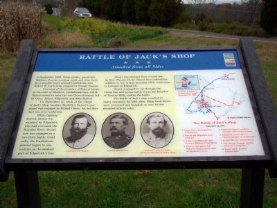
1. Battle of Jack’s Shop Marker
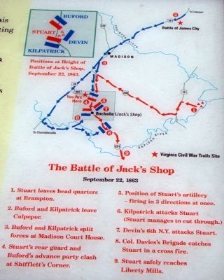
In September 1863, Union cavalry moved into Madison County, scouting roads and river fords for a possible move around Confederate Gen. Robert E. Lee’s army camped in Orange County.
Learning of the presence of Federal troops in the town of Madison, Confederate Gen. J.E.B. Stuart moved to meet the two Union divisions led by Gens. Judson Kilpatrick and John Buford.
On September 22, while at the village of Jack’s Shop (modern Rochelle), Stuart’s rear guard was engaged by Buford’s force. An artillery duel was soon underway.
While fighting Buford, Stuart was attacked by Kilpatrick, who had recrossed the Rapidan River. Stuart now was engaged in a two-front battle. Gradually, the Confederate general began to concentrate on the weakest part of Kilpatrick’s line.
Stuart was attacked from a third side by Gen. Thomas Devin. Stuart then ordered his artillery to fire in that direction while continuing to hammer at Kilpatrick.
Stuart managed to cut through the Union line and escape safely across the Rapidan at Liberty Mills, ending the battle.
The Battle of Jack’s shop resulted in heavy casualties for both sides.
this page online
Erected by Virginia Civil War Trails.
Topics. This historical marker is listed in this topic list: War, US Civil. A significant historical month for this entry is September 1863.
Location. 38° 18.539′ N, 78° 16.409′ W. Marker has been reported damaged. Marker is near Rochelle, Virginia, in Madison County. It is at the intersection of Shelby Road (County Route 662) and South Blue Ridge Turnpike (Virginia Route 231), on the right when traveling west on Shelby Road. The marker stands in a small carpool parking lot. Touch for map. Marker is in this post office area: Rochelle VA 22738, United States of America. Touch for directions.

Regionally, this marker is in Northern Virginia and in the Piedmont. It is also in the American South and specifically in the Upper South. Globally, it is in North America, the Western Hemisphere, the Western World, and the Anglosphere. Historically, it finds itself in what was once the territory of the Mississippian Culture, one of the original Thirteen Colonies, one of the Confederate States of America, and the Antebellum
Photographed by Molly Thacker, August 5, 2026
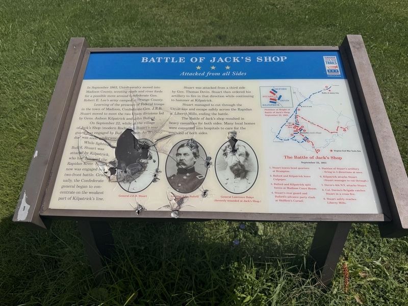
2. Battle of Jack’s Shop Marker
The marker has been defaced, apparently with bullets.
Other nearby markers. At least 8 other markers are within 5 miles of this location, measured as the crow flies: Cavalry Engagement at Jack’s Shop (approx. 1.3 miles away); Joseph Early Home (approx. 2.7 miles away); Oliver Dinwiddie Tucker (approx. 3.7 miles away); Greene County / Madison County (approx. 4.3 miles away); The Fallen Warriors Monument (approx. 5 miles away); Cpl. Clinton Greaves (1855-1906) (approx. 5 miles away); Madison County Confederate Dead (approx. 5 miles away); Madison County Courthouse (approx. 5 miles away).
More about this marker. The marker shows a large map of the battle on its right and includes a timeline key. At the bottom are portraits of General J.E.B. Stuart, General John Buford and General Lawrence Baker, who was severely wounded at Jack’s Shop.
Photographed by J. J. Prats, October 31, 2009
3. Battle of Jack’s Shop Marker
Photographed by J. J. Prats, October 31, 2009
4. Battle of Jack’s Shop Marker
Photographed by J. J. Prats, October 31, 2009
5. Closeup of Map Shown on Marker
Credits. This page was last revised on August 6, 2026. It was originally submitted on November 1, 2009, by J. J. Prats of Powell, Ohio. This page has been viewed 6,990 times since then and 252 times this year. Last updated on August 5, 2026, by Molly Thacker of Arlington, Virginia. Photos: 1. submitted on November 1, 2009, by J. J. Prats of Powell, Ohio. 2. submitted on August 5, 2026, by Molly Thacker of Arlington, Virginia. 3, 4, 5. submitted on November 1, 2009, by J. J. Prats of Powell, Ohio. • Devry Becker Jones was the editor who published this page.
