Chickamauga in Walker County, Georgia — The American South (South Atlantic)
Estelle Mining Community

Photographed by Edward Troxel, August 6, 2026
1. Estelle Mining Community Marker
The community of Estelle grew during the late 19th-century due to its location along the Chattanooga Southern Railroad completed in 1891 that ran from Chattanooga, Tennessee to Gadsden, Alabama a distance 91.7 miles. It was re-organized as the Tennessee, Alabama, Georgia (TAG Line) in 1911. From 1922 until 1951, the "scooter" motor car handled passenger service on the line. There was a tunnel constructed through Pigeon Mountain for the use of the railroad a short distance east of Estelle.
In 1897, John V. Costello, W.D. Hicks, and James Costello took over some small iron ore mines that had been earlier worked on Pigeon Mountain and incorporated the Chattanooga iron and Coal Corporation. Mining triples, a six-mile railroad
this page online
The ore was brought out of the mines by mule drawn tram cars, with the mules being managed by young boys. These boys, around twelve years of age, were called "mule boys." The workday of the mule boys started at 6:00 am. When they prepared the mules for the day's w work and had them in the mines by 6:30. The boys worked a ten-hour day and were paid ten cents per hour. Most of the mule boys had already been working several years before given that position. Boys as young as seven were used in loading the tram cars, and when they were ten, they would be put to work around the crusher.
During the 1920s, the mining operation became unprofitable since the ore became more difficult to dig. The mining operation closed in 1924, the population declined and the commercial
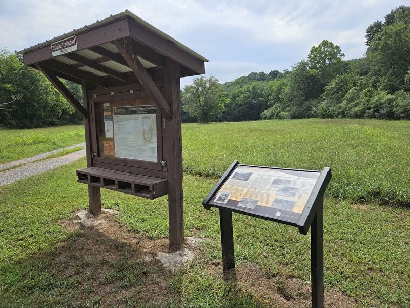
Photographed by Edward Troxel, August 6, 2026
2. Estelle Mining Community Marker
The Estelle Cemetery, railroad bed, and railroad tunnel remain as remnants of the community. The railroad was purchased by Southern Railway in 1971 and later abandoned.
Erected by Walker County Historic Preservation Commission.
Topics. This historical marker is listed in these topic lists: Industry & Commerce • Railroads & Streetcars • Settlements & Settlers. A significant historical year for this entry is 1883.
Location. 34° 44.938′ N, 85° 20.792′ W. Marker is in Chickamauga, Georgia, in Walker County. It is on Georgia Route 193 1.4 miles east of Route 341, on the right when traveling east. The marker is located at the Crockford-Pigeon Mountain Estelle Trailhead next to the Crockford-Pigeon Mountain Information Kiosk. Touch for map. Marker is in this post office area: Chickamauga GA 30707, United States of America. Touch for directions.

Regionally, this marker is in the Mountains. It is also in the American South, specifically in the Deep South, in Appalachia, and specifically in Southern Appalachia. Globally, it is in North America, the Western Hemisphere, the Western World, and the Anglosphere. Historically, it finds itself in what was once the original Cherokee Nation, the territory of the Mississippian Culture, one of the original Thirteen Colonies, one of the Confederate States of America, and the Antebellum South.
Other nearby markers. At least 8 other markers are within 5 miles of this marker, measured as the crow flies: Skirmish at McLemore’s Cove (approx. half a mile away); a different marker also named Skirmish at McLemore’s Cove (approx. half a mile away); a different marker also named Skirmish at McLemore’s Cove (approx. half a mile away); Martin Davis House and Farm (approx. 1.3 miles away); Catlett’s Gap (approx. 2½ miles away); Bailey's Crossroads (approx. 3.6 miles away); Fort Cumming (approx. 4.1 miles away); Stephens Gap (approx. 4½ miles away). Touch for a list and map of all markers in Chickamauga.
Another marker is no longer nearby. Davis' Cross Roads (was approx. 1.3 miles away but has been confirmed missing).
Credits. This page was last revised on August 14, 2026. It was originally submitted on August 6, 2026, by Edward Troxel of Creal Springs, Illinois. This page has been viewed 18 times since then. Photos: 1, 2. submitted on August 6, 2026, by Edward Troxel of Creal Springs, Illinois. • Bernard Fisher was the editor who published this page.
