Near LaFayette in Walker County, Georgia — The American South (South Atlantic)
Ship's Gap
Photographed by David Seibert, November 18, 2008
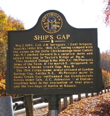
1. Ship's Gap Marker
May 7, 1864. Col. J.W. Sprague's (2nd) brigade, Veatch's (4th) Div., 16th A.C., having camped with the corps on the little Chickamauga (near Catlett 4 mi. N.), pushed forward in a surprise move and seized this gap in Taylor's Ridge at 9p.m.
This enabled Dodge & the 16th A.C. (McPherson's Army of the Tenn. [US]) to march E., unopposed, to Villanow & Snake Creek Gap, May 8.
The 15th Corps (same army) crossed at Gordon Springs Gap, 4miles N.E.. McPherson's move to Snake Creek Gap outflanked the Confederate forces under Gen. J.C. Johnston [CS] at Dalton -- resulting later in the evacuation of that place and the two days of battle at Resaca.
Erected 1992 by Georgia Department of Natural Resources. (Marker Number 146-7.)
Topics and series. This historical marker is listed in this topic list: War, US Civil. In addition, it is included in the Georgia Historical Society series list. A significant historical date for this entry is May 7, 1839.
Location. This marker has been replaced by another marker nearby. It was located near 34° 41.861′ N, 85° 11.216′ W. Marker was near LaFayette, Georgia, in Walker County. It was at the
this page online

Regionally, this marker was in the Mountains. It was also in the American South, specifically in the Deep South, in Appalachia, and specifically in Southern Appalachia. Globally, it was in North America, the Western Hemisphere, the Western World, and the Anglosphere. Historically, it found itself in what was once the original Cherokee Nation, the territory of the Mississippian Culture, one of the original Thirteen Colonies, one of the Confederate States of America, and the Antebellum South.
Other nearby markers. At least 8 other markers are within 5 miles of this location, measured as the crow flies: A different marker also named Ship's Gap (about 800 feet away, measured in a direct line); West Armuchee Valley (approx. 1.3 miles away); Chestnut Flat (approx. 3.3 miles away); William Little House (approx. 4 miles away); a different marker also named William Little House (approx. 4 miles away);
Photographed by David Seibert, November 18, 2008
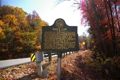
2. Ship's Gap Marker
Regarding Ship's Gap. There's an obvious spelling error on the arker: The General McPerson mentioned should be (Major General James Birdseye) McPherson.
Related marker. Click here for another marker that is related to this marker. New Replacement Marker Located Nearby also titled "Ship's Gap".
Credits. This page was last revised on August 14, 2026. It was originally submitted on November 27, 2008, by David Seibert of Sandy Springs, Georgia. This page has been viewed 1,698 times since then and 77 times this year. Last updated on August 6, 2026, by Edward Troxel of Creal Springs, Illinois. Photos: 1, 2. submitted on November 27, 2008, by David Seibert of Sandy Springs, Georgia. • Devry Becker Jones was the editor who published this page.
