
St. Louis Place , Missouri — The American Midwest (Upper Plains)
St. Louis Place Historic District
Neighborhood: St. Louis Place
| — | Architects, Aristocrats, Enslavers | — |
Photographed by Jason Voigt, June 5, 2025
1. St. Louis Place Historic District Marker
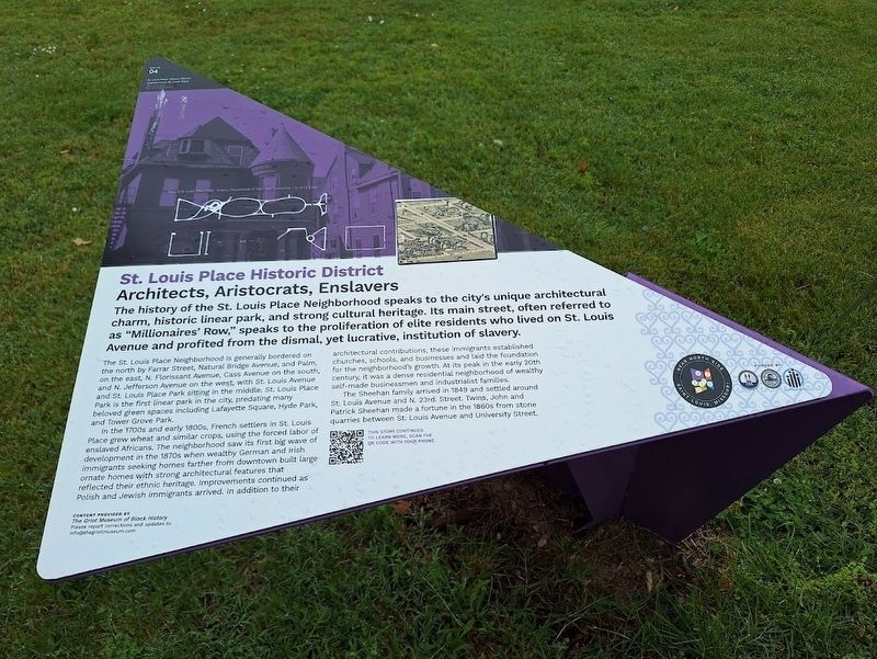
The history of the St. Louis Place Neighborhood speaks to the city's unique architectural charm, historic linear park, and strong cultural heritage. Its main street, often referred to as "Millionaires' Row," speaks to the proliferation of elite residents who lived on St. Louis Avenue and profited from the dismal, yet lucrative, institution of slavery.
The St. Louis Place Neighborhood is generally bordered on the north by Farrar Street, Natural Bridge Avenue, and Palm, on the east, N. Florissant Avenue, Cass Avenue on the south, and N. Jefferson Avenue on the west, with St. Louis Avenue and St. Louis Place Park sitting in the middle. St. Louis Place Park is the first linear park in the city, predating many beloved green spaces including Lafayette Square, Hyde Park, and Tower Grove Park.
In the 1700s and early 1800s, French settlers in St. Louis Place grew wheat and similar crops, using the forced labor of enslaved Africans. The neighborhood saw its first big wave of development in the 1870s when wealthy German and Irish immigrants seeking homes farther from downtown built large ornate homes with strong architectural
this page online
The Sheehan family arrived in 1849 and settled around St. Louis Avenue and N. 23rd Street. Twins, John and Patrick Sheehan made a fortune in the 1860s from stone quarries between St. Louis Avenue and University Street.
Erected 2025 by the City of St. Louis, St. Louis Community Development Administration, Near North Side Organization and Urban Strategies, Inc. (Marker Number 4.)
Topics. This historical marker is listed in these topic lists: African Americans • Architecture • Immigration • Settlements & Settlers. A significant historical year for this entry is 1849.
Location. 38° 39.081′ N, 90° 12.246′ W. Marker is in St. Louis, Missouri. It is in St. Louis Place. It is on Saint Louis Avenue west of North
Photographed by Jason Voigt, June 5, 2025
2. St. Louis Place Historic District Marker
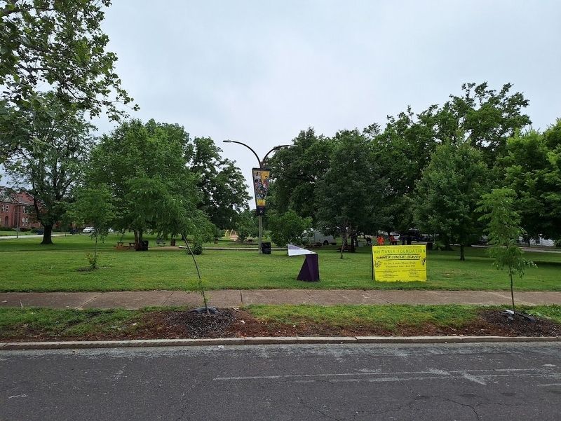
Marker is located at St. Louis Place Park (south of St. Louis Avenue)

Regionally, this marker is in the American Midwest, in the Lewis & Clark Corridor, in the Corn Belt, and in the Great River Road Region. Globally, it is in North America, the Western Hemisphere, the Western World, and the Anglosphere. Historically, it finds itself in what was once the territory of the Mississippian Culture, the Louisiana Purchase, and the Antebellum South.
Other nearby markers. At least 8 other markers are within one mile of this marker, measured as the crow flies: George Boyer Vashon Museum of African American History (about 600 feet away, measured in a direct line); Charles S Brown House (approx. ¼ mile away); Murphy-Blair National Historic District (approx. ¼ mile away); The Griot Museum Of Black History (approx. 0.3 miles away); Our Story (approx. 0.3 miles away); Star Bucket Pump Company (approx. 0.9 miles away); Official Site of Sportsman's Park (approx. 0.9 miles away); Plymouth House (approx. one mile away). Touch for a list and map of all markers in St. Louis.
Credits. This page was last revised on August 6, 2026. It was originally submitted on August 6, 2026, by Jason Voigt of Glen Carbon, Illinois. This page has been viewed 12 times since then. Photos: 1, 2. submitted on August 6, 2026, by Jason Voigt of Glen Carbon, Illinois.
