Quincy in Norfolk County, Massachusetts — The American Northeast (New England)
The Souther Tide Mill
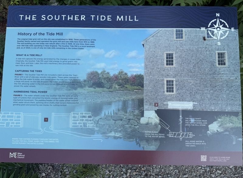
History of the Tide Mill
Photographed by G.W.Bartlett, August 8, 2026
1. The Souther Tide Mill Marker
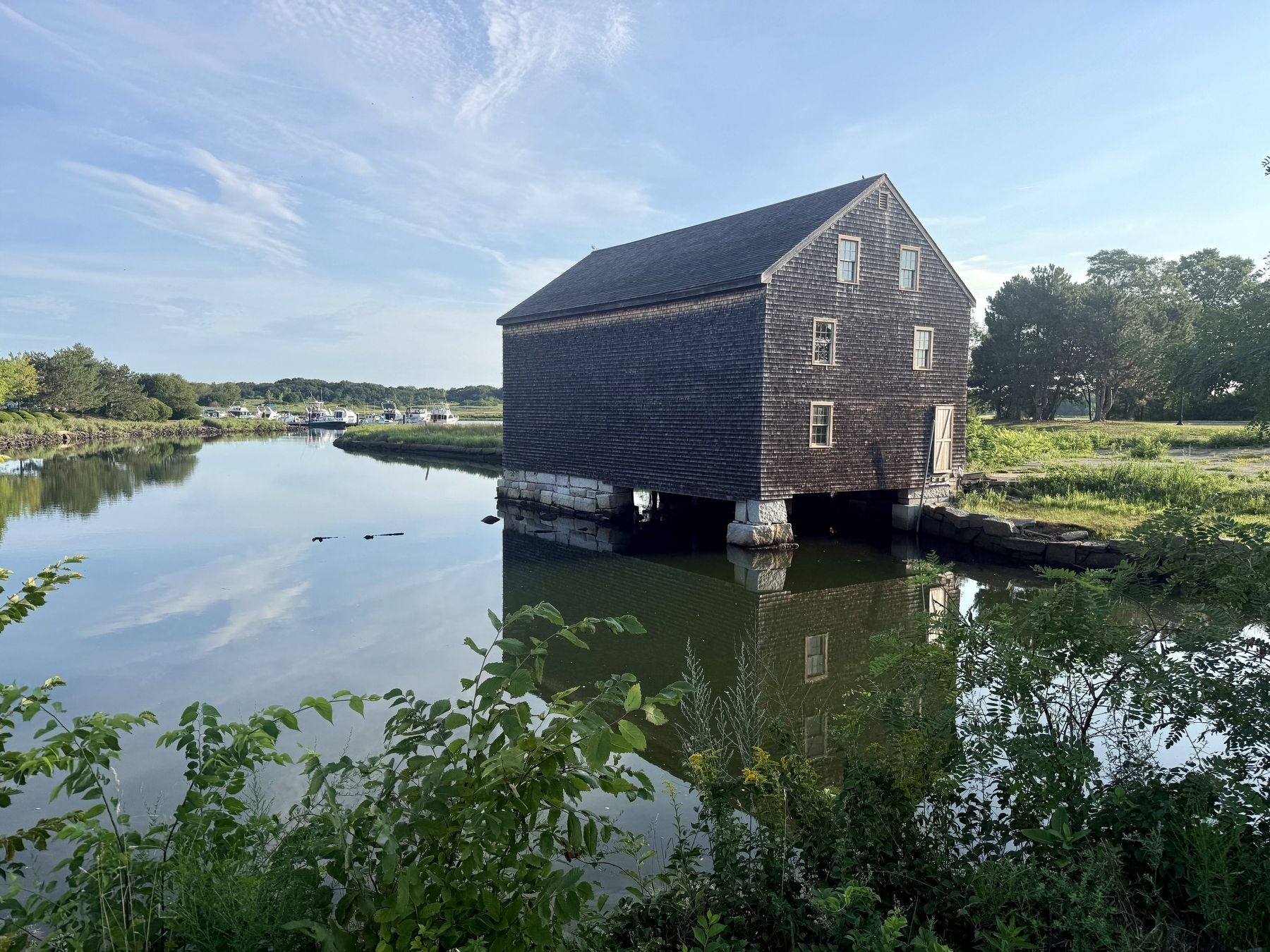
The original tidal grist mill on this site was established in 1806. Three generations of the Souther family owned and operated the grist mill and say mills here from 1815 to 1888. The mill building you see today was rebuilt after a fire in 1846. At one time, there were over 350 tide mills operating in New England. The Souther Tide Mill is a local landmark and, as of 2023, is one of only ten tide mills remaining in the United States.
WHAT IS A TIDE MILL?
A tide mill captures the energy generated by the changes in ocean tides. Originally, the Souther Tide Mill used tidal energy to grind grains into meal, flower and bran. Later the mill's machinery also provided power to saw mills at the site.
CAPTURING THE TIDES
FIGURE 1 - The Souther Tide Mill site included a dam across the Town River with a set of one-way wooden tide gates. These gates opened to allow the tide water to enter, and closed when the tide was high, forming a large mill pond. As the tide dropped, the miller would open a gate under the mill, allowing water in the mill pond to run through a sluice way to
this page online
HARNESSING TIDAL POWER
FIGURE 2 - The water wheels under the Souther Tide Mill were an early type of turbine that converted the kinetic energy of moving water into mechanical movement. The paddles/blades of the water wheel rotated when water struck them, spinning drive shafts that turned millstones for grinding grain and powering saw blades for cutting lumber.
Erected by Massachusetts Cultural Council (MCC).
Topics. This historical marker is listed in these topic lists: Bridges & Viaducts • Industry & Commerce • Waterways & Vessels. A significant historical year for this entry is 1806.
Location. 42° 15.157′ N, 70° 59.344′ W. Marker is in Quincy, Massachusetts, in Norfolk County. It is on Southern Artery (Massachusetts Route 3A), on the right when traveling west. Touch for map. Marker is at or near this postal address: 622 Southern Artery, Quincy MA 02169, United States of America. Touch for directions.

Regionally, this marker is in Historic Boston and specifically in Greater Boston. It is also in the American Northeast, in New England, and on the Eastern Seaboard. Globally, it is in the
Photographed by G.W.Bartlett, August 8, 2026
2. The Souther Tide Mill Marker (wide)
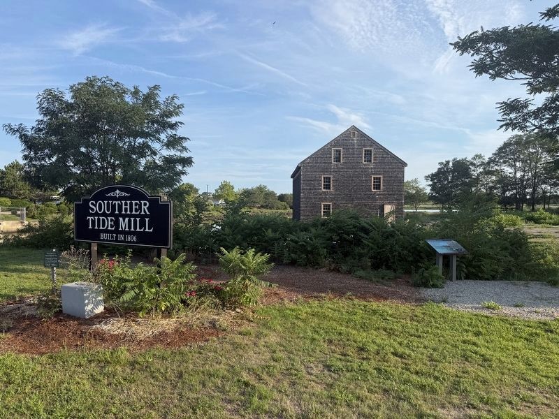
There is also a sign facing the street identifying the Souther Tide Mill historical location.
Other nearby markers. At least 8 other markers are within walking distance of this marker: A different marker also named The Souther Tide Mill (a few steps from this marker); Site of the Original Dunkin Donuts (approx. 0.2 miles away); World War II Memorial (approx. half a mile away); World War Memorial (approx. half a mile away); George F. Bryan (approx. half a mile away); Veterans Memorial (approx. half a mile away); Civil War Memorial (approx. half a mile away); Spanish-American War Memorial (approx. half a mile away). Touch for a list and map of all markers in Quincy.
Also see . . .
1. Friends of Souther Tide Mill. The Friends of the Souther Tide Mill mission is to preserve the Souther Tide Mill, which stands on former Quincy Lumber Company site located on the Southern Artery in Quincy. We aim to promote public interest in and educational programs interpreting the grist mill, granite, lumber, ship building and maritime history
Photographed by G.W.Bartlett, August 8, 2026
3. The Souther Tide Mill Marker (wide)
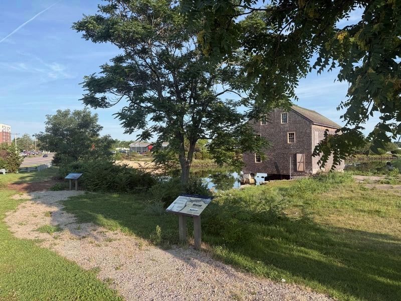
Both markers are visible here with the Southern Artery (Route 3A) visible in the background to the west.
2. Saugus Iron Works National Park.
Saugus Iron Works is a twelve-acre National Historic Site that includes working waterwheels, forges, mills, a historic 17th century home, and a lush river basin.(Submitted on August 8, 2026, by G.W.Bartlett of Hingham, Massachusetts.)
3. Plimoth Grist Mill. At our reproduction of the Plymouth Colonists’ original 1636 grain mill on Town Brook, take a fascinating look at the mill’s history and workings, from the 200-year-old millstones grinding corn to the ecology of the brook that has powered mills throughout the centuries.
Plimoth Grist Mill is a working mill and is proud to be part of a growing movement to localize grain production and rebuild regional grain economies. (Submitted on August 8, 2026, by G.W.Bartlett of Hingham, Massachusetts.)
Photographed by G.W.Bartlett, August 8, 2026
4. The Souther Tide Mill
Credits. This page was last revised on August 11, 2026. It was originally submitted on August 8, 2026, by G.W.Bartlett of Hingham, Massachusetts. This page has been viewed 19 times since then. Photos: 1, 2, 3, 4. submitted on August 8, 2026, by G.W.Bartlett of Hingham, Massachusetts. • Andrew Ruppenstein was the editor who published this page.
