De Cocksdorp in Texel, North Holland, Netherlands — Northwestern Europe
De Vuurtoren in de Tweede Wereldoorlog
⎯⎯⎯
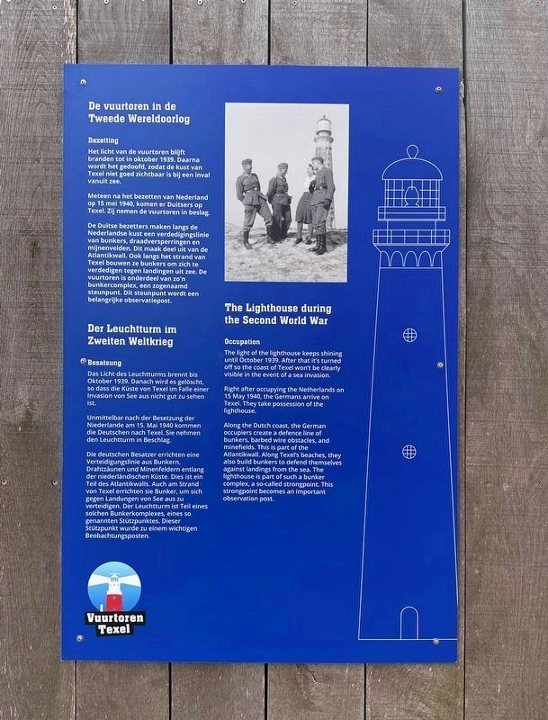
The Lighthouse during the Second World War
Der Leuchtturm im Zweiten Weltkrieg
Photographed by Andrew Ruppenstein, June 1, 2026
1. The Lighthouse during the Second World War Marker - first panel

Occupation
The light of the lighthouse keeps shining until October 1939. After that it's turned off so the coast of Texel won't be clearly visible in the event of a sea invasion.
Right after occupying the Netherlands on 15 May 1940, the Germans arrive on Texel. They take possession of the lighthouse.
Along the Dutch coast, the German occupiers create a defence line of bunkers, barbed wire obstacles, and minefields. This is part of the Atlantikwall. Along Texel's beaches, they also build bunkers to defend themselves against landings from the sea. The lighthouse is part of such a bunker complex, a so-called strongpoint. This strongpoint becomes an important observation post.
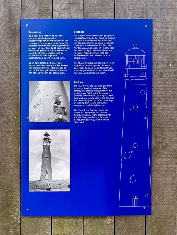
Shelling
On 6 April 1945, the Georgian prisoners of war on Texel take control of the strongpoint around the lighthouse. But under heavy fighting, the Germans advance to the North. On 20 April, Texel is almost completely back in the hands of the Germans again, and after three days of shelling, they isolate the bunker complex around the lighthouse.
On 21 April, the Germans begin
this page online
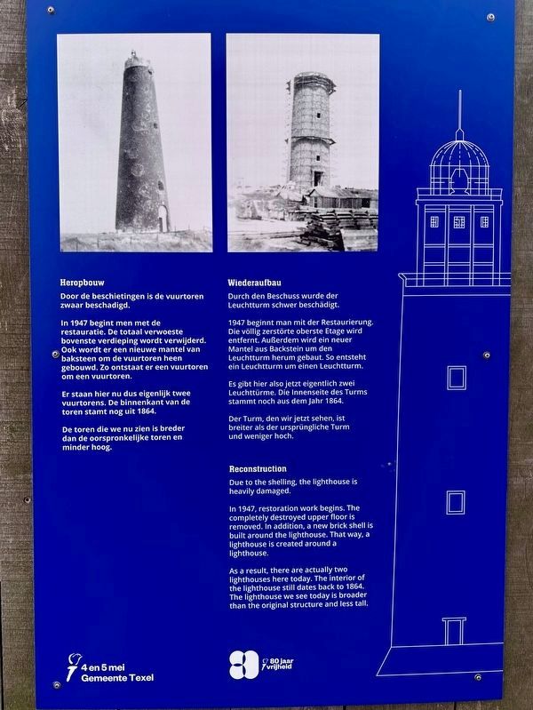
Reconstruction
Due to the shelling, the lighthouse is heavily damaged.
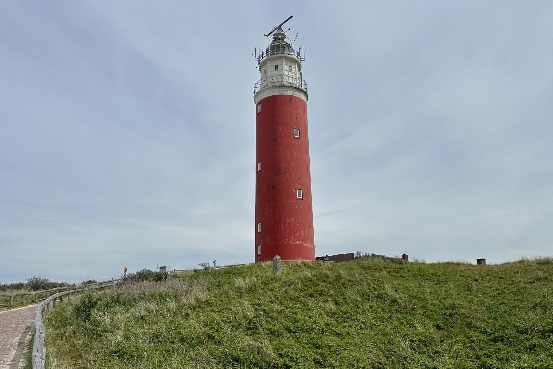
In 1947, restoration work begins. The completely destroyed upper floor is removed. In addition, a new brick shell is built around the lighthouse. That way, a lighthouse is created around a lighthouse.
As a result, there are actually two lighthouses here today. The interior of the lighthouse still dates back to 1864. The lighthouse we see today is broader than the original structure and less tall.
Bezetting
Het licht van de vuurtoren blijft branden tot in oktober 1939. Daarna wordt het gedoofd, zodat de kust van Texel niet goed zichtbaar is bij een inval vanuit zee.
Meteen na het bezetten van Nederland op 15 mei 1940, komen er Duitsers op Texel. Zij nemen de vuurtoren in beslag.
De Duitse bezetters maken langs de Nederlandse kust een verdedigingslinie van bunkers, draadversperringen en mijnenvelden. Dit maak deel uit van de Atlantikwall.
Photographed by Andrew Ruppenstein, June 1, 2026
2. The Lighthouse during the Second World War Marker - second panel
Op 6 april 1945 maken de op Texel gestationeerde Georgische krijgsgevangenen zich meester van het steunpunt rond de vuurtoren. Maar de Duitsers rukken onder zware gevechten op naar het noorden. Op 20 april is Texel weer bijna geheel in Duitse handen en wordt het bunkercomplex rond de vuurtoren, na drie dagen van beschietingen, door hen ingesloten.
Op 21 april zetten de Duitsers de aanval in op het steunpunt, het laatste Georgische bolwerk. Hierbij vallen 59 van de 110 Georgiërs levend in Duitse handen. Zij worden doodgeschoten.
Heropbouw
Door de beschietingen is de vuurtoren zwaar beschadigd.
In 1947 begint men met de restauratie. De totaal verwoeste bovenste verdieping wordt verwijderd. Ook wordt er een nieuwe mantel van baksteen om de vuurtoren heen gebouwd. Zo ontstaat er een vuurtoren om een vuurtoren.
Er staan hier nu dus eigenlijk twee vuurtorens. De binnenkant van de toren
Photographed by Andrew Ruppenstein, June 1, 2026
3. The Lighthouse during the Second World War Marker - third panel
De toren die we nu zien is breder dan de oorspronkelijke toren en minder hoog.
Besatzung
Das Licht des Leuchtturms brennt bis Oktober 1939. Danach wird es gelöscht, so dass die Küste von Texel im Falle einer Invasion von See aus nicht gut zu sehen ist.
Unmittelbar nach der Besetzung der Niederlande am 15. Mai 1940 kommen die Deutschen nach Texel. Sie nehmen den Leuchtturm in Beschlag.
Die deutschen Besatzer errichten eine Verteidigungslinie aus Bunkern, Drahtzäunen und Minenfeldern entlang der niederländischen Küste. Dies ist ein Teil des Atlantikwalls. Auch am Strand von Texel errichten sie Bunker, um sich gegen Landungen von See aus zu verteidigen. Der Leuchtturm ist Teil eines solchen Bunkerkomplexes, eines so genannten Stützpunktes. Dieser Stützpunkt wurde zu einem wichtigen Beobachtungsposten.
Beschuss
Am 6. April 1945 übernehmen georgische Kriegsgefangene, die auf Texel stationiert sind, die Kontrolle über den Stützpunkt um den Leuchtturm. Doch die Deutschen rücken unter schweren Kämpfen nach Norden vor. Am 20. April ist Texel wieder fast vollständig
Photographed by Andrew Ruppenstein, June 1, 2026
4. The Lighthouse during the Second World War Marker
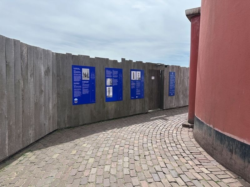
The panels are set on an inward facing wall directly in front of the entrance to the lighthouse.
Am 21. April starten die Deutschen einen Angriff auf den Stützpunkt, die letzte georgische Festung. Dabei fallen 59 von 110 Georgiern lebend in deutsche Hände. Sie werden allesamt erschossen.
Wiederaufbau
Durch den Beschuss wurde der Leuchtturm schwer beschädigt. 1947 beginnt man mit der Restaurierung. Die völlig zerstörte oberste Etage wird entfernt. Außerdem wird ein neuer Mantel aus Backstein um den Leuchtturm herum gebaut. So entsteht ein Leuchtturm um einen Leuchtturm.
Es gibt hier also jetzt eigentlich zwei Leuchttürme. Die Innenseite des Turms stammt noch aus dem Jahr 1864.
Der Turm, den wir jetzt sehen, ist breiter als der ursprüngliche Turm und weniger hoch.
Erected by 4 en 5 mei Gemeente Texel.
Topics and series. This historical marker is listed in these topic lists: Forts and Castles • War, World II • Waterways & Vessels. In addition, it is included in the Lighthouses series list. A significant historical date for this entry is May 15, 1940.
Location. 53° 10.928′ N, 4° 51.32′ E. Marker
Photographed by Andrew Ruppenstein, June 1, 2026
5. De Vuurtoren / The Lighthouse

Regionally, this marker is on the German Wadden Sea. Globally, it is in Europe, the European Union, Atlantic Europe, the Benelux Low Countries, the Schengen Area, Western Europe, and the Western World. Historically, it finds itself in what was once the Holy Roman Empire.
Other nearby markers. At least 8 other markers are within 3 kilometers of this marker, measured as the crow flies: De Cocksdorp - Kikkertstraat 59, Polderhuis (approx. 3 kilometers away); De Cocksdorp openbare lagere school / De Cocksdorp Public Primary School (approx. 3 kilometers away); De Waddenkerk / The Wadden Church (approx. 3 kilometers away); Stengweg (approx. 3 kilometers away); De Cocksdorp - Kikkerstraat 47 (approx. 3 kilometers away); De Gele Buurt / The “Yellow Neighborhood” (approx. 3 kilometers away); De Strekdam / The Breakwater (approx. 3 kilometers away); De Posthoorn / The Post Horn (approx. 3 kilometers away). Touch for a list and map of all markers in De Cocksdorp.
Also see . . . Eierland Lighthouse (Wikipedia). Excerpt:
During the Georgian Uprising of Texel of April 1945 the lighthouse suffered heavy damage. It was repaired by constructing a new wall around it and a new upper-level construction. In this process the lighthouse lost two of its original nine storeys.(Submitted on August 11, 2026.)
Credits. This page was last revised on August 11, 2026. It was originally submitted on August 10, 2026, by Andrew Ruppenstein of Lamorinda, California. This page has been viewed 28 times since then. Photos: 1. submitted on August 10, 2026, by Andrew Ruppenstein of Lamorinda, California. 2, 3, 4, 5. submitted on August 11, 2026, by Andrew Ruppenstein of Lamorinda, California.
