Hiawatha in Minneapolis in Hennepin County, Minnesota — The American Midwest (Upper Plains)
Welcome to Lock and Dam No. 1
⎯⎯⎯
The Federal Engineer
Photographed by McGhiever, May 28, 2023
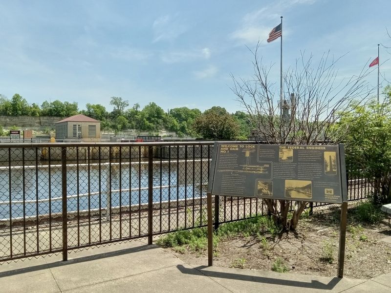
1. Welcome to Lock and Dam No. 1 / The Federal Engineer Marker
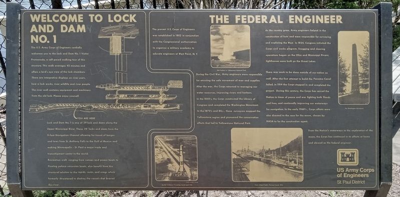
The U.S. Army Corps of Engineers cordially welcomes you to the Lock and Dam No. 1 Visitor Promenade, a self-paced walking tour of this structure. This walk averages 45 minutes and offers a bird's eye view of the lock chambers. There are interpretive displays on river users, how a lock works, river wildlife and river people. The river wall contains equipment and machinery from the old lock. Please enjoy yourself.
Lock and Dam No. 1 is one of 29 lock and dams along the Upper Mississippi River. These 29 locks and dams form the 9-foot Navigation Channel allowing for travel of barges and tows from St. Anthony Falls to the Gulf of Mexico and making Minneapolis - St. Paul a major trade and transshipment center to the world.
Recreation craft, ranging from canoes and power boats to floating palace excursion boats, also benefit from this structural solution to the rapids, rocks, and snags which formerly threatened to destroy the vessels that braved this river.
The present U.S. Corps of Engineers was established in 1802 in conjunction with the Congressional authorization
this page online
Old Faithful in Yellowstone National Park.
During the Civil War, Army engineers were responsible for ensuring the safe movement of men and supplies. After the war, the Corps returned to managing our water resources, improving rivers and harbors. In the 1850's, the Corps constructed the Library of Congress and completed the Washington Monument. In the 1870's and 80's, these surveyors mapped the Yellowstone region and pioneered the conservation efforts that led to Yellowstone National Park.
Apollo 11/Saturn V nearing launch pad 39A.
As the country grew, Army engineers helped in the construction of forts and were responsible for surveying and exploring the West. In 1824, Congress initiated the Corps civil works program. Snagging and clearing operations began on the Ohio and Mississippi Rivers; lighthouses were built on the Great Lakes.
There was work to be done outside of our nation as well. After the first attempt to build the Panama Canal failed, in 1914 the Corps stepped in and completed the project. During this century, the Corps has served the
Photographed by McGhiever, May 28, 2023
2. Welcome to Lock and Dam No. 1 / The Federal Engineer Marker
The Washington Monument.
From the Nation's waterways to the exploration of the moon, the Corps has continued in its efforts at home and abroad as the federal engineer.
Pedro Miguel Locks, Panama Canal, 1914.
Erected by US Army Corps of Engineers, St. Paul District.
Topics. This historical marker is listed in these topic lists: Air & Space • Architecture • Military • Waterways & Vessels. A significant historical year for this entry is 1802.
Location. 44° 54.949′ N, 93° 12.181′ W. Marker is in Minneapolis, Minnesota, in Hennepin County. It is in Hiawatha. It can be reached from the intersection of W. River Parkway and Godfrey Parkway, on the left when traveling south. Touch for map. Marker is at or near this postal address: 5000 W River Parkway, Minneapolis MN 55417, United States of America. Touch for directions.

Regionally, this marker is in the Twin Cities Metropolitan Area. It is also in the American Midwest, in the Corn Belt, and in the Great River Road Region. Globally, it is in North America, the Western Hemisphere, the Western World, and the Anglosphere. Historically, it finds itself in what was once Rupert’s Land, the territory of the Mississippian Culture, and the Louisiana Purchase.
Other nearby markers. At least 8 other markers are within walking distance of this marker: Miter Gate Operating Mechanism (within shouting distance of this marker); Big Water / Stairway of Water (about 300 feet away, measured in a direct line); A River Highway (about 300 feet away); Wing Dams (about 400 feet away); Welcome to the Wabun Picnic Family Play Area! (about 500 feet away); Stoney Valve Operating Mechanism (about 500 feet away); The Lock and Dam No. 1 Story (about 600 feet away); Hydro Electric Turbine (approx. ¼ mile away). Touch for a list and map of all markers in Minneapolis.
Credits. This page was last revised on August 10, 2026. It was originally submitted on August 10, 2026, by McGhiever of Minneapolis, Minnesota. This page has been viewed 16 times since then. Photos: 1, 2. submitted on August 10, 2026, by McGhiever of Minneapolis, Minnesota.
