Maywood in Burnaby in Metro Vancouver, British Columbia — Canada’s West Coast (North America)
Central Park Bandstand
City of Burnaby Heritage Site

Photographed by Bradley Owen, August 8, 2026
1. Central Park Bandstand Marker
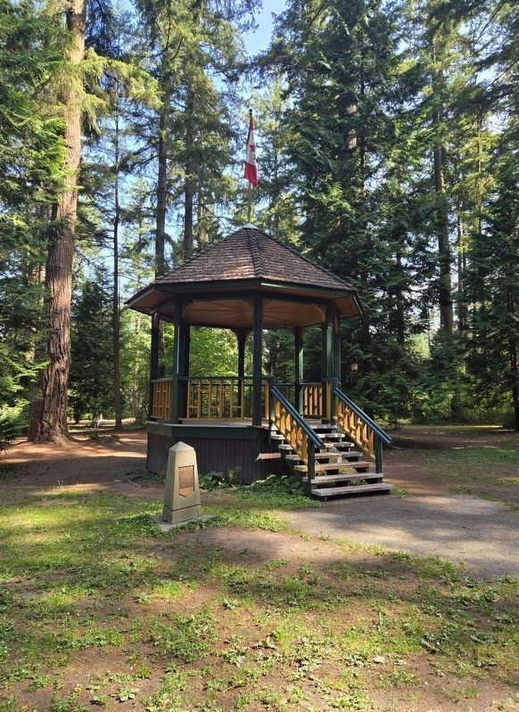
When the Province dedicated Central Park for the public's enjoyment in 1891, one of the first structures erected in the original picnic grounds was an octagonal Queen Anne styled bandstand. It served as a stage for civic events and as a shelter for picnic parties. The Central Park Jubilee Band, organized by local residents to celebrate Queen Victoria's Jubilee in 1896, performed Sunday Concerts. Reeve J.W. Weart used the bandstand as a podium on "Splash Day" to dedicate Burnaby's new water system in 1912. The bandstand was finally demolished in the 1930's after trees toppled by a windstorm damaged the old structure.
This new bandstand, a replica of the original, was donated by the families of Mr. and Mrs. Gordon Smith and Mr. and Mrs. Mario Fontanin for all to enjoy.
Erected 1996 by The City of Burnaby, British Colombia.
Topics. This historical marker is listed in these topic lists: Notable Places • Parks & Recreational Areas. A significant historical date for this entry is May 29, 1996.
Location. 49° 13.775′ N, 123° 1.177′ W. Marker is in Burnaby, British Columbia, in Metro Vancouver. It is in Maywood. It can be reached
this page online

Regionally, this marker is on the Lower Mainland and in Coast & Mountains. Globally, it is in North America, in the Cascade Range, in the Inside Passage, on the Ring of Fire, on the Pacific Rim, in the Western Hemisphere, in the Western World, and in the Anglosphere. Historically, it finds itself in what was once a British colony.
Other nearby markers. At least 8 other markers are within 8 kilometers of this marker, measured as the crow flies: Central Park (about 240 meters away, measured in a direct line); Variety Park Playground (approx. 0.3 kilometers away); Korean War Memorial (approx. 0.3 kilometers away); Jubilee Grove (approx. 0.6 kilometers away); Bright Waters (approx. 1.2 kilometers away); South Burnaby Cenotaph (approx. 2 kilometers away); 144 West 10th Avenue (approx. 7.4 kilometers away); 148 West 10th Avenue (approx. 7.4
Photographed by Bradley Owen, August 8, 2026
2. Central Park Bandstand and Marker
Credits. This page was last revised on August 10, 2026. It was originally submitted on August 10, 2026, by Bradley Owen of Morgantown, West Virginia. This page has been viewed 6 times since then. Photos: 1, 2. submitted on August 10, 2026, by Bradley Owen of Morgantown, West Virginia.
