Grottoes in Augusta County, Virginia — The American South (Mid-Atlantic)
Honoring Their Sacrifice
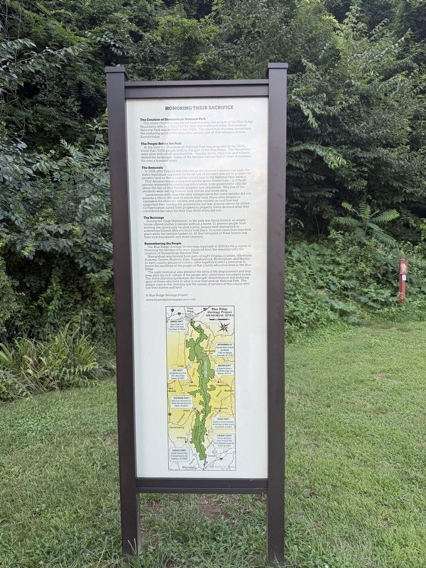
The Creation of Shenandoah National Park
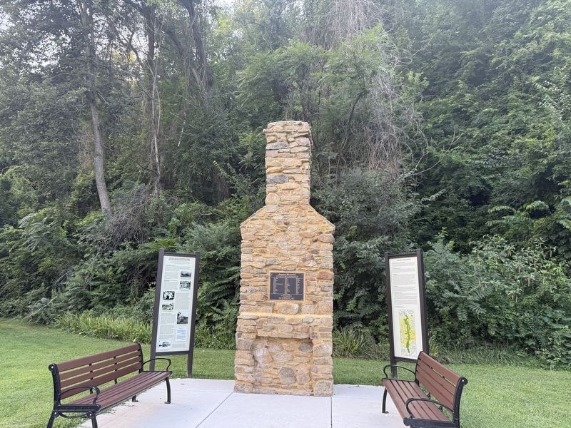
This stone chimney was placed here to honor the people of the Blue Ridge Mountains who lost their homes, land and livelihood when Shenandoah National Park was formed in the 1930s. The memorial chimney symbolizes the enduring spirit of the mountain people and all that remains of their homes today.
The People Before the Park
At the time the Shenandoah Park was proposed in the 1920s, more than 3,000 people lived in this part of the Blue Ridge. The mountains were alive with small communities — houses, farms, churches, and schools dotted the landscape. Some of the families had resided in these mountains for over a hundred years.
The Removals
In 1928, after Virginia was selected as the location for a national park, the state's legislature approved the broad use of eminent domain to acquire the people's land so that it could be turned over to the National Park Service.
That decision began a long and painful series of evictions — a difficult process worsened by conflicting information from government officials about the fate of their homes, property and cemeteries. Very few
this page online
Landowners with clear title were compensated, but some families did not possess a title to the land on which they lived. Many were tenants or caretakers for absentee owners, and a few resided on land that had supported their families for generations, but was actually owned by others. Compensation varied from property to property. Some received what they considered fair value for their loss, while many did not.
The Burnings
During the Great Depression, as the park was being formed, an empty house offered shelter to people without a home. To prevent people from moving into previously vacated homes, houses were dismantled or sometimes burned after evictions took place. In some cases, burnings took place while the families looked on. All that remained of these homes was their rock foundation and stone chimney.
Remembering the People
The Blue Ridge Heritage Project was organized in 2013 for the purpose of honoring the families who were displaced from the mountains for the creation of Shenandoah National Park.
Shenandoah was formed from parts of eight Virginia
Photographed by Devry Becker Jones (CC0), August 8, 2026
2. Blue Ridge Heritage Project memorial and markers
The eight memorial sites preserve the story of the displacement and help keep alive the rich culture of the people who called these mountains home. The stone chimney symbolizes the strength, determination and enduring spirit of those who lived in what is now Shenandoah National Park. The plaque inset in the chimney lists the names of the families of this county who lost their homes and land.
Memorial Sites
Warren County
Happy Creek Trail
460 E. Criser Road
Front Royal, VA 22630
Rappahannock Co.
Thornton River Orchard
and Market
11587 Lee Highway
Sperryville, VA 22740
Madison County
At Mountain Museum
1128 Old Blue Ridge Tpke.
Madison, VA 22127
Page County
Ed Good Memorial Park
332 E. Main Street
Stanley, VA 22851
Rockingham County
Elkton Area Community Ctr.
20593 Blue and Gold Drive
Elkton, VA 228227
Greene County
Grounds of Greene Commons
40 Colt Road (at Main Street)
Stanardsville, VA 22973
Albemarle County
Patricia Ann Byrom
Forest Preserve Park
6610 Blackwells Hollow Rd.
Crozet, VA 22932
Augusta County
Grand Caverns Park
5 Grand Caverns Rd.
Grottoes, VA 24441
Erected by Blue Ridge Heritage Project.
Topics. This historical marker is listed in these topic lists: Parks & Recreational Areas • Settlements & Settlers. A significant historical year for this entry is 1928.
Location. 38° 15.531′ N, 78° 50.083′ W. Marker is in Grottoes, Virginia, in Augusta County. It is on Grand Cavern Road west of South River Road, on the left when traveling west. Touch for map. Marker is at or near this postal address: 5 Grand Cavern Rd, Grottoes VA 24441, United States of America. Touch for directions.

Regionally, this marker is in the Shenandoah Valley. It is also in the American South and specifically in the Upper South. Globally, it is in North America, the Western Hemisphere, the Western World, and the Anglosphere. Historically, it finds itself in what was once the territory of the Mississippian Culture, one of the original Thirteen Colonies, one of the Confederate States of America, and the Antebellum South.
Other nearby markers. At least 8 other markers are within walking distance of this marker: Augusta Memorial (here, next to this marker); The Blue Ridge in Augusta County Before Shenandoah National Park (here, next to this marker); a different marker also named Civil War Tourism Attraction (a few steps from this marker); Grand Caverns Inn (within shouting distance of this marker); The Gladys E. Kellow Garden (within shouting distance of this marker); George Caleb Bingham (approx. half a mile away); Veterans Memorial (approx. 0.7 miles away); a different marker also named Veterans Memorial (approx. 0.7 miles away). Touch for a list and map of all markers in Grottoes.
Another marker is no longer nearby. Civil War Tourism Attraction (was a few steps from this marker but has been replaced with another marker now near it).
Additional keywords. rural displacement; eminent domain
Credits. This page was last revised on August 10, 2026. It was originally submitted on August 10, 2026, by Devry Becker Jones of Washington, District of Columbia. This page has been viewed 23 times since then. Photos: 1, 2. submitted on August 10, 2026, by Devry Becker Jones of Washington, District of Columbia.
