South Coast Metro in Costa Mesa in Orange County, California — The American West (Pacific Coastal)
California Scenario
Introduced in 1980
Photographed by Liam Williams, May 31, 2026
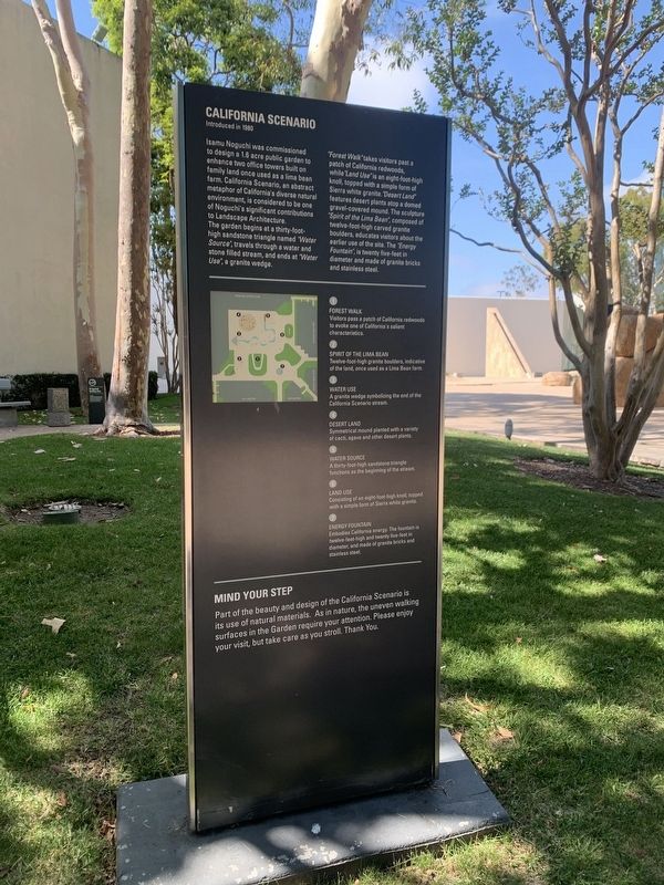
1. California Scenario Marker
"Forest Walk" takes visitors past a patch of California redwoods, while "Land Use" is an eight-foot-high knoll, topped with a simple form of Sierra white granite. "Desert Land" features desert plants atop a domed gravel-covered mound. The sculpture "Spirit of the Lima Bean", composed of twelve-foot-high carved granite boulders, educates visitors about the earlier use of the site. The "Energy Fountain", is twenty five-feet in diameter and made of granite bricks and stainless steel.
1
FOREST WALK
Visitors pass a patch of California redwoods to evoke one of California's salient characteristics.
2
SPIRIT OF THE LIMA BEAN
Twelve-foot-high
this page online
3
WATER USE
A granite wedge symbolizing the end of the California Scenario stream.
4
DESERT LAND
Symmetrical mound planted with a variety of cacti, agave and other desert plants.
5
WATER SOURCE
A thirty-foot-high sandstone triangle functions as the beginning of the stream.
6
LAND USE
Consisting of an eight-foot-high knoll, topped with a simple form of Sierra white granite.
7
ENERGY FOUNTAIN
Embodies California energy. The fountain is twelve-feet-high and twenty five-feet in diameter, and made of granite bricks and stainless steel.
MIND YOUR STEP
Part of the beauty and design of the California Scenario is its use of natural materials. As in nature, the uneven walking surfaces in the Garden require your attention. Please enjoy your visit, but take care as you stroll. Thank You.
Topics. This historical marker is listed in these topic lists: Architecture • Arts, Letters, Music • Asian Americans • Parks & Recreational Areas. A significant historical year for this entry is 1980.
Location. 33° 41.35′ N, 117° 52.935′ W. Marker is

Photographed by Liam Williams, May 31, 2026
2. California Scenario Marker

Regionally, this marker is in Greater Los Angeles and in the Peninsular Ranges. It is also on the American Pacific Coast. Globally, it is in North America, on the Ring of Fire, on the Pacific Rim, in the Western Hemisphere, in the Western World, and in the Anglosphere. Historically, it finds itself in what was once New Spain and also Mexico’s Alta California.
Other nearby markers. At least 8 other markers are within 4 miles of this marker, measured as the crow flies: John Wayne Airport (approx. 1.4 miles away); El Camino Real (approx. 1.4 miles away); The Oldest Protestant Church Building in Use in Orange County (approx. 1½ miles away); Santa Ana Army Air Base Site (approx. 2 miles away); Upper Newport Bay (approx. 2.6 miles away); Apollo 11 (approx. 3 miles away); In Memory of Jim Olson (approx. 3.1 miles away); Joint Outfall System
Photographed by Liam Williams, May 31, 2026
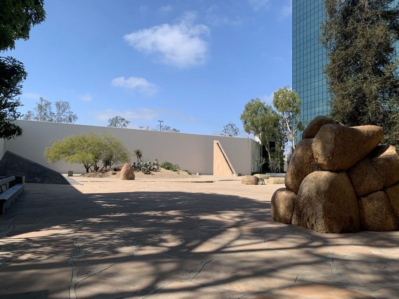
3. California Scenario
View of California Scenario as seen from behind "Spirit of the Lima Bean"
Another marker is no longer nearby. The Salt Works (was approx. 2.6 miles away).

Photographed by Liam Williams, May 31, 2026
4. Forest Walk
"Visitors pass a patch of California redwoods to evoke one of California's salient characteristics."
Photographed by Liam Williams, May 31, 2026
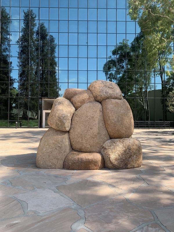
5. Spirit of the Lima Bean
"Twelve-foot-high granite boulders, indicative of the land, once used as a Lima Bean farm."

Photographed by Liam Williams, May 31, 2026
6. Water Use
"A granite wedge symbolizing the end of the California Scenario stream."
Credits. This page was last revised on August 11, 2026. It was originally submitted on August 10, 2026, by Liam Williams of Irvine, California. This page has been viewed 26 times since then. Photos: 1, 2, 3, 4, 5, 6. submitted on August 10, 2026, by Liam Williams of Irvine, California. • Andrew Ruppenstein was the editor who published this page.
