Near Prescott in Walla Walla County, Washington — The American West (Northwest)
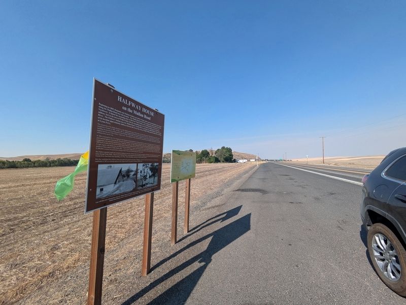
Halfway House
on the Mullan Road

Photographed by Clayton Pickett, August 8, 2026
1. Halfway House Marker
The construction of the Mullan Road by Lt. John Mullan and his crew of 100 civilians and 100 soldiers began in Walla Walla in June of 1859, and was completed in October of 1860. In May, 1861, Lt. Mullan began rebuilding and improving portions of the route. In August 1862, the 655 mile road, including the previously existing portion from Wallula to Walla Walla, was finally completed, providing a route for pioneer families, miners, and military supplies between two of the
this page online
In 1866 a memorial to the U.S. Congress by the Montana territorial legislature in Helena pleaded for repairs, and reminded Congress of “the necessity for a great national highway connecting the Missouri and Columbia rivers by a good and substantial wagon road.” Though the figures used were perhaps an exaggeration, the memorial went on to say, “From Jan. 1 to Nov. 15, 1866, 1500 head of horses have been purchased by individual miners at Walla Walla; 5000 head of cattle were driven from Walla Walla to Montana; 6000 mules have left the Columbia river and Walla Walla loaded with freight for Montana; 52 light wagons with families have left Walla Walla for Montana; 31 wagons with immigrants have come through from the States via the Mullan Road, a portion of whom settled in Walla Walla valley... not less than 20,000 persons have passed over the Mullan road to and from Montana during the past season; $1,000,000 in treasure has passed down through Walla Walla and Wallula during the same
Photographed by Clayton Pickett, August 8, 2026
2. Halfway House Marker
Ben Flathers operated a pack train along the California coast from 1854-61 before moving his operation to The Dalles, from which he packed to the Montana mines through Walla Walla. There he met Malinda Harris, whose husband and sons had died. In 1869 they were married, and acquired land along the Touchet River from Henry Hart Spaulding, son of Rev. Henry Spaulding, missionary to the Nez Perce Indians.
Here they established their Halfway House just south of the present intersection of Highway 124 and 125, and west of where the town of Prescott was established in 1882 as a railroad station on the Oregon Rail & Navigation Company (OR&N) line.
(Photo Captions)
Flathers home on the hill above the barns, corrals, and outbuildings.
Packers leaving after overnight stay at Halfway House at Prescott
You will find more information about the Mullan Road and Walla Walla area history at www.ww2020.net/historic-sites and at the planned Mullan Road History Site at 13th & Abadie in Walla Walla. Sign courtesy of Walla Walla 2020.
Erected by Walla Walla 2020.
Topics. This historical marker is listed in these topic lists: Roads & Vehicles • Settlements & Settlers. A significant historical year for this entry is 1869.
Location. 46° 17.925′ N, 118° 20.161′ W. Marker is near Prescott, Washington, in Walla Walla County. It is on Washington Route 124 0.2 miles east of Route 125, on the right when traveling east. Touch for map. Marker is in this post office area: Prescott WA 99348, United States of America. Touch for directions.

Regionally, this marker is in the Columbia Basin. It is also in the American Mountain West and in the Lewis & Clark Corridor. Globally, it is in North America, on the Pacific Rim, in the Western Hemisphere, in the Western World, and in the Anglosphere.
Other nearby markers. At least 2 other markers are within walking distance of this marker: Cayuse, Umatilla, and Walla Walla Homeland (here, next to this marker); "honest, and sincere people" (here, next to this marker).
Credits. This page was last revised on August 11, 2026. It was originally submitted on August 10, 2026, by Clayton Pickett of Richland, Washington. This page has been viewed 17 times since then. Photos: 1, 2. submitted on August 10, 2026, by Clayton Pickett of Richland, Washington. • Andrew Ruppenstein was the editor who published this page.
